Category:Forton, Lancashire
Jump to navigation
Jump to search
English: Forton is a village and a civil parish near the A6 road, in between the city of Lancaster and the town of Garstang, in the Wyre District, in the English county of Lancashire near the Forest of Bowland. Its population is approximately 574. It has one school, Forton Primary School, several churches and one pub, the New Holly. (→Forton, Lancashire)
Polski: Forton – wieś w Anglii, w hrabstwie Lancashire, w dystrykcie Wyre. Leży 66 km na północny zachód od miasta Manchester i 326 km na północny zachód od Londynu. (→Forton (Lancashire))

village in Wyre, Lancashire, UK  | |||||
| Upload media | |||||
| Instance of | |||||
|---|---|---|---|---|---|
| Location | Wyre, Lancashire, North West England, England | ||||
| Population |
| ||||
 | |||||
Subcategories
This category has the following 6 subcategories, out of 6 total.
Media in category "Forton, Lancashire"
The following 200 files are in this category, out of 320 total.
(previous page) (next page)-
 An unfamiliar view of a very familiar building - geograph.org.uk - 4693574.jpg 3,974 × 2,473; 6.25 MB
-
 Approach road to M6 southbound Lancaster services - geograph.org.uk - 5225376.jpg 1,600 × 1,200; 703 KB
-
 Approach Road, Forton Services M6 Northbound - geograph.org.uk - 3160797.jpg 4,000 × 3,000; 2.44 MB
-
 Approach to Lancaster Services, M6 - geograph.org.uk - 2879254.jpg 4,320 × 3,240; 2.85 MB
-
 Approaching Cockerham Bridge - geograph.org.uk - 1092502.jpg 640 × 480; 149 KB
-
 Barn conversion on Winder Lane - geograph.org.uk - 3021564.jpg 1,600 × 1,200; 284 KB
-
 Boardwalk on the Wyre Way - geograph.org.uk - 1092828.jpg 640 × 425; 138 KB
-
 BP filling station at Lancaster Services, M6 northbound - geograph.org.uk - 2962337.jpg 3,648 × 2,736; 2.23 MB
-
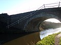
 Bridge 77, Lancaster Canal - geograph.org.uk - 5219030.jpg 640 × 425; 261 KB
-
 Bridge 77, Lancaster Canal - geograph.org.uk - 5219031.jpg 640 × 425; 244 KB
-
 Bridge 78, Lancaster Canal - geograph.org.uk - 5219029.jpg 640 × 425; 203 KB
-
 Bridge 79, Lancaster Canal - geograph.org.uk - 2156011.jpg 640 × 425; 389 KB
-
 Bridge 79, Lancaster Canal - geograph.org.uk - 2156021.jpg 640 × 425; 401 KB
-
 Bridge 79, Lancaster Canal - geograph.org.uk - 5141324.jpg 640 × 425; 224 KB
-
 Bridge and Tower at Lancaster Services - geograph.org.uk - 6363037.jpg 600 × 800; 497 KB
-
 Bridge no 82 and Potters Brook - geograph.org.uk - 946230.jpg 520 × 640; 128 KB
-
 Bridge over the River Cocker - geograph.org.uk - 2327045.jpg 640 × 480; 114 KB
-
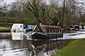
 Canal boats moored on the Lancaster Canal - geograph.org.uk - 4922185.jpg 4,592 × 3,056; 6.19 MB
-
 Canal cruising - geograph.org.uk - 651946.jpg 427 × 640; 65 KB
-
 Canal Mile Stone - geograph.org.uk - 651256.jpg 640 × 398; 137 KB
-
 Canal mooring at Potters Brook - geograph.org.uk - 946221.jpg 640 × 416; 91 KB
-
 Canal side foliage, Potters Brook Bridge - geograph.org.uk - 946428.jpg 640 × 449; 100 KB
-
 Canal side patio, Potters Brook - geograph.org.uk - 946204.jpg 425 × 640; 95 KB
-

-

-
 Car Park, Lancaster Services - geograph.org.uk - 1348921.jpg 640 × 430; 53 KB
-
 Centre Farm - geograph.org.uk - 6430771.jpg 1,024 × 768; 158 KB
-
 Chapel near Lancaster Forton motorway services - geograph.org.uk - 3266916.jpg 1,024 × 685; 148 KB
-
 Church at Forton - geograph.org.uk - 1922401.jpg 1,600 × 1,200; 421 KB
-
 Cleveley Bridge - geograph.org.uk - 811627.jpg 640 × 480; 120 KB
-
 Cleveley rail bridge - geograph.org.uk - 1210670.jpg 640 × 427; 39 KB
-
 Clifton Hill near Forton - geograph.org.uk - 2340190.jpg 640 × 480; 126 KB
-
 Clifton Hill near Forton - geograph.org.uk - 2340243.jpg 640 × 480; 146 KB
-
 Coach park at Forton Services - geograph.org.uk - 4380867.jpg 800 × 540; 88 KB
-
 Cocker House Bridge - geograph.org.uk - 4919561.jpg 4,218 × 2,807; 7.5 MB
-
 Cockerham Road Bridge - geograph.org.uk - 1092506.jpg 640 × 480; 62 KB
-
 Cockerham Road Bridge - geograph.org.uk - 1092507.jpg 640 × 480; 102 KB
-
 Cockerham Road Bridge - geograph.org.uk - 3902959.jpg 2,510 × 1,852; 2.65 MB
-
 Cockerham Road Bridge No 79 - geograph.org.uk - 6077896.jpg 800 × 569; 173 KB
-

-
 Cockerham Road Bridge on the Lancaster Canal - geograph.org.uk - 4919415.jpg 4,592 × 3,056; 7.74 MB
-
 Cockerham Road, near Forton - geograph.org.uk - 1888013.jpg 640 × 451; 70 KB
-
 Communication Mast - geograph.org.uk - 1212621.jpg 640 × 426; 91 KB
-
 Corless Bridge - geograph.org.uk - 3905341.jpg 2,560 × 1,920; 3.44 MB
-
 Corless Bridge No 76 - geograph.org.uk - 6077743.jpg 800 × 526; 171 KB
-
 Cottages at Potters Brook - geograph.org.uk - 2330404.jpg 640 × 480; 109 KB
-
 Country road near Forton - geograph.org.uk - 5146812.jpg 640 × 480; 174 KB
-
 Damaged Bridge - geograph.org.uk - 1198380.jpg 640 × 426; 160 KB
-
 Date stone, Centre Farm - geograph.org.uk - 2327042.jpg 477 × 633; 103 KB
-
 Date stone, Holly House - geograph.org.uk - 2327025.jpg 569 × 640; 162 KB
-
 David Cox-98227 -.jpg 2,250 × 1,438; 633 KB
-
 Electric car charging points - geograph.org.uk - 4264692.jpg 1,280 × 1,280; 516 KB
-
 Ellel , M6 Motorway - geograph.org.uk - 6300483.jpg 6,000 × 4,000; 5.19 MB
-
 Ellel , M6 Motorway - geograph.org.uk - 6359855.jpg 6,000 × 4,000; 4.34 MB
-
 Ellel , M6 Motorway - geograph.org.uk - 6359857.jpg 6,000 × 4,000; 5.84 MB
-
 Entrance to Lancaster (Forton) services - geograph.org.uk - 3506696.jpg 2,000 × 1,500; 499 KB
-
 Entrance to Lancaster (Forton) services, M6 - geograph.org.uk - 3512264.jpg 2,000 × 1,333; 1.23 MB
-
 Entrance to Winder Lane House - geograph.org.uk - 3021574.jpg 1,600 × 1,200; 488 KB
-
 Exit from Lancaster (Forton) services, M6 - geograph.org.uk - 3512281.jpg 2,000 × 1,500; 1.19 MB
-
 Extra large plant pot at Hollins Lane - geograph.org.uk - 3021556.jpg 1,600 × 1,200; 381 KB
-
 Extra long haulage lorry at Forton Services - geograph.org.uk - 6617209.jpg 3,507 × 2,340; 1.29 MB
-
 Farm and greenhouses - geograph.org.uk - 3814364.jpg 800 × 438; 56 KB
-
 Farmhouse, Centre Farm - geograph.org.uk - 2327037.jpg 640 × 480; 138 KB
-
 Farmland east of Forton - geograph.org.uk - 3814361.jpg 640 × 393; 40 KB
-
 Farmland near Nan's Nook - geograph.org.uk - 6361297.jpg 1,280 × 862; 796 KB
-
 Farmland off Ratcliffe Wharf Lane - geograph.org.uk - 3813360.jpg 640 × 538; 56 KB
-
 Farmland towards Potters Brook - geograph.org.uk - 3814360.jpg 640 × 459; 47 KB
-
 Field near Forton - geograph.org.uk - 3272679.jpg 640 × 480; 307 KB
-
 Field with trees, Threshers Court - geograph.org.uk - 2260116.jpg 2,560 × 1,920; 2.95 MB
-
 Fields near Greenways Farm - geograph.org.uk - 5471076.jpg 640 × 334; 80 KB
-
 Fields near Greenways Farm - geograph.org.uk - 5471078.jpg 640 × 360; 90 KB
-
 Fields north of Lancaster (Forton) services - geograph.org.uk - 3506705.jpg 2,000 × 1,500; 622 KB
-
 Footbridge on path to Lathwaite - geograph.org.uk - 6430786.jpg 1,024 × 768; 191 KB
-
 Footbridge on River Cocker - geograph.org.uk - 6430762.jpg 1,024 × 768; 193 KB
-
 Footbridge over M6 near Nan's Nook - geograph.org.uk - 3341762.jpg 640 × 480; 37 KB
-
 Footbridge over the M6 - geograph.org.uk - 2683618.jpg 640 × 480; 159 KB
-
 Footbridge over the M6 - geograph.org.uk - 3121036.jpg 4,601 × 2,590; 2.28 MB
-
 Footpath Approaching Forton Hall Farm - geograph.org.uk - 3930739.jpg 2,560 × 1,920; 2.89 MB
-
 Forton , Grassy Field - geograph.org.uk - 6300485.jpg 6,000 × 4,000; 6.22 MB
-
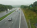
 Forton , M6 Motorway - geograph.org.uk - 6300481.jpg 6,000 × 4,000; 5.7 MB
-
 Forton , M6 Motorway - geograph.org.uk - 6300484.jpg 6,000 × 4,000; 5.56 MB
-
 Forton Bowling Green - geograph.org.uk - 1198345.jpg 640 × 426; 116 KB
-
 Forton Hall Farm - geograph.org.uk - 6430785.jpg 1,024 × 768; 190 KB
-
 Forton M6 services, southbound - geograph.org.uk - 3696772.jpg 640 × 422; 128 KB
-
 Forton Service Area and Tower, M6 Northbound - geograph.org.uk - 2406221.jpg 768 × 1,024; 119 KB
-
 Forton Services (Northbound) - geograph.org.uk - 4164811.jpg 3,072 × 1,728; 1.36 MB
-
 Forton Services - geograph.org.uk - 1852099.jpg 425 × 640; 49 KB
-
 Forton Services - geograph.org.uk - 1956928.jpg 2,448 × 3,264; 1.25 MB
-
 Forton Services - geograph.org.uk - 3272692.jpg 640 × 480; 322 KB
-
 Forton Services - geograph.org.uk - 4014725.jpg 3,648 × 2,736; 3.61 MB
-
 Forton Services - geograph.org.uk - 4435386.jpg 5,026 × 3,045; 2.04 MB
-
 Forton Services - geograph.org.uk - 4510922.jpg 640 × 316; 17 KB
-
 Forton Services - geograph.org.uk - 4510928.jpg 426 × 640; 40 KB
-
 Forton Services - geograph.org.uk - 4510929.jpg 426 × 640; 40 KB
-
 Forton Services - geograph.org.uk - 6396295.jpg 1,632 × 918; 449 KB
-
 Forton Services M6 - geograph.org.uk - 2434831.jpg 640 × 480; 56 KB
-
 Forton Services M6 - geograph.org.uk - 2434839.jpg 640 × 472; 57 KB
-
 Forton Services, M6 - geograph.org.uk - 2639274.jpg 640 × 430; 35 KB
-
 Forton Services, M6 - geograph.org.uk - 5029830.jpg 1,024 × 430; 85 KB
-
 Forton's Playing Field Pavilion - geograph.org.uk - 1198341.jpg 640 × 426; 110 KB
-
 Fortonbank Farm - geograph.org.uk - 2340207.jpg 640 × 480; 87 KB
-
 Grazing Land at Clifton House - geograph.org.uk - 1198391.jpg 640 × 426; 98 KB
-
 Grazing, Patten House Farm - geograph.org.uk - 3813357.jpg 640 × 480; 57 KB
-
 Grooves on Stony Lane Bridge - geograph.org.uk - 2340261.jpg 480 × 640; 154 KB
-
 Hannah Rose on the Lancaster Canal - geograph.org.uk - 4922338.jpg 4,592 × 3,056; 7 MB
-
 Hay Carr from the south - geograph.org.uk - 2329898.jpg 640 × 480; 89 KB
-

-
 Heading south - geograph.org.uk - 3857750.jpg 1,600 × 1,071; 360 KB
-
 Heading towards Berries Head - geograph.org.uk - 4648764.jpg 640 × 468; 185 KB
-
 HGVs at Forton Services - geograph.org.uk - 3869814.jpg 640 × 457; 332 KB
-
 HGVs refuelling - geograph.org.uk - 5512439.jpg 1,280 × 960; 1.05 MB
-
 Highways England notice, Forton - geograph.org.uk - 6360623.jpg 1,024 × 1,280; 410 KB
-
 Hillside house, near Cockerham - geograph.org.uk - 946160.jpg 640 × 467; 87 KB
-
 Holleth Cottage - geograph.org.uk - 6430772.jpg 1,024 × 768; 209 KB
-
 Hollins Lane - geograph.org.uk - 1386673.jpg 640 × 480; 66 KB
-
 Hollins Lane alongside West Coast Main Line railway - geograph.org.uk - 2376996.jpg 1,600 × 1,111; 387 KB
-
 Holly House - geograph.org.uk - 2327019.jpg 640 × 480; 79 KB
-
 House at Ratcliffe Wharf, Scorton - geograph.org.uk - 1154471.jpg 576 × 383; 328 KB
-
 House Field Pond, Forton - geograph.org.uk - 2340201.jpg 640 × 480; 191 KB
-
 House next to Lancaster Canal - geograph.org.uk - 509100.jpg 640 × 479; 113 KB
-
 House, south end of Stoney Lane - geograph.org.uk - 2340274.jpg 640 × 480; 165 KB
-
 Jackson Hill - geograph.org.uk - 5147367.jpg 5,184 × 2,931; 1.59 MB
-

-

-
 Lancaster (aka Forton) Services, M6 - geograph.org.uk - 2683605.jpg 640 × 480; 145 KB
-
 Lancaster (Forton ) Services, M6, North-bound - geograph.org.uk - 1959171.jpg 1,499 × 842; 1.25 MB
-
 Lancaster (Forton) M6 Services Northbound - geograph.org.uk - 3160793.jpg 4,000 × 3,000; 2.37 MB
-
 Lancaster (Forton) Services - geograph.org.uk - 5500125.jpg 1,280 × 960; 805 KB
-
 Lancaster (Forton) Services - geograph.org.uk - 5500156.jpg 1,280 × 960; 720 KB
-
 Lancaster (Forton) Services - geograph.org.uk - 5878905.jpg 1,333 × 2,000; 1.28 MB
-
 Lancaster (Forton) Services on the M6 - geograph.org.uk - 3121035.jpg 4,486 × 2,561; 2.12 MB
-
 Lancaster (Forton) services on the M6 - geograph.org.uk - 3934500.jpg 1,024 × 680; 100 KB
-
 Lancaster (Forton) services, M6 - geograph.org.uk - 3512259.jpg 2,000 × 1,500; 1.16 MB
-
 Lancaster (Forton) Services, M6 northbound - geograph.org.uk - 2708676.jpg 2,306 × 1,712; 424 KB
-
 Lancaster (Forton) Services.jpg 3,024 × 4,032; 3.76 MB
-
 Lancaster Canal - geograph.org.uk - 1092514.jpg 640 × 480; 54 KB
-
 Lancaster Canal - geograph.org.uk - 1198398.jpg 640 × 426; 138 KB
-
 Lancaster Canal - geograph.org.uk - 1759349.jpg 480 × 640; 91 KB
-
 Lancaster Canal - geograph.org.uk - 2066910.jpg 2,560 × 1,920; 1.71 MB
-
 Lancaster Canal - geograph.org.uk - 2066911.jpg 2,560 × 1,920; 1.58 MB
-
 Lancaster Canal - geograph.org.uk - 2116449.jpg 2,560 × 1,920; 2.15 MB
-
 Lancaster Canal - geograph.org.uk - 2154863.jpg 2,560 × 1,920; 1.82 MB
-
 Lancaster Canal - geograph.org.uk - 4294919.jpg 2,739 × 2,563; 1.42 MB
-
 Lancaster canal - geograph.org.uk - 788430.jpg 640 × 480; 97 KB
-
 Lancaster Canal at Clifton Hill - geograph.org.uk - 6077764.jpg 800 × 622; 172 KB
-
 Lancaster Canal at Potters Brook - geograph.org.uk - 5911236.jpg 640 × 461; 58 KB
-
 Lancaster Canal at Potters Brook - geograph.org.uk - 6077916.jpg 800 × 558; 136 KB
-
 Lancaster Canal from Cockerham Road Bridge - geograph.org.uk - 1888036.jpg 1,024 × 768; 350 KB
-
 Lancaster Canal near Forton - geograph.org.uk - 5139850.jpg 640 × 425; 222 KB
-
 Lancaster Canal near Forton - geograph.org.uk - 5139852.jpg 640 × 425; 293 KB
-
 Lancaster Canal near Forton - geograph.org.uk - 5139854.jpg 640 × 425; 243 KB
-
 Lancaster Canal near Potters Brook - geograph.org.uk - 6077901.jpg 800 × 545; 140 KB
-
 Lancaster canal near the Cockerham road - geograph.org.uk - 946236.jpg 640 × 421; 118 KB
-

-

-
 Lancaster Canal, Forton - geograph.org.uk - 5219032.jpg 640 × 425; 174 KB
-
 Lancaster Canal, Forton - geograph.org.uk - 5496687.jpg 640 × 425; 181 KB
-
 Lancaster Forton Services - geograph.org.uk - 2230962.jpg 640 × 480; 48 KB
-
 Lancaster Forton Services - geograph.org.uk - 3922224.jpg 528 × 400; 436 KB
-
 Lancaster Forton Services - geograph.org.uk - 6261873.jpg 2,700 × 2,025; 338 KB
-
 Lancaster Forton Services - northbound - geograph.org.uk - 3599961.jpg 800 × 451; 187 KB
-
 Lancaster Forton Services - northbound, 2019 - geograph.org.uk - 6260077.jpg 1,600 × 1,069; 477 KB
-
 Lancaster Moto services northbound - geograph.org.uk - 1880741.jpg 640 × 480; 59 KB
-
 Lancaster Service Area (M6) - geograph.org.uk - 4120173.jpg 640 × 480; 59 KB
-
 Lancaster Services (M6 Southbound) - geograph.org.uk - 4741541.jpg 2,784 × 1,568; 2.09 MB
-
 Lancaster Services - geograph.org.uk - 3379976.jpg 3,872 × 2,592; 2.54 MB
-
 Lancaster Services - geograph.org.uk - 4654323.jpg 1,850 × 1,229; 1.43 MB
-
 Lancaster Services - geograph.org.uk - 5086564.jpg 1,024 × 768; 155 KB
-
 Lancaster Services - geograph.org.uk - 6254679.jpg 2,000 × 1,333; 2.07 MB
-
 Lancaster services - geograph.org.uk - 6569408.jpg 4,032 × 3,024; 3.01 MB
-
 Lancaster Services and the Pennine Tower - geograph.org.uk - 5286019.jpg 640 × 480; 143 KB
-
 Lancaster Services on a wet day - geograph.org.uk - 1970430.jpg 3,872 × 2,480; 2.4 MB
-
 Lancaster services tower from the Southbound side - geograph.org.uk - 5957603.jpg 1,352 × 1,310; 784 KB
-
 Lancaster Services, M6 - geograph.org.uk - 5373671.jpg 4,651 × 3,076; 4.23 MB
-
 Lancaster Services, The "Pennine Tower" - geograph.org.uk - 6363044.jpg 800 × 533; 282 KB
-
 Lancaster Services, The Pennine Tower - geograph.org.uk - 6409538.jpg 1,024 × 768; 428 KB
-
 Looking towards the lorry park - geograph.org.uk - 5878907.jpg 2,000 × 1,333; 1.9 MB
-
 Lorries at Lancaster Services - geograph.org.uk - 5500159.jpg 1,280 × 1,142; 879 KB
-
 Lorries at Lancaster Services - geograph.org.uk - 6624630.jpg 1,280 × 960; 958 KB
-

-
 Lorry Park at Lancaster (Forton) Services - geograph.org.uk - 5512427.jpg 1,280 × 971; 858 KB
-
 Lorry Park at Lancaster Services - geograph.org.uk - 5500150.jpg 1,280 × 960; 862 KB
-
 Lorry parking at Lancaster Services - geograph.org.uk - 6624621.jpg 1,280 × 972; 901 KB
-
 M6 at Forton Services - geograph.org.uk - 2951359.jpg 2,520 × 1,680; 343 KB
-
 M6 at Lancaster Forton - geograph.org.uk - 3266918.jpg 1,024 × 685; 102 KB
-
 M6 Forton Services - geograph.org.uk - 3140444.jpg 800 × 600; 104 KB
-
 M6 from Nans Nook footbridge - geograph.org.uk - 6361288.jpg 1,280 × 850; 627 KB
-
 M6 Jam North - geograph.org.uk - 3140459.jpg 800 × 600; 101 KB
-
 M6 Lancaster Forton Services - geograph.org.uk - 2475583.jpg 640 × 460; 52 KB
-
 M6 Motorway - geograph.org.uk - 2552582.jpg 640 × 480; 246 KB
-
 M6 Motorway, Forton - geograph.org.uk - 2552584.jpg 640 × 480; 193 KB
-

-
 M6 south at Forton Services - geograph.org.uk - 3341760.jpg 640 × 480; 40 KB
-
 M6, northbound - geograph.org.uk - 4510914.jpg 640 × 370; 31 KB
-

-
 Mile Stone - geograph.org.uk - 651266.jpg 427 × 640; 129 KB
-
 Milestone, Preston Lancaster Road, Forton - geograph.org.uk - 436408.jpg 453 × 640; 107 KB
-
 Moto in the morning - geograph.org.uk - 1271165.jpg 640 × 465; 43 KB
-
 Muddy Pond at Forton - geograph.org.uk - 1198327.jpg 640 × 426; 188 KB
-
 Nans Nook footbridge - geograph.org.uk - 6360628.jpg 1,280 × 720; 519 KB


_-_geograph.org.uk_-_1414509.jpg)
_services_on_the_M6_-_geograph.org.uk_-_1435137.jpg)


_services_-_geograph.org.uk_-_3506696.jpg)
_services,_M6_-_geograph.org.uk_-_3512264.jpg)

_services,_M6_-_geograph.org.uk_-_3512281.jpg)


_services_-_geograph.org.uk_-_3506705.jpg)


_-_geograph.org.uk_-_4164811.jpg)


_Services,_M6_-_geograph.org.uk_-_2683605.jpg)
_Services,_M6,_North-bound_-_geograph.org.uk_-_1959171.jpg)
_M6_Services_Northbound_-_geograph.org.uk_-_3160793.jpg)
_Services_-_geograph.org.uk_-_5500125.jpg)
_Services_-_geograph.org.uk_-_5500156.jpg)
_Services_-_geograph.org.uk_-_5878905.jpg)
_Services_on_the_M6_-_geograph.org.uk_-_3121035.jpg)
_services_on_the_M6_-_geograph.org.uk_-_3934500.jpg)
_services,_M6_-_geograph.org.uk_-_3512259.jpg)
_Services,_M6_northbound_-_geograph.org.uk_-_2708676.jpg)
_Services.jpg)


_-_geograph.org.uk_-_4120173.jpg)
_-_geograph.org.uk_-_4741541.jpg)


_Services_-_geograph.org.uk_-_5512427.jpg)


.jpg)


