Category:Fort Sisseton State Park (South Dakota)
Jump to navigation
Jump to search
| Object location | | View all coordinates using: OpenStreetMap |
|---|
park in Marshall County, South Dakota, United States of America | |||||
| Upload media | |||||
| Instance of | |||||
|---|---|---|---|---|---|
| Location | Marshall County, South Dakota | ||||
 | |||||
Media in category "Fort Sisseton State Park (South Dakota)"
The following 26 files are in this category, out of 26 total.
-
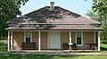
 Fort Sisseton adjutant office from NE 1.jpg 1,945 × 1,143; 631 KB
-
 Fort Sisseton boundary marker 1.jpg 824 × 2,253; 651 KB
-
 Fort Sisseton carpenter-blacksmith shop from SW 1.jpg 2,311 × 758; 458 KB
-
 Fort Sisseton commanding officer and officer qtrs from NE 1.jpg 2,301 × 1,362; 924 KB
-
 Fort Sisseton commanding officer quarters from NE 1.jpg 2,349 × 1,684; 1.23 MB
-
 Fort Sisseton commissary-QM sgt from SE 1.jpg 1,962 × 948; 498 KB
-
 Fort Sisseton doctor residence from ESE 1.jpg 2,158 × 1,195; 701 KB
-
 Fort Sisseton guardhouse from SW 1.jpg 2,076 × 915; 621 KB
-
 Fort Sisseton guardhouse interior 1.jpg 2,560 × 1,920; 2.01 MB
-
 Fort Sisseton guardhouse interior 2.jpg 2,560 × 1,920; 1.87 MB
-
 Fort Sisseton guardhouse interior 3.jpg 1,920 × 2,560; 2 MB
-
 Fort Sisseton guardhouse interior 4.jpg 2,537 × 1,903; 969 KB
-
 Fort Sisseton guardhouse-magazine-adjutant from NE 1.jpg 2,501 × 1,313; 1 MB
-
 Fort Sisseton hospital from SW 1.jpg 2,197 × 1,299; 1,002 KB
-
 Fort Sisseton library-schoolhouse from S 1.jpg 2,213 × 922; 615 KB
-
 Fort Sisseton magazine and guardhouse from SSE 1.jpg 2,041 × 875; 554 KB
-
 Fort Sisseton magazine from NE 1.jpg 2,019 × 1,393; 784 KB
-
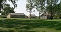
 Fort Sisseton NE corner across parade ground 1.jpg 2,549 × 861; 665 KB
-
 Fort Sisseton north barracks from SW 1.jpg 2,314 × 1,097; 757 KB
-
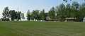
 Fort Sisseton NW corner across parade ground 1.jpg 2,559 × 981; 736 KB
-
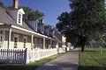
 Fort Sisseton officer quarters from E 1.jpg 2,475 × 967; 802 KB
-
 Fort Sisseton south barracks from W 1.jpg 2,327 × 643; 496 KB
-
 Fort Sisseton stable from SE 1.jpg 2,126 × 945; 548 KB
-
 Fort Sisseton SW corner across parade ground 1.jpg 2,559 × 1,100; 803 KB
-
 Hy1126.JPG (3340147210).jpg 333 × 500; 92 KB
-
 Hy1127.JPG (3339319021).jpg 500 × 333; 99 KB


.jpg)
.jpg)