Category:Fort Good Hope (Ghana)
Jump to navigation
Jump to search
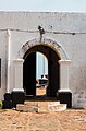
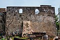
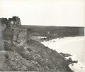
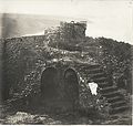
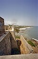
English: The Fort De Goede Hoop (English: "Fort Good Hope") was built in 1664 at the village Senya-Beraku (hist. Berrecoe, Senniah-Beracoe, Bercoe or similarly) by the Dutch.
| Object location | | View all coordinates using: OpenStreetMap |
|---|
material cultural heritage site in Ghana  | |||||
| Upload media | |||||
| Instance of | |||||
|---|---|---|---|---|---|
| Part of | |||||
| Location | Senya Beraku, Awutu Senya District, Central Region, Ghana | ||||
| Heritage designation |
| ||||
| Inception |
| ||||
 | |||||
Notice:
Historically was differentiated between "Little-Beraku" (= contemporary Senya Beraku = location of the fort) on the western border of the Densu (river) swamps and "Great-Beraku" on the eastern border. Senya Beraku was in historical times an important whistle stop on the old trading route between Accra and Winneba.
Media in category "Fort Good Hope (Ghana)"
The following 19 files are in this category, out of 19 total.
-
 AMH-7733-NA Floor plan of Fort Goede Hoop at Berku.jpg 1,572 × 2,400; 643 KB
-
 Fort de Goede Hoop, entrance.jpg 4,000 × 3,000; 3.72 MB
-
 Fort de Goede Hoop, front and side.jpg 4,000 × 3,000; 4.11 MB
-
 Fort Goede Hoop (Ghana).png 457 × 367; 150 KB
-
Fort Goede Hoop, Ghana.webm 8.3 s, 5,120 × 2,880; 24.95 MB
-
 Fort Good Hope 1.2.jpg 3,129 × 4,754; 3.48 MB
-
 Fort Good Hope 1.3.jpg 5,023 × 3,349; 5.56 MB
-
 Fort Good Hope 1.jpg 5,472 × 3,648; 6.28 MB
-
 Fort Good Hope in Ghana.jpg 6,000 × 4,000; 4.85 MB
-
 Overzicht binnenplaats naar de achtergevel - Senya Beraku - 20375244 - RCE.jpg 3,375 × 2,204; 3.21 MB
-

-
 Overzicht binnenplaats naar de voorgevel - Senya Beraku - 20375248 - RCE.jpg 1,200 × 783; 174 KB
-

-
 Overzicht voorgevel - Senya Beraku - 20375250 - RCE.jpg 1,200 × 783; 211 KB
-
 The National Archives UK - CO 1069-34-41-1-001.jpg 854 × 718; 156 KB
-
 The National Archives UK - CO 1069-34-57 001.jpg 841 × 743; 115 KB
-
 The National Archives UK - CO 1069-34-59-1-001.jpg 840 × 705; 201 KB
-
 The National Archives UK - CO 1069-34-59-2-002.jpg 751 × 711; 231 KB
-


.png)


