Category:Fornham All Saints
Jump to navigation
Jump to search
English: Fornham All Saints is a small settlement in Suffolk, England. It is near the town of Bury St Edmunds.
village in United Kingdom   | |||||
| Upload media | |||||
| Instance of | |||||
|---|---|---|---|---|---|
| Location |
| ||||
 | |||||
Subcategories
This category has the following 4 subcategories, out of 4 total.
A
F
T
V
Media in category "Fornham All Saints"
The following 47 files are in this category, out of 47 total.
-
 A1101 towards Bury St Edmunds - geograph.org.uk - 4856389.jpg 640 × 480; 76 KB
-
 Arable Land Prepared For Development - geograph.org.uk - 5860496.jpg 2,104 × 1,184; 304 KB
-

-
 Crop field near Hyde Wood - geograph.org.uk - 4856367.jpg 640 × 480; 57 KB
-

-

-
 Farmers Gated Track - geograph.org.uk - 2593754.jpg 1,024 × 768; 211 KB
-
 Farmland at Fornham All Saints - geograph.org.uk - 1170612.jpg 640 × 427; 79 KB
-
 Farmland near Fornham All Saints - geograph.org.uk - 4856372.jpg 640 × 480; 70 KB
-
 Farmland, Fornham All Saints - geograph.org.uk - 4856387.jpg 640 × 480; 62 KB
-
 Fields at Fornham All Saints - geograph.org.uk - 613688.jpg 640 × 427; 100 KB
-
 Fornham All Saints - geograph.org.uk - 3424063.jpg 2,304 × 1,536; 967 KB
-
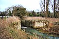 Fornham Park Lock, River Lark - geograph.org.uk - 639703.jpg 640 × 427; 134 KB
-
 Give Way sign before the B1106 to Fornham All Saints - geograph.org.uk - 5821786.jpg 3,344 × 2,508; 2.23 MB
-
 Golfer - geograph.org.uk - 2593741.jpg 1,024 × 768; 165 KB
-
 Golfers' bridge over the River Lark - geograph.org.uk - 5284435.jpg 6,720 × 4,480; 5.87 MB
-
 Hengrave Road, Fornham All Saints - geograph.org.uk - 4856452.jpg 2,592 × 1,944; 1.23 MB
-
 Hengrave Road, Fornham All Saints - geograph.org.uk - 4856453.jpg 2,592 × 1,944; 1.2 MB
-

-

-
 Hyde Road, towards Hyde Wood - geograph.org.uk - 2865028.jpg 3,264 × 2,448; 1.38 MB
-
 Hyde Wood - geograph.org.uk - 3424076.jpg 2,304 × 1,536; 736 KB
-
 Lone tree on Hyde Road - geograph.org.uk - 4856370.jpg 640 × 476; 61 KB
-
 Main entrance, Hengrave Farm - geograph.org.uk - 3424085.jpg 2,304 × 1,536; 538 KB
-
 Mere Lane - geograph.org.uk - 4856375.jpg 640 × 480; 62 KB
-
 Mildenhall Road - geograph.org.uk - 3425537.jpg 2,304 × 1,536; 1.29 MB
-
 Misty March Morning - geograph.org.uk - 1749873.jpg 1,000 × 586; 440 KB
-
 New Housing Development, Marham Park - geograph.org.uk - 5860511.jpg 2,104 × 1,184; 293 KB
-
 Pigeon Lane, Towards Bury St Edmunds - geograph.org.uk - 5772847.jpg 1,184 × 2,104; 404 KB
-
 Ploughed Farmland, outside Fornham All Saints - geograph.org.uk - 2865037.jpg 1,600 × 1,200; 485 KB
-
 Private road to Hengrave Farm - geograph.org.uk - 4856374.jpg 640 × 480; 52 KB
-
 River Lark downstream of the former Fornham Lock - geograph.org.uk - 5284755.jpg 3,000 × 4,500; 5.19 MB
-
 River Lark north of Bury St Edmunds - geograph.org.uk - 20737.jpg 427 × 640; 103 KB
-
 Shades of green in the crops beside Hyde Road - geograph.org.uk - 5821782.jpg 3,456 × 2,592; 3.75 MB
-
 Slip road at Westley Interchange - geograph.org.uk - 2072891.jpg 640 × 453; 54 KB
-
 The Green, Fornham All Saints - geograph.org.uk - 3433616.jpg 2,048 × 1,536; 670 KB
-
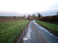
 To Fornham - geograph.org.uk - 1560319.jpg 640 × 480; 74 KB
-
 Tut Hill (B1106), Fornham All Saints - geograph.org.uk - 4856385.jpg 640 × 480; 75 KB
-
 Twitchetts End, Fornham All Saints - geograph.org.uk - 4856377.jpg 2,492 × 1,563; 668 KB
-
 Village Hall, Fornham All Saints - geograph.org.uk - 1359280.jpg 640 × 480; 109 KB
-
 Weak Bridge - geograph.org.uk - 1800835.jpg 1,600 × 1,200; 651 KB
-
 Westley Road - geograph.org.uk - 2593744.jpg 1,024 × 768; 257 KB
-
 Westley Road - geograph.org.uk - 2593750.jpg 1,024 × 768; 208 KB
-
 Bury St Edmunds Golf Course - geograph.org.uk - 20731.jpg 640 × 427; 71 KB
-
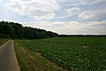
 Field west of Bury St Edmunds - geograph.org.uk - 21067.jpg 640 × 427; 77 KB
-
 Hyde Wood and Queen Elizabeth's Walk - geograph.org.uk - 20728.jpg 640 × 427; 77 KB
-
 Track leading to Hyde Wood - geograph.org.uk - 20727.jpg 640 × 427; 61 KB


,_Fornham_All_Saints_-_geograph.org.uk_-_4856382.jpg)
,_Fornham_All_Saints_-_geograph.org.uk_-_4856383.jpg)


,_Fornham_All_Saints_-_geograph.org.uk_-_4856385.jpg)


