Category:Former town hall of Seyssel (Ain)
Jump to navigation
Jump to search
| Object location | | View all coordinates using: OpenStreetMap |
|---|
museum in France  | |||||
| Upload media | |||||
| Instance of | |||||
|---|---|---|---|---|---|
| Location | Seyssel, Ain, Auvergne-Rhône-Alpes, Metropolitan France, France | ||||
 | |||||
Media in category "Former town hall of Seyssel (Ain)"
The following 7 files are in this category, out of 7 total.
-
 Ancienne mairie Seyssel Ain 1.jpg 3,456 × 5,184; 6.11 MB
-
 Ancienne mairie Seyssel Ain 2.jpg 5,250 × 4,983; 23.1 MB
-
 Ancienne mairie Seyssel Ain 3.jpg 3,456 × 5,184; 5.5 MB
-
 Ancienne mairie Seyssel Ain 4.jpg 3,528 × 3,690; 11.88 MB
-
 Ancienne mairie Seyssel Ain 5.jpg 5,184 × 3,456; 6.72 MB
-
 Ancienne mairie Seyssel Ain 6.jpg 3,975 × 3,882; 12.99 MB
-
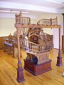 Escalier double révoution.jpg 1,920 × 2,560; 2.35 MB


