Category:Former hospital complex, Sandomierz
Jump to navigation
Jump to search
| Object location | | View all coordinates using: OpenStreetMap |
|---|
 | |||||
| Upload media | |||||
| Instance of | |||||
|---|---|---|---|---|---|
| Location | Sandomierz, Sandomierz County, Świętokrzyskie Voivodeship, Poland | ||||
| Street address |
| ||||
| Has part(s) | |||||
| Heritage designation |
| ||||
| Inception |
| ||||
 | |||||
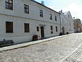
Polski: Dawny zespół szpitalny: kościół, ob. rektoralny p.w. Świętego Ducha w Sandomierzu oraz 2 budynki szpitalne.
Subcategories
This category has only the following subcategory.
H
Media in category "Former hospital complex, Sandomierz"
The following 7 files are in this category, out of 7 total.
-
 Czerwiec 2011 576.jpg 3,648 × 2,736; 5.87 MB
-
 PL - Sandomierz - szpital - 2012-08-18--14-27-33-01.jpg 3,719 × 2,479; 5.35 MB
-
 Sandomierz 03.JPG 2,304 × 3,072; 1.22 MB
-
 Sandomierz 06.JPG 3,072 × 2,304; 1.12 MB
-
 Sandomierz Brama Opatowska1.jpg 2,112 × 2,816; 2.79 MB
-
 Sandomierz, Caritas Diecezji Sandomierskiej - fotopolska.eu (17214).jpg 1,400 × 1,028; 256 KB
-
 Skrzydło.jpg 4,288 × 3,216; 4.5 MB


.jpg)
