Category:Former dam at Vaires-sur-Marne
Jump to navigation
Jump to search
| Object location | | View all coordinates using: OpenStreetMap |
|---|
Media in category "Former dam at Vaires-sur-Marne"
The following 7 files are in this category, out of 7 total.
-
 Former dam at Vaires D110109.jpg 4,416 × 3,312; 3.05 MB
-
 Former dam at Vaires D110605.jpg 3,312 × 4,416; 2.84 MB
-
 Former dam at Vaires D120219.jpg 4,416 × 3,312; 2.71 MB
-
 Former dam at Vaires D180122.jpg 2,816 × 2,112; 3.11 MB
-
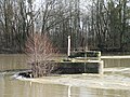
 Former dam at Vaires D180202 - inondations.jpg 2,816 × 2,112; 1.69 MB
-
 Former dam at Vaires D180211 - inondations.jpg 2,816 × 2,112; 3.28 MB
-
 Former dam at Vaires D180305 - inondations.jpg 2,816 × 2,112; 3.58 MB


