Category:Former county hall in Kemence
Jump to navigation
Jump to search
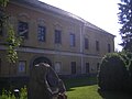
- Former county hall of Hont County in Kemence.
- Hont vármegye régi megyeháza Kemencén .
| Object location | | View all coordinates using: OpenStreetMap |
|---|
Media in category "Former county hall in Kemence"
The following 8 files are in this category, out of 8 total.
-
 Coat of arms of Hont County.jpg 1,380 × 1,700; 425 KB
-
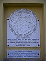
 Domszky Pál emléktábla, Kemence11.jpg 768 × 1,024; 190 KB
-
 Kemence légifotó1.jpg 480 × 326; 30 KB
-
 Kemence04.JPG 1,024 × 768; 234 KB
-
 Kemence05.JPG 1,024 × 768; 217 KB
-
 Kemence08.JPG 1,024 × 768; 267 KB
-
 Kemence09.JPG 768 × 1,024; 180 KB
-
 Kemence10.JPG 768 × 1,024; 240 KB


