Category:Former Toxteth Fire Station, High Park Street
Jump to navigation
Jump to search
| Object location | | View all coordinates using: OpenStreetMap |
|---|
Media in category "Former Toxteth Fire Station, High Park Street"
The following 2 files are in this category, out of 2 total.
-
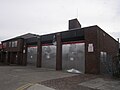 Disused fire station, Toxteth (1).JPG 4,320 × 3,240; 2.52 MB
-
 Disused fire station, Toxteth (2).JPG 4,320 × 3,240; 2.37 MB
.JPG)
.JPG)