Category:Former Quarry Bay School
Jump to navigation
Jump to search
| Object location | | View all coordinates using: OpenStreetMap |
|---|
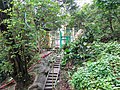
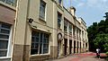
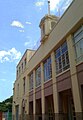
English: Former Quarry Bay School. Now housing the Hong Kong Association of Youth Development (Training Centre).
中文:前鰂魚涌學校
Media in category "Former Quarry Bay School"
The following 7 files are in this category, out of 7 total.
-
 Former Quarry Bay School 01.jpg 4,023 × 3,017; 6.11 MB
-
 Former Quarry Bay School 02.jpg 4,065 × 3,049; 4.95 MB
-
 Former Quarry Bay School 2012.JPG 1,600 × 1,200; 692 KB
-
 Former Quarry Bay School.JPG 3,456 × 5,184; 3.51 MB
-
 L1370697a.jpg 3,264 × 1,840; 418 KB
-
 香港青少年發展聯會 (德育中心).jpg 2,592 × 1,944; 1.03 MB
-
 香港青少年發展聯會(德育發展中心).JPG 1,696 × 2,453; 576 KB


.jpg)
.JPG)