Category:Forests in South Yorkshire
Jump to navigation
Jump to search
Subcategories
This category has the following 6 subcategories, out of 6 total.
Media in category "Forests in South Yorkshire"
The following 117 files are in this category, out of 117 total.
-
-
 5 4 3 2 1.... - geograph.org.uk - 993547.jpg 424 × 640; 95 KB
-
 A path through Woolley Wood, Wincobank - geograph.org.uk - 1773258.jpg 2,309 × 3,600; 7.79 MB
-
 A quick dip in the brook - geograph.org.uk - 406385.jpg 640 × 480; 168 KB
-

-
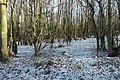
 A snowy walk through the trees - geograph.org.uk - 1143875.jpg 480 × 640; 122 KB
-
 A walk in the woods - geograph.org.uk - 405478.jpg 480 × 640; 116 KB
-
 After the fire, Horse Carr wood - geograph.org.uk - 1308932.jpg 640 × 480; 107 KB
-
 Another path through Woolley Wood, Wincobank - geograph.org.uk - 1780646.jpg 2,128 × 2,700; 7.68 MB
-
 Barnsley boundary walk - geograph.org.uk - 405412.jpg 480 × 640; 145 KB
-
 Birch trees on a former 'muck stack' - geograph.org.uk - 1153659.jpg 530 × 640; 172 KB
-
 Bole Edge Plantation - geograph.org.uk - 171070.jpg 640 × 480; 199 KB
-
 Can you see the toy^ - geograph.org.uk - 791890.jpg 640 × 483; 130 KB
-
 Canklow Wood - geograph.org.uk - 180960.jpg 640 × 480; 145 KB
-
 Concrete road from Tyers Hall Farm - geograph.org.uk - 786909.jpg 494 × 640; 139 KB
-
 Cross Riding, Sandall Beat Wood - geograph.org.uk - 449066.jpg 463 × 640; 114 KB
-
 Dappled shade in Smeekley Wood - geograph.org.uk - 552184.jpg 430 × 640; 268 KB
-
 Rear of St John's Church, Deepcar - geograph.org.uk - 1054909.jpg 640 × 427; 80 KB
-
 Entrance to Margery Wood - geograph.org.uk - 180453.jpg 640 × 480; 154 KB
-
 Farm track into grassland - geograph.org.uk - 900098.jpg 640 × 480; 72 KB
-
 Footpath stile - geograph.org.uk - 1702819.jpg 3,648 × 2,736; 3.78 MB
-
 Hanging Wood, Highfields Country Park (geograph 6051582).jpg 2,736 × 1,824; 3.24 MB
-
 Howell Wood - geograph.org.uk - 597394.jpg 640 × 527; 204 KB
-
 Husband Wood Footpath - geograph.org.uk - 415230.jpg 640 × 480; 154 KB
-
 Hutcliffe Wood Road sunset - panoramio.jpg 5,376 × 3,024; 4.2 MB
-
 Knots - geograph.org.uk - 762901.jpg 640 × 481; 142 KB
-
 Langsett Woods - geograph.org.uk - 458392.jpg 640 × 480; 132 KB
-

-

-
 Picnic area at Wombwell Woods - geograph.org.uk - 1715622.jpg 2,560 × 1,920; 1.43 MB
-
 Public Footpath near Dovecliffe Road - geograph.org.uk - 1192395.jpg 640 × 480; 126 KB
-
 Rock and Wood - geograph.org.uk - 713884.jpg 640 × 480; 136 KB
-
 Scholes Coppice - geograph.org.uk - 139027.jpg 640 × 480; 196 KB
-
 Scraith Wood, Herries Road, Sheffield - geograph.org.uk - 760161.jpg 640 × 427; 114 KB
-
 Silkstone Fall from the A628 - geograph.org.uk - 113295.jpg 640 × 426; 102 KB
-
 Storrs Mill Wood bluebells - geograph.org.uk - 786551.jpg 510 × 640; 171 KB
-
 Sun through the trees - geograph.org.uk - 585853.jpg 640 × 480; 103 KB
-
 Sunlight in a plantation near Rossington (geograph 5977977).jpg 1,024 × 768; 387 KB
-
 Swinefleet Warping Drain - geograph.org.uk - 644005.jpg 640 × 480; 95 KB
-
 The north edge of Howell Wood - geograph.org.uk - 597400.jpg 620 × 640; 187 KB
-

-
 Tracks and signpost in Ecclesall Woods - geograph.org.uk - 373071.jpg 640 × 480; 161 KB
-
 Trees in Scholes Coppice - geograph.org.uk - 1724989.jpg 640 × 480; 164 KB
-

-
 View from Redmires wood - geograph.org.uk - 407520.jpg 640 × 480; 113 KB
-
 Wadworth Wood - geograph.org.uk - 487815.jpg 640 × 427; 119 KB
-
 Weir on the River Don - geograph.org.uk - 655879.jpg 640 × 480; 141 KB
-
 Weir on the River Don ^2 - geograph.org.uk - 655883.jpg 640 × 480; 168 KB
-
 Wharncliffe - geograph.org.uk - 136319.jpg 640 × 480; 164 KB
-
 Woodhead Road - geograph.org.uk - 665656.jpg 640 × 480; 163 KB
-
 Woodland Marker above Rivelin Dams - geograph.org.uk - 1438485.jpg 640 × 480; 134 KB
-

-
 Woodland near Kimberworth Park - geograph.org.uk - 487792.jpg 640 × 427; 151 KB
-
 Woodland, Litherop Lane, High Hoyland - geograph.org.uk - 726107.jpg 640 × 480; 143 KB
-
 A Ploughed Field - geograph.org.uk - 531653.jpg 640 × 480; 88 KB
-
 A view of 'The Roughs' - geograph.org.uk - 441200.jpg 480 × 640; 93 KB
-
 A Woodland View - geograph.org.uk - 577254.jpg 640 × 427; 107 KB
-
 Across Ploughed field to un-named wood - geograph.org.uk - 127839.jpg 640 × 480; 119 KB
-

-
 Bawtry forest. - geograph.org.uk - 508845.jpg 640 × 480; 171 KB
-
 Belgrave Road Conservation Area - geograph.org.uk - 170141.jpg 640 × 480; 218 KB
-
 Birchcliff Bank - geograph.org.uk - 83230.jpg 640 × 480; 78 KB
-
 Bluebells on river Dearne bank. - geograph.org.uk - 493058.jpg 640 × 480; 166 KB
-
 Bole Edge Plantation - geograph.org.uk - 169463.jpg 640 × 480; 147 KB
-
 Burnt Wood - geograph.org.uk - 435652.jpg 640 × 480; 348 KB
-
 Cawthorne Park Woodland - geograph.org.uk - 180464.jpg 640 × 480; 156 KB
-
 Cock wood. - geograph.org.uk - 519420.jpg 640 × 586; 186 KB
-
 Common Road Woods - geograph.org.uk - 122313.jpg 640 × 427; 104 KB
-
 Cornfield at Champany Hill - geograph.org.uk - 520183.jpg 640 × 480; 92 KB
-

-
 Doubting Plantation - geograph.org.uk - 110140.jpg 640 × 426; 99 KB
-
 Ecclesall Woods. - geograph.org.uk - 122756.jpg 640 × 480; 83 KB
-
 Eccleshall Woods. - geograph.org.uk - 111027.jpg 640 × 480; 201 KB
-
 Edge of the wood - geograph.org.uk - 308657.jpg 640 × 480; 115 KB
-
 Edlington Wood - geograph.org.uk - 238915.jpg 640 × 480; 145 KB
-
 Field and Trees and Clouds - geograph.org.uk - 238920.jpg 640 × 480; 107 KB
-
 Fields and Deffer Wood - geograph.org.uk - 397478.jpg 640 × 480; 66 KB
-
 Forestry on White Lea Moor - geograph.org.uk - 124838.jpg 640 × 480; 221 KB
-
 Hall Wood and Low Hall Wood - geograph.org.uk - 369669.jpg 640 × 437; 56 KB
-
 Hampole Woods - geograph.org.uk - 282367.jpg 640 × 480; 77 KB
-
 King's Wood - geograph.org.uk - 148169.jpg 640 × 480; 80 KB
-
 Langsett Woods Track - geograph.org.uk - 458396.jpg 640 × 480; 105 KB
-
 Loscar Wood - geograph.org.uk - 122312.jpg 640 × 427; 149 KB
-
 Margery Wood - geograph.org.uk - 180457.jpg 480 × 640; 148 KB
-
 Melton Wood and Sheep Lane - geograph.org.uk - 127889.jpg 640 × 480; 97 KB
-
 NE edge of Silkstone Fall - geograph.org.uk - 113333.jpg 640 × 409; 123 KB
-
 Old gatepost in Melton Woods. - geograph.org.uk - 534145.jpg 640 × 480; 173 KB
-
 Path Through Hood Wood - geograph.org.uk - 180448.jpg 480 × 640; 172 KB
-
 Path through the Limb Valley - geograph.org.uk - 411399.jpg 480 × 640; 247 KB
-
 Path through the Limb Valley - geograph.org.uk - 411411.jpg 640 × 480; 232 KB
-
 Path through the Limb Valley - geograph.org.uk - 411422.jpg 640 × 480; 209 KB
-
 Path to Hood Wood - geograph.org.uk - 180445.jpg 480 × 640; 156 KB
-
 Rough Park near Stone - geograph.org.uk - 560546.jpg 640 × 434; 121 KB
-
 Scabba Wood - geograph.org.uk - 197465.jpg 640 × 480; 74 KB
-
 Scholes Wood - geograph.org.uk - 336839.jpg 640 × 480; 171 KB
-
 Scrat Haigh Wood Track - geograph.org.uk - 599321.jpg 640 × 480; 122 KB
-

-
 Smelter Bank Wood. - geograph.org.uk - 305200.jpg 640 × 480; 119 KB
-
 Squirrel Wood from Common Lane - geograph.org.uk - 287305.jpg 640 × 480; 86 KB
-

-
 Sun Shines Through In Hugset Woods - geograph.org.uk - 422297.jpg 640 × 480; 127 KB
-
 The Backside of Fall Head Farm - geograph.org.uk - 422247.jpg 640 × 480; 103 KB
-
 The Edge of the Wood - geograph.org.uk - 374319.jpg 640 × 480; 100 KB
-
 The End is in Sight - geograph.org.uk - 574853.jpg 640 × 480; 95 KB
-
 The track through Bagger Wood - geograph.org.uk - 117027.jpg 640 × 426; 175 KB
-
 Thickwoods by Thickwoods Lane - geograph.org.uk - 634671.jpg 640 × 480; 120 KB
-
 Tickhill Low Common - geograph.org.uk - 377451.jpg 640 × 480; 110 KB
-
 Towards Foulstone Delf - geograph.org.uk - 325852.jpg 480 × 640; 77 KB
-
 Track through coniferous woodland - geograph.org.uk - 552180.jpg 430 × 640; 229 KB
-
 Wickersley Woods. - geograph.org.uk - 394232.jpg 640 × 427; 183 KB
-
 Wombwell Wood - geograph.org.uk - 57923.jpg 640 × 480; 106 KB
-
 Wood on a Hill - geograph.org.uk - 122309.jpg 640 × 427; 63 KB
-
 Wooded area - geograph.org.uk - 117774.jpg 640 × 480; 70 KB
-
 Wooded area - geograph.org.uk - 117846.jpg 640 × 480; 71 KB
-
 Woodland and Field - geograph.org.uk - 125614.jpg 640 × 480; 108 KB
-
 Woodland bordering M1 - geograph.org.uk - 400934.jpg 640 × 480; 166 KB
-
 Woods Adjacent to Ironside Road - geograph.org.uk - 356553.jpg 640 × 480; 142 KB


.jpg)


.jpg)


