Category:Forests in Somerset
Jump to navigation
Jump to search
Subcategories
This category has the following 4 subcategories, out of 4 total.
W
- Warleigh Wood (1 F)
- Weston Big Wood (21 F)
Media in category "Forests in Somerset"
The following 200 files are in this category, out of 242 total.
(previous page) (next page)-
 Abandoned dam project - geograph.org.uk - 1263727.jpg 640 × 427; 101 KB
-
 Above Ebbor Gorge.jpg 1,024 × 768; 214 KB
-
 Ashington Wood - geograph.org.uk - 643355.jpg 640 × 480; 75 KB
-
 Beech hedge in the woods. - geograph.org.uk - 104507.jpg 480 × 640; 163 KB
-
 Beech wood, Lansdown - geograph.org.uk - 713496.jpg 640 × 492; 205 KB
-
 Bracken and Ferns in the Quantock Hills and Forest.JPG 1,280 × 960; 283 KB
-
 Bridleway in Croydon Hill Forest - geograph.org.uk - 194180.jpg 640 × 425; 82 KB
-
 Bridleway through newly planted woodland. - geograph.org.uk - 228933.jpg 640 × 426; 183 KB
-
 Bridleway to Timberscombe. - geograph.org.uk - 162655.jpg 640 × 505; 124 KB
-
 Bridleway, Skilgate Wood - geograph.org.uk - 694564.jpg 640 × 426; 185 KB
-
 Broadwood Road - geograph.org.uk - 1433073.jpg 480 × 640; 100 KB
-
 Brompton Regis, Barlynch Wood - geograph.org.uk - 197349.jpg 640 × 427; 308 KB
-
 Callins - The track to Hopcott - geograph.org.uk - 177310.jpg 640 × 480; 148 KB
-

-
 Cleared area in Tyning Wood - geograph.org.uk - 466288.jpg 640 × 480; 139 KB
-
 Cleeve, bluebell wood - geograph.org.uk - 62547.jpg 640 × 440; 172 KB
-
 Coast path below Sugarloaf Hill - geograph.org.uk - 1461284.jpg 480 × 640; 157 KB
-
 Coast path in Culbone Wood, Oare - geograph.org.uk - 35044.jpg 597 × 400; 100 KB
-
 Cockercombe Forest Office - geograph.org.uk - 224505.jpg 640 × 425; 121 KB
-
 Collyhill Wood - geograph.org.uk - 271393.jpg 640 × 480; 116 KB
-
 Combe Sydenham Country Park - geograph.org.uk - 104573.jpg 480 × 640; 158 KB
-
 Coming down from Monkham Wood. - geograph.org.uk - 162660.jpg 640 × 503; 138 KB
-
 Conifer plantation near Escott Farm - geograph.org.uk - 1654012.jpg 640 × 430; 109 KB
-
 Coscombe and Glenthorne Plantation - geograph.org.uk - 565086.jpg 640 × 480; 136 KB
-
 Crook Horn Hill, near the Cattle Grid - geograph.org.uk - 98754.jpg 640 × 480; 152 KB
-

-
 Deer in the Quarme valley - geograph.org.uk - 771962.jpg 640 × 514; 117 KB
-
 Deer sighting - geograph.org.uk - 459836.jpg 640 × 477; 137 KB
-
 Dulverton, lane near Anstey Farm - geograph.org.uk - 390888.jpg 640 × 427; 282 KB
-
 Dulverton, Looseall Wood - geograph.org.uk - 308572.jpg 640 × 427; 325 KB
-
 Dulverton, wood near Three Gates Cross - geograph.org.uk - 150055.jpg 640 × 427; 275 KB
-
 Dunster Forest - geograph.org.uk - 1433040.jpg 480 × 640; 126 KB
-
 Dunster Park - geograph.org.uk - 147979.jpg 640 × 480; 141 KB
-
 Dunster Park. - geograph.org.uk - 147978.jpg 480 × 640; 113 KB
-
 Entering Quants Nature Reserve - geograph.org.uk - 1606307.jpg 480 × 640; 128 KB
-
 Footbridge over stream near Hollam Farm - geograph.org.uk - 679009.jpg 640 × 480; 127 KB
-
 Footings for abandoned dam project - geograph.org.uk - 1263699.jpg 427 × 640; 119 KB
-
 Footings for abandoned dam project - geograph.org.uk - 1263706.jpg 640 × 427; 143 KB
-
 Footpath alongside wood at Brockham End - geograph.org.uk - 453466.jpg 640 × 480; 103 KB
-
 Footpath Around Wood - geograph.org.uk - 1439798.jpg 640 × 480; 120 KB
-
 Furzehill Lane - geograph.org.uk - 455241.jpg 640 × 480; 205 KB
-
 Fyne Court nature trail 2 - geograph.org.uk - 1197323.jpg 640 × 480; 187 KB
-
 Fyne Court nature trail 4 - geograph.org.uk - 1197325.jpg 640 × 480; 167 KB
-
 Geographh 2868675 Cogley Wood.jpg 640 × 416; 78 KB
-
 Ground frost and autumn sunshine - geograph.org.uk - 271397.jpg 640 × 480; 112 KB
-
 Haddeo Valley - geograph.org.uk - 47354.jpg 640 × 480; 167 KB
-
 Haddeo valley.jpg 6,087 × 2,764; 7.79 MB
-

-
 Hole's Corner - geograph.org.uk - 108201.jpg 640 × 480; 165 KB
-
 Hopcott Brake - geograph.org.uk - 212816.jpg 640 × 425; 93 KB
-
 Horner Water, Luccombe - geograph.org.uk - 415271.jpg 640 × 480; 141 KB
-
 Horner Woods, Luccombe - geograph.org.uk - 415282.jpg 640 × 480; 124 KB
-
 Horse Parks Wood - geograph.org.uk - 686898.jpg 640 × 387; 138 KB
-
 House at the edge of Chargot Wood - geograph.org.uk - 271398.jpg 640 × 473; 111 KB
-
 Huish Champflower, wood at Potters Cross - geograph.org.uk - 158173.jpg 640 × 427; 232 KB
-
 King's Brompton Forest - geograph.org.uk - 273069.jpg 640 × 480; 68 KB
-
 King's Wood - typical scenery - geograph.org.uk - 87577.jpg 640 × 480; 193 KB
-
 Lane on Wellington Hill - geograph.org.uk - 1692300.jpg 640 × 480; 116 KB
-
 Langford Budville, edge of Coram's Wood - geograph.org.uk - 153961.jpg 640 × 427; 239 KB
-
 Leaving Orchardleigh Wood - geograph.org.uk - 439434.jpg 640 × 477; 116 KB
-
 Lime Ridge Wood - geograph.org.uk - 353120.jpg 640 × 480; 153 KB
-
 Looking back into Buckland Wood - geograph.org.uk - 448967.jpg 640 × 480; 135 KB
-
 Looking over to Nine Springs - geograph.org.uk - 190517.jpg 640 × 480; 75 KB
-
 Looking towards Knowle Hill - geograph.org.uk - 177268.jpg 640 × 480; 107 KB
-
 Loxley Woods - geograph.org.uk - 150886.jpg 640 × 426; 104 KB
-
 Luccombe, by the Horner Water - geograph.org.uk - 93976.jpg 640 × 422; 216 KB
-

-
 Lyncombe Wood - geograph.org.uk - 693099.jpg 464 × 640; 181 KB
-
 Lyncombe Wood - geograph.org.uk - 693681.jpg 640 × 426; 144 KB
-
 Nutcombe Bottom - geograph.org.uk - 162640.jpg 640 × 467; 121 KB
-
 Opposite Totterdown Farm - geograph.org.uk - 177264.jpg 640 × 480; 95 KB
-
 Orchard Wood from bridleway - geograph.org.uk - 353058.jpg 480 × 640; 160 KB
-
 Park Wood - geograph.org.uk - 181563.jpg 640 × 480; 77 KB
-

-
 Path in Moor Wood - geograph.org.uk - 1719779.jpg 640 × 480; 148 KB
-
 Path into a wood - geograph.org.uk - 563266.jpg 640 × 427; 60 KB
-
 Pitminster, near Culmhead - geograph.org.uk - 278024.jpg 640 × 427; 315 KB
-
 Pool Bridge -in early April - geograph.org.uk - 393284.jpg 640 × 426; 202 KB
-
 Porlock, footpath in Homebush Wood - geograph.org.uk - 221394.jpg 640 × 427; 290 KB
-
 Porlock, footpath to South Terrace - geograph.org.uk - 221398.jpg 640 × 427; 296 KB
-
 Porlock, the toll road - geograph.org.uk - 75784.jpg 640 × 427; 197 KB
-
 Primroses on the bridleway bank - geograph.org.uk - 734495.jpg 480 × 640; 127 KB
-
 Private Road leading to Hollam Farm - geograph.org.uk - 679006.jpg 640 × 480; 99 KB
-
 Remains of Chard Canal near Dowlish Ford - geograph.org.uk - 156917.jpg 640 × 480; 174 KB
-
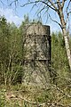 Reservoir tower at abandoned dam project - geograph.org.uk - 1263721.jpg 427 × 640; 154 KB
-
 Rickford chapel.JPG 3,456 × 2,304; 2.16 MB
-

-
 Ruggin bridleway - geograph.org.uk - 1263733.jpg 427 × 640; 124 KB
-
 Ruggin Nature Reserve - geograph.org.uk - 1290012.jpg 640 × 427; 138 KB
-
 Ruggin Nature Reserve - geograph.org.uk - 1290062.jpg 640 × 427; 128 KB
-
 Seal wood - geograph.org.uk - 318155.jpg 548 × 640; 87 KB
-
 Geograph 1698017 Memorial cross in Allerford Plantation.jpg 640 × 480; 139 KB
-
 Selworthy, above Selworthy Combe - geograph.org.uk - 547641.jpg 640 × 427; 174 KB
-

-
 Selworthy, Selworthy Combe - geograph.org.uk - 547638.jpg 640 × 427; 269 KB
-
 Selworthy, Selworthy Combe - geograph.org.uk - 547640.jpg 640 × 427; 288 KB
-
 Selworthy, towards West Lynch - geograph.org.uk - 547650.jpg 640 × 427; 199 KB
-
 Shiner's Wood on Prospect Stile - geograph.org.uk - 745042.jpg 640 × 426; 74 KB
-
 Signpost - geograph.org.uk - 147981.jpg 640 × 480; 181 KB
-
 Skilgate Wood - geograph.org.uk - 694575.jpg 640 × 409; 102 KB
-
 Snow Drop Valley - geograph.org.uk - 22207.jpg 640 × 480; 181 KB
-
 Southstoke, Millennium Wood - geograph.org.uk - 283307.jpg 640 × 427; 233 KB
-
 Staple Hill, Blackdown Hills - geograph.org.uk - 125925.jpg 640 × 480; 146 KB
-
 Sully - geograph.org.uk - 269845.jpg 480 × 640; 166 KB
-
 Tadbesom Wood to the left - geograph.org.uk - 1478710.jpg 640 × 474; 192 KB
-
 Tarr Steps 10 (4652980196).jpg 3,648 × 2,736; 14.85 MB
-
 Tarr Steps Woodland 1.jpg 4,128 × 2,848; 7.37 MB
-
 Tarr Steps Woodland 2.jpg 4,072 × 2,848; 7.11 MB
-
 The lake in Wayford Wood - geograph.org.uk - 450686.jpg 480 × 640; 123 KB
-

-
 Track to Wellingtons Monument - geograph.org.uk - 161034.jpg 640 × 426; 180 KB
-
 Upton Wood viewed from the east - geograph.org.uk - 670979.jpg 640 × 326; 32 KB
-
 Vagg's Hill Bushes - geograph.org.uk - 673263.jpg 640 × 480; 132 KB
-
 View from the banks of River Haddeo - geograph.org.uk - 691576.jpg 640 × 426; 119 KB
-
 View on Foxdon Hill - geograph.org.uk - 139360.jpg 640 × 480; 120 KB
-
 View through the hedge, Ash Lane - geograph.org.uk - 455260.jpg 640 × 480; 187 KB
-
 Walk through Staddlecombe Plantation - geograph.org.uk - 524960.jpg 640 × 480; 141 KB
-
 Wall and leat above Horner.jpg 4,176 × 2,848; 6.89 MB
-
 Wambrook, stream in Bickham Wood - geograph.org.uk - 227164.jpg 640 × 427; 304 KB
-
 Webbers Post, The woods - geograph.org.uk - 98775.jpg 475 × 640; 127 KB
-
 Wellington, on Quarts Moor - geograph.org.uk - 174816.jpg 640 × 427; 340 KB
-
 Withycombe Scruffets. - geograph.org.uk - 153295.jpg 640 × 480; 153 KB
-
 Wood near Spinney Farm - geograph.org.uk - 635740.jpg 640 × 466; 149 KB
-
 Woodland above Down Farm - geograph.org.uk - 470355.jpg 640 × 480; 52 KB
-
 Woodland edge near Leigh Farm - geograph.org.uk - 273054.jpg 640 × 480; 85 KB
-
 Woodland Exmoor Devon - geograph.org.uk - 212224.jpg 640 × 480; 230 KB
-
 Woodland near Alfred's Tower - geograph.org.uk - 101947.jpg 408 × 640; 100 KB
-
 Woodland path near Leigh Farm - geograph.org.uk - 273059.jpg 640 × 480; 131 KB
-
 Woodland Road. - geograph.org.uk - 162646.jpg 640 × 480; 106 KB
-
 Woodland walks - geograph.org.uk - 563324.jpg 640 × 427; 97 KB
-

-
 Access to Witham Park woods - geograph.org.uk - 458776.jpg 640 × 477; 138 KB
-
 Annis Hill from A303 - geograph.org.uk - 542971.jpg 640 × 480; 55 KB
-
 Awkward underfoot - geograph.org.uk - 563313.jpg 640 × 427; 106 KB
-
 Bluebells in Greyfield Woods - geograph.org.uk - 424514.jpg 640 × 480; 103 KB
-
 Bluebells in Kings Wood Warren - geograph.org.uk - 417759.jpg 480 × 640; 150 KB
-
 Britty Common, Blackdown Hills - geograph.org.uk - 126291.jpg 640 × 480; 183 KB
-

-
 Chipstable, beech wood at Heydon Hill - geograph.org.uk - 167609.jpg 427 × 640; 231 KB
-
 Chipstable, in the Tone valley - geograph.org.uk - 91238.jpg 640 × 435; 191 KB
-
 Cleaves Wood - geograph.org.uk - 613104.jpg 640 × 464; 120 KB
-
 Cleaves Wood and Hinton Hill - geograph.org.uk - 363234.jpg 640 × 480; 60 KB
-
 Cleeve, field path to King's Wood - geograph.org.uk - 92473.jpg 640 × 431; 120 KB
-
 Compton Dando, Lord's Wood - geograph.org.uk - 86792.jpg 430 × 640; 187 KB
-
 Crendle Hill Wood - geograph.org.uk - 459273.jpg 640 × 480; 108 KB
-
 Crooked Copse - geograph.org.uk - 7209.jpg 634 × 474; 435 KB
-
 Cutcombe, Mansley Combe - geograph.org.uk - 216912.jpg 640 × 427; 303 KB
-
 Cutcombe, towards the Avill valley - geograph.org.uk - 216919.jpg 640 × 427; 228 KB
-
 Death and life within the forest - geograph.org.uk - 459816.jpg 640 × 477; 159 KB
-
 Dulverton, near Springfield - geograph.org.uk - 85985.jpg 640 × 427; 97 KB
-
 Eastern edge of Dolebury Warren - geograph.org.uk - 91534.jpg 640 × 480; 97 KB
-
 Elworthy, Elworthy Combe - geograph.org.uk - 152299.jpg 640 × 427; 181 KB
-
 Entering Blackslough Wood - geograph.org.uk - 459855.jpg 640 × 477; 147 KB
-
 Entrance into East Harptree Woods - geograph.org.uk - 616461.jpg 640 × 480; 144 KB
-
 Entrance to Great Boles - geograph.org.uk - 171579.jpg 640 × 480; 132 KB
-
 Fallen tree in Syndercombe Wood - geograph.org.uk - 193557.jpg 640 × 425; 117 KB
-
 Field And Skinners Wood - geograph.org.uk - 149164.jpg 640 × 426; 117 KB
-
 Field and Woods on the Mendips - geograph.org.uk - 164439.jpg 640 × 426; 111 KB
-
 Field to Stockhill Woods - geograph.org.uk - 164791.jpg 640 × 426; 114 KB
-
 Field to woods - geograph.org.uk - 164788.jpg 640 × 426; 130 KB
-
 Fitzhead, north west from the village - geograph.org.uk - 125885.jpg 640 × 427; 94 KB
-
 Gate into woodland - geograph.org.uk - 618688.jpg 640 × 480; 162 KB
-
 GOML woodland on Toomer Hill - geograph.org.uk - 687709.jpg 640 × 480; 138 KB
-
 Great Plantation, near Stringston - geograph.org.uk - 172485.jpg 640 × 425; 86 KB
-
 Greyfield Woods - geograph.org.uk - 424507.jpg 480 × 640; 133 KB
-
 Greyfield Woods - geograph.org.uk - 424512.jpg 640 × 480; 111 KB
-
 Harvant Wood - geograph.org.uk - 623868.jpg 640 × 480; 77 KB
-
 Harvested field on Windmill Hill - geograph.org.uk - 524966.jpg 640 × 480; 113 KB
-
 Hatherstone Millennium Wood. - geograph.org.uk - 93353.jpg 640 × 480; 145 KB
-
 Hick's Park Wood - geograph.org.uk - 750074.jpg 640 × 480; 131 KB
-
 Hodder's Combe. - geograph.org.uk - 147025.jpg 640 × 425; 152 KB
-
 In Orchardleigh Wood - geograph.org.uk - 439424.jpg 640 × 477; 170 KB
-
 In Witham Park woods - geograph.org.uk - 458759.jpg 477 × 640; 96 KB
-
 In woods on the Macmillan Way - geograph.org.uk - 440630.jpg 640 × 477; 155 KB
-
 King's Wood-Corporation Wood - geograph.org.uk - 97076.jpg 640 × 480; 184 KB
-
 Lane and Chewton Wood - geograph.org.uk - 184099.jpg 640 × 480; 94 KB
-
 Lime Breach Wood - geograph.org.uk - 127941.jpg 640 × 426; 203 KB
-
 Long Wood, adjoining Fernhill Farm - geograph.org.uk - 455011.jpg 640 × 480; 105 KB
-
 Longley wood - geograph.org.uk - 479494.jpg 640 × 480; 164 KB
-
 Looking down to Hilcombe Farm - geograph.org.uk - 459806.jpg 640 × 477; 112 KB
-
 Milverton, Milverton Heath - geograph.org.uk - 154003.jpg 640 × 427; 164 KB
-
 Mixed woodland in King's Wood Warren - geograph.org.uk - 459763.jpg 640 × 477; 134 KB
-
 Muddy track at Buncombe Wood - geograph.org.uk - 217452.jpg 640 × 425; 112 KB
-

-
 Oare, Culbone Wood - geograph.org.uk - 98335.jpg 640 × 426; 215 KB
-
 Old Hill Woods - geograph.org.uk - 127947.jpg 640 × 426; 180 KB
-
 Old Wood - geograph.org.uk - 222725.jpg 600 × 428; 57 KB
-
 Old Wood from New Lane - geograph.org.uk - 507970.jpg 640 × 470; 115 KB
-
 Orchardleigh Wood - geograph.org.uk - 101959.jpg 640 × 379; 114 KB
-
 Pasture above The Thickets - geograph.org.uk - 373739.jpg 640 × 480; 47 KB
-
 Path through Lea Wood - geograph.org.uk - 85850.jpg 480 × 640; 172 KB
-
 Pitminster, by Luxhay Wood - geograph.org.uk - 278015.jpg 640 × 427; 339 KB
-
 Pitminster, the Wellington road - geograph.org.uk - 278020.jpg 640 × 427; 370 KB
-
 Pitts Wood - geograph.org.uk - 341196.jpg 640 × 480; 497 KB
-
 Porlock, edge of Shillett Wood - geograph.org.uk - 221402.jpg 640 × 427; 285 KB
-
 Porlock, nearing Culbone - geograph.org.uk - 358223.jpg 640 × 427; 263 KB
-
 Porlock, Yearnor Wood - geograph.org.uk - 358220.jpg 640 × 427; 277 KB
-
 Quantock tracks. - geograph.org.uk - 116156.jpg 640 × 480; 132 KB
-
 Rams Combe - geograph.org.uk - 7099.jpg 640 × 412; 83 KB
-


.jpg)


