Category:Forests in East Renfrewshire
Jump to navigation
Jump to search
Council areas (municipalities) of Scotland: Aberdeen · Aberdeenshire · Angus · Argyll and Bute · Clackmannanshire · Dumfries and Galloway · East Ayrshire · East Dunbartonshire · East Lothian · East Renfrewshire · Edinburgh · Falkirk · Fife · Glasgow · Highland · Inverclyde · Midlothian · Moray · North Ayrshire · North Lanarkshire · Outer Hebrides · Orkney Islands · Perth and Kinross · Renfrewshire · Scottish Borders · Shetland Islands · South Ayrshire · South Lanarkshire · Stirling · West Dunbartonshire · West Lothian
Subcategories
This category has the following 2 subcategories, out of 2 total.
K
- Knockenae Plantation (2 F)
W
- Whitelee Forest (91 F)
Media in category "Forests in East Renfrewshire"
The following 14 files are in this category, out of 14 total.
-
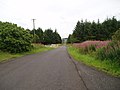 1 Km Long Road - geograph.org.uk - 1418771.jpg 640 × 480; 69 KB
-
 Cyclists, Corse Hill - geograph.org.uk - 13028.jpg 640 × 480; 53 KB
-
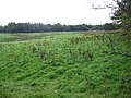
 East Renfrewshire Community Woodland - geograph.org.uk - 1031265.jpg 640 × 480; 55 KB
-
 Forest edge at Flow Moss - geograph.org.uk - 378097.jpg 640 × 480; 122 KB
-
 Forest edge at Flow Moss - geograph.org.uk - 378103.jpg 640 × 480; 149 KB
-
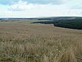 Hillside and Forest - geograph.org.uk - 131536.jpg 640 × 480; 88 KB
-
 Long Wood - geograph.org.uk - 1617319.jpg 640 × 480; 160 KB
-
 Melons Wood - geograph.org.uk - 251927.jpg 640 × 480; 110 KB
-
 Shillford Road - geograph.org.uk - 1582586.jpg 640 × 478; 103 KB
-
 Threepgrass Wood - geograph.org.uk - 200006.jpg 640 × 429; 56 KB
-
 Trees at Lochliboside Hills - geograph.org.uk - 200011.jpg 640 × 457; 120 KB
-
 Uplawmoor Woods.JPG 2,288 × 1,712; 1.38 MB
-
 Wooded Hill Near Eaglesham - geograph.org.uk - 635408.jpg 640 × 480; 184 KB
-
 Woodland Near Glenouther Rig - geograph.org.uk - 635424.jpg 640 × 480; 186 KB


