Category:Forests in Derbyshire
Jump to navigation
Jump to search
Subcategories
This category has the following 4 subcategories, out of 4 total.
Media in category "Forests in Derbyshire"
The following 200 files are in this category, out of 238 total.
(previous page) (next page)-
 Along the side of Sherriff Wood - geograph.org.uk - 579021.jpg 640 × 430; 207 KB
-

-
 Backside Wood - geograph.org.uk - 226231.jpg 640 × 480; 193 KB
-
 Bankswood in early May - geograph.org.uk - 619559.jpg 427 × 640; 169 KB
-
 Banktop Plantation - geograph.org.uk - 122275.jpg 640 × 480; 236 KB
-
 Beardsley Plantation - geograph.org.uk - 272458.jpg 480 × 640; 134 KB
-
 Bee Low Wood - geograph.org.uk - 558615.jpg 640 × 480; 127 KB
-
 Bee Low Wood viewed from Back Lane - geograph.org.uk - 561424.jpg 640 × 480; 107 KB
-
 Beech hanger - geograph.org.uk - 1485329.jpg 640 × 452; 103 KB
-
 Beeley Plantation - geograph.org.uk - 475358.jpg 640 × 480; 184 KB
-
 Bent Lane - View across Fields - geograph.org.uk - 567186.jpg 640 × 480; 126 KB
-
 Birch woodland as seen from Froggatt Edge - geograph.org.uk - 551050.jpg 640 × 430; 208 KB
-
 Birch woodland below Froggatt Edge - geograph.org.uk - 550978.jpg 640 × 430; 193 KB
-
 Birch woodland on the edge of Eyam Moor - geograph.org.uk - 579013.jpg 640 × 461; 265 KB
-
 Birchill Bank Wood - geograph.org.uk - 586892.jpg 640 × 430; 83 KB
-
 Birchin Wood - geograph.org.uk - 693857.jpg 640 × 427; 184 KB
-
 Black Wood - geograph.org.uk - 312405.jpg 640 × 480; 114 KB
-
 Bluebell Wood - geograph.org.uk - 165586.jpg 480 × 640; 125 KB
-
 Bluebells oakerthorpe.jpg 4,912 × 3,264; 2.89 MB
-
 Bolehill Wood above Grindleford - geograph.org.uk - 579656.jpg 640 × 480; 134 KB
-
 Boundary of Low Moor Wood - geograph.org.uk - 558611.jpg 640 × 480; 140 KB
-
 Bow Wood, Lea Bridge - geograph.org.uk - 281275.jpg 640 × 480; 223 KB
-
 Bradley Wood - geograph.org.uk - 327406.jpg 480 × 640; 154 KB
-
 Brailsford Gorse - geograph.org.uk - 289794.jpg 640 × 480; 124 KB
-
 Brockholes Wood - geograph.org.uk - 426539.jpg 640 × 475; 113 KB
-
 Brockle Holes Wood - geograph.org.uk - 392197.jpg 640 × 480; 124 KB
-

-
 Clough Wood near Darley Bridge - geograph.org.uk - 280967.jpg 640 × 478; 150 KB
-
 Coniferous woodland on Bretton Moor - geograph.org.uk - 591733.jpg 640 × 428; 207 KB
-

-
 Edge of forest in Alport valley - panoramio.jpg 2,030 × 3,089; 1.15 MB
-
 Entering Meadow Place Wood - geograph.org.uk - 561466.jpg 640 × 480; 161 KB
-
 Entrance to Shaw Wood from B6013 - geograph.org.uk - 539635.jpg 640 × 480; 151 KB
-
 Entrance to Tupton Wood - geograph.org.uk - 404384.jpg 640 × 468; 155 KB
-
 Farley Moor - Field and Woodland - geograph.org.uk - 337390.jpg 640 × 480; 116 KB
-
 Farley Moor - Woodland and Field - geograph.org.uk - 337395.jpg 640 × 480; 155 KB
-
 Farley Moor - Woodland Entrance - geograph.org.uk - 332880.jpg 640 × 480; 143 KB
-
 Farley Moor - Woodland Path - geograph.org.uk - 333454.jpg 640 × 480; 130 KB
-
 Farley Moor - Woodland Path - geograph.org.uk - 333462.jpg 640 × 480; 145 KB
-
 Farley Moor - Woodland Path - geograph.org.uk - 333822.jpg 640 × 480; 104 KB
-
 Farley Moor - Woodland Path - geograph.org.uk - 333838.jpg 640 × 480; 173 KB
-
 Farley Moor - Woodland Path - geograph.org.uk - 333840.jpg 640 × 480; 159 KB
-
 Farley Moor - Woodland Path - geograph.org.uk - 333843.jpg 640 × 480; 188 KB
-
 Farley Moor - Woodland Path - geograph.org.uk - 337403.jpg 640 × 480; 141 KB
-
 Farley Moor - Woodland Path - geograph.org.uk - 338806.jpg 640 × 480; 118 KB
-
 Farley Moor - Woodland Path - geograph.org.uk - 714874.jpg 640 × 480; 110 KB
-
 Farley Moor - Woodland Paths Crossing - geograph.org.uk - 333443.jpg 640 × 480; 126 KB
-

-
 Flash Lane Autumn Gold - geograph.org.uk - 298023.jpg 640 × 480; 143 KB
-
 Footpath to Hope Cross - geograph.org.uk - 473288.jpg 480 × 640; 111 KB
-
 Footpath to Hope Cross - geograph.org.uk - 473297.jpg 640 × 480; 86 KB
-
 Footpath to Ladybower Reservoir - geograph.org.uk - 473275.jpg 640 × 480; 133 KB
-

-
 Forestry above Errwood Reservoir - geograph.org.uk - 701719.jpg 640 × 426; 60 KB
-
 Forestry on the Chatsworth Estate - geograph.org.uk - 583321.jpg 640 × 430; 83 KB
-
 Forty Acre Wood Footpath - geograph.org.uk - 313716.jpg 640 × 480; 171 KB
-
 Fox Covert at Lullington - geograph.org.uk - 392671.jpg 640 × 481; 90 KB
-
 Granby Wood - geograph.org.uk - 637352.jpg 640 × 469; 114 KB
-
 Great Shacklow Wood - Footpath - geograph.org.uk - 755116.jpg 640 × 480; 152 KB
-

-

-
 Haddon Fields Plantation - geograph.org.uk - 288034.jpg 640 × 480; 126 KB
-
 Haddonfields Plantation - geograph.org.uk - 288028.jpg 640 × 480; 127 KB
-
 Hall Wood, Swadlincote - geograph.org.uk - 372915.jpg 640 × 480; 84 KB
-
 Hell Bank Plantation View - geograph.org.uk - 298700.jpg 480 × 640; 75 KB
-
 Hell Bank Plantation Waterfall - geograph.org.uk - 298702.jpg 480 × 640; 84 KB
-
 Hill at the edge of the large forest in Alport Valley - panoramio.jpg 3,174 × 2,063; 616 KB
-
 Jack Flat below Wellington's Monument - geograph.org.uk - 255748.jpg 640 × 480; 116 KB
-
 Jagger's Clough, Backside Wood - geograph.org.uk - 226226.jpg 640 × 480; 188 KB
-
 Lady Clough Plantation in winter - geograph.org.uk - 323563.jpg 480 × 640; 66 KB
-
 Lindop Wood - geograph.org.uk - 275899.jpg 640 × 480; 101 KB
-
 Long Walk Wood - geograph.org.uk - 450107.jpg 640 × 480; 106 KB
-
 Longshaw Estate - Footpath View - geograph.org.uk - 752247.jpg 640 × 480; 127 KB
-
 Low Moor Wood - geograph.org.uk - 45165.jpg 480 × 640; 190 KB
-
 Low Moor Wood Entrance - geograph.org.uk - 558621.jpg 640 × 480; 175 KB
-
 Distant view of Lullington Church - geograph.org.uk - 594435.jpg 480 × 640; 76 KB
-
 Manners Wood, Bakewell - geograph.org.uk - 371525.jpg 640 × 480; 90 KB
-
 Mansell Park Wood - geograph.org.uk - 289801.jpg 480 × 640; 121 KB
-
 Marlpit Plantation - geograph.org.uk - 381054.jpg 640 × 480; 106 KB
-
 Matlock Bath Church, Derbyshire. Tinted lithograph by S. Ray Wellcome V0013945.jpg 3,241 × 2,349; 3.68 MB
-
 Mist over Kinder - geograph.org.uk - 323577.jpg 640 × 480; 95 KB
-
 New planting for the National Forest - geograph.org.uk - 615732.jpg 640 × 429; 106 KB
-
 Oak's Wood near Longshaw - geograph.org.uk - 579632.jpg 480 × 640; 123 KB
-
 Old Quarry in Corbar Wood - geograph.org.uk - 1568984.jpg 400 × 600; 189 KB
-
 On the edge of Stanage Plantation - geograph.org.uk - 752711.jpg 640 × 480; 143 KB
-
 Osierbed Wood - geograph.org.uk - 312422.jpg 640 × 480; 119 KB
-
 Path Alongside Matlock Moor - geograph.org.uk - 303760.jpg 640 × 480; 134 KB
-
 Path in Clough Wood - geograph.org.uk - 455537.jpg 480 × 640; 317 KB
-
 Path Through Ditch Clough Plantation - geograph.org.uk - 423934.jpg 480 × 640; 134 KB
-
 Path towards Upper Hurst Brook - geograph.org.uk - 1108063.jpg 640 × 480; 175 KB
-
 Peter Nook Wood - geograph.org.uk - 247320.jpg 640 × 480; 157 KB
-
 Pine trees in Farley Moor Wood - geograph.org.uk - 254862.jpg 640 × 480; 151 KB
-
 Redferns's Wood - geograph.org.uk - 426056.jpg 640 × 480; 104 KB
-
 River Derwent Footpath View - geograph.org.uk - 742955.jpg 640 × 480; 130 KB
-
 Scar Wood and Todd Brook - geograph.org.uk - 77829.jpg 480 × 640; 154 KB
-
 Smiths Wood - geograph.org.uk - 672417.jpg 640 × 429; 107 KB
-
 Smiths Wood and Highfield House - geograph.org.uk - 672450.jpg 640 × 429; 77 KB
-
 Sycamore, Oak and Ash, Lineacre Reservoir - geograph.org.uk - 734705.jpg 640 × 480; 345 KB
-
 The Great Wood - geograph.org.uk - 57097.jpg 640 × 480; 181 KB
-
 Tip of forest in Alport Valley - panoramio.jpg 3,030 × 2,136; 1.98 MB
-

-
 Track opposite Derwent Reservoir Inlet - geograph.org.uk - 730200.jpg 640 × 480; 129 KB
-

-

-
 Treetop canopy in Alport Valley forest - panoramio.jpg 3,216 × 2,136; 3.23 MB
-
 Trusley Coppice - geograph.org.uk - 316042.jpg 640 × 480; 95 KB
-
 Two woods and a gap - geograph.org.uk - 397570.jpg 640 × 481; 99 KB
-
 Walton Woods - Footpath - geograph.org.uk - 552937.jpg 640 × 480; 162 KB
-
 Welcome to (Tin Town) Birchinlee - geograph.org.uk - 734545.jpg 640 × 480; 127 KB
-
 Whitesprings - Covering of Snow - geograph.org.uk - 674396.jpg 640 × 480; 81 KB
-
 Whitesprings - geograph.org.uk - 313722.jpg 640 × 480; 150 KB
-

-
 Whitesprings Plantation Boundary - geograph.org.uk - 367148.jpg 640 × 480; 119 KB
-
 Whitesprings Plantation Boundary - geograph.org.uk - 367151.jpg 640 × 480; 160 KB
-
 Whitwell Wood Centre - geograph.org.uk - 128683.jpg 640 × 480; 128 KB
-
 Whitwell Wood Entrance - geograph.org.uk - 115283.jpg 640 × 427; 94 KB
-
 Winter wonderland - geograph.org.uk - 676586.jpg 640 × 480; 127 KB
-
 Wood by the B6105 Woodhead Road - geograph.org.uk - 263331.jpg 640 × 319; 30 KB
-
 Wood with no name - geograph.org.uk - 394979.jpg 640 × 481; 93 KB
-
 Woodland - geograph.org.uk - 596749.jpg 640 × 360; 133 KB
-
 Woodland and stream at Drakelow - geograph.org.uk - 402992.jpg 480 × 640; 241 KB
-

-
 Woodland Bridge over Crowhole Brook - geograph.org.uk - 557799.jpg 640 × 480; 163 KB
-
 Woodland clearing - geograph.org.uk - 543724.jpg 640 × 480; 136 KB
-
 Woodland footpath - geograph.org.uk - 543735.jpg 640 × 480; 132 KB
-

-
 Woodland Gate - geograph.org.uk - 571562.jpg 640 × 480; 183 KB
-
 Woodland on the edge of Big Moor - geograph.org.uk - 545345.jpg 640 × 430; 191 KB
-
 Woodland path through Farley Moor Wood - geograph.org.uk - 254865.jpg 461 × 640; 161 KB
-
 Woodland scene - Willersley Castle - geograph.org.uk - 598591.jpg 482 × 640; 159 KB
-
 Woodland Sunset at Mooredge - geograph.org.uk - 623409.jpg 640 × 480; 153 KB
-
 Woods near Oak Farm - geograph.org.uk - 591824.jpg 396 × 591; 231 KB
-
 A Footpath in Heatherdene Wood - geograph.org.uk - 527487.jpg 640 × 480; 143 KB
-
 A Short Walk - geograph.org.uk - 474175.jpg 640 × 360; 97 KB
-

-
 Alders Wood Rookery Ogston - geograph.org.uk - 305080.jpg 480 × 640; 64 KB
-
 An Autumnal Stroll - geograph.org.uk - 335858.jpg 640 × 360; 135 KB
-
 Astwith Dumbles - geograph.org.uk - 603582.jpg 640 × 359; 144 KB
-
 Autumn beeches in Shining Cliff Woods - geograph.org.uk - 617013.jpg 429 × 640; 175 KB
-
 Beech trees at Shining Cliff Woods - geograph.org.uk - 506143.jpg 480 × 640; 157 KB
-
 Bluebells at Shining Cliff Woods - geograph.org.uk - 506139.jpg 640 × 480; 185 KB
-
 Bluebells in Tupton Wood - geograph.org.uk - 298594.jpg 640 × 480; 50 KB
-

-

-
 Bottom Moor - Main Woodland Path - geograph.org.uk - 340267.jpg 640 × 480; 113 KB
-
 Bottom Moor - Silver Birch and Heather - geograph.org.uk - 341316.jpg 640 × 480; 155 KB
-
 Bottom Moor - Woodland Path - geograph.org.uk - 336610.jpg 640 × 480; 131 KB
-
 Bottom Moor - Woodland Path - geograph.org.uk - 336619.jpg 640 × 480; 121 KB
-
 Bottom Moor - Woodland Path - geograph.org.uk - 340268.jpg 640 × 480; 156 KB
-
 Bottom Moor Forestry Plantation - geograph.org.uk - 670714.jpg 640 × 480; 82 KB
-

-
 Broomridding Wood - geograph.org.uk - 363935.jpg 640 × 360; 139 KB
-
 Brown Cross Plantation - geograph.org.uk - 312451.jpg 640 × 480; 117 KB
-
 Bunting Wood - "To death do us part" - geograph.org.uk - 217291.jpg 640 × 480; 195 KB
-
 Burrs Wood. - geograph.org.uk - 133583.jpg 640 × 481; 191 KB
-
 Cadborough Wood - geograph.org.uk - 365721.jpg 640 × 480; 134 KB
-
 Car Plantation - geograph.org.uk - 190742.jpg 640 × 480; 80 KB
-
 Carr Wood - geograph.org.uk - 159756.jpg 640 × 480; 82 KB
-
 Cressbrook Dale, Wood. - geograph.org.uk - 270446.jpg 640 × 480; 147 KB
-
 Down the valley towards Milthorpe - geograph.org.uk - 552150.jpg 640 × 430; 230 KB
-
 Draycott Plantation - geograph.org.uk - 276421.jpg 640 × 480; 96 KB
-
 Ellentree Brow - geograph.org.uk - 138399.jpg 640 × 480; 115 KB
-

-
 Entrance to Walton Woods - geograph.org.uk - 552924.jpg 640 × 480; 158 KB
-
 Exiting Grange Wood - geograph.org.uk - 557811.jpg 640 × 480; 196 KB
-
 Far Tupton Wood - geograph.org.uk - 357600.jpg 640 × 480; 167 KB
-
 Farley Moor woodland near Matlock - geograph.org.uk - 247017.jpg 640 × 480; 141 KB
-
 Farmland dividing Woodland - geograph.org.uk - 656321.jpg 640 × 480; 112 KB
-
 Field and Wood - geograph.org.uk - 133962.jpg 640 × 480; 98 KB
-
 Footpath - geograph.org.uk - 385967.jpg 640 × 360; 111 KB
-
 Footpath through Britton Wood - geograph.org.uk - 178531.jpg 640 × 480; 195 KB
-
 Footpath Through Britton Wood - geograph.org.uk - 299614.jpg 480 × 640; 123 KB
-
 Foxstone Wood - Track Junction - geograph.org.uk - 354946.jpg 640 × 480; 161 KB
-
 Frith Wood - geograph.org.uk - 264753.jpg 640 × 457; 378 KB
-
 Gores Heights - geograph.org.uk - 122278.jpg 640 × 480; 234 KB
-
 Great Shacklow Wood in spring - geograph.org.uk - 373178.jpg 640 × 480; 98 KB
-
 Handley Wood - geograph.org.uk - 285068.jpg 640 × 480; 148 KB
-

-
 In the wood - geograph.org.uk - 467598.jpg 640 × 480; 130 KB
-
 Lady Clough Woods - geograph.org.uk - 22694.jpg 640 × 480; 127 KB
-
 Lady Wood - geograph.org.uk - 17044.jpg 640 × 423; 133 KB
-
 Linacre - Beech Wood - geograph.org.uk - 546514.jpg 640 × 480; 171 KB
-
 Linacre Beech Wood - geograph.org.uk - 303506.jpg 480 × 640; 88 KB
-
 Linacre Beech Wood in Autumn - geograph.org.uk - 599802.jpg 640 × 480; 171 KB
-
 Linacre Wood Bluebells - geograph.org.uk - 303515.jpg 640 × 480; 52 KB
-
 Lindway Springs Wood - geograph.org.uk - 191457.jpg 640 × 480; 168 KB
-
 Linshaws Scar - geograph.org.uk - 99502.jpg 640 × 480; 153 KB
-
 Manchester Wood - geograph.org.uk - 61983.jpg 640 × 480; 112 KB
-
 Narrow woodland - geograph.org.uk - 467593.jpg 640 × 480; 127 KB
-
 National Forest - geograph.org.uk - 10729.jpg 640 × 480; 95 KB
-

-
 Nitticarhill Wood - geograph.org.uk - 190740.jpg 640 × 480; 90 KB
-
 Norcliff Wood - geograph.org.uk - 286584.jpg 640 × 480; 114 KB
-

-
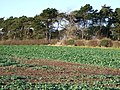 Oilseed rape crop near Scarcliffe Park - geograph.org.uk - 308552.jpg 640 × 480; 124 KB
-
 Over and Out - geograph.org.uk - 300701.jpg 640 × 480; 123 KB
-
 Park Farm - geograph.org.uk - 10727.jpg 640 × 480; 97 KB
-
 Path across Baslow Bar - geograph.org.uk - 579078.jpg 428 × 640; 232 KB
-
 Path along Abney Clough - geograph.org.uk - 591570.jpg 640 × 428; 211 KB
-
 Path through Gresley Wood - geograph.org.uk - 64172.jpg 640 × 480; 59 KB


_towards_Forty_Acre_and_Seventy_Acre_Woods_-_geograph.org.uk_-_329518.jpg)


_Birchinlee_-_geograph.org.uk_-_734545.jpg)


_-_geograph.org.uk_-_305088.jpg)


_-_geograph.org.uk_-_341027.jpg)


