Category:Footpaths in Salisbury
Jump to navigation
Jump to search
Images of footpaths and other non-vehicular by-ways in the City of Salisbury, Wiltshire, UK
Subcategories
This category has the following 5 subcategories, out of 5 total.
B
- Brick Lane, Salisbury (1 F)
C
- Churchfields' Riverside (10 F)
E
M
- Market Walk, Salisbury (1 F)
W
- Water Lane, Salisbury (37 F)
Media in category "Footpaths in Salisbury"
The following 75 files are in this category, out of 75 total.
-
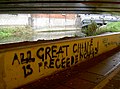 'All great change is preceeded by chaos' - geograph.org.uk - 4257821.jpg 2,304 × 1,704; 1.54 MB
-
 Avon Valley Nature Reserve - geograph.org.uk - 1400604.jpg 640 × 480; 118 KB
-
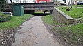
 Back under the road - geograph.org.uk - 2432670.jpg 800 × 600; 137 KB
-
 BishopdownLaverstock footpath (n).jpg 2,048 × 1,536; 1.63 MB
-
 Blue Boar Row - geograph.org.uk - 2437140.jpg 800 × 600; 175 KB
-
 Brick Lane, Skew Bridge - geograph.org.uk - 5830723.jpg 2,848 × 4,288; 1.56 MB
-
 Bridge over River Avon - geograph.org.uk - 5629630.jpg 640 × 480; 129 KB
-
 Britford - footpath alongside The Moat - geograph.org.uk - 1295235.jpg 640 × 480; 119 KB
-
 Castle roundabout subway - geograph.org.uk - 3746403.jpg 1,704 × 2,304; 1.74 MB
-
 Chapel Place- pedestrian access only - geograph.org.uk - 1898918.jpg 480 × 640; 87 KB
-
 Churchill Gardens11.jpg 1,920 × 1,080; 255 KB
-
 Churchill Gardens15.jpg 1,440 × 810; 266 KB
-

-
 Cycleway 47 - along Millstream - geograph.org.uk - 780919.jpg 640 × 454; 72 KB
-
 Cyclist on the Town Path - geograph.org.uk - 4306422.jpg 1,024 × 768; 270 KB
-
 Darker from this end - geograph.org.uk - 3746409.jpg 2,304 × 1,704; 1.35 MB
-

-
 Footpath from Cathedral towards De Vaux Place. - geograph.org.uk - 2883884.jpg 1,024 × 683; 236 KB
-
 Footpath through tunnel of leaves - geograph.org.uk - 4027986.jpg 640 × 427; 143 KB
-
 Footpath to Bemerton - geograph.org.uk - 330820.jpg 480 × 640; 113 KB
-
 Ford, footpath - geograph.org.uk - 2595866.jpg 1,024 × 768; 169 KB
-
 From one street to another - geograph.org.uk - 4166288.jpg 2,304 × 1,704; 1.33 MB
-
 Gate across road to cathedral from south - geograph.org.uk - 2883929.jpg 683 × 1,024; 161 KB
-
 Harnham, Old Shaftesbury Drove - geograph.org.uk - 3412000.jpg 1,024 × 768; 273 KB
-
 Harnham, steps - geograph.org.uk - 3411985.jpg 1,024 × 768; 299 KB
-
 Heading for the city - geograph.org.uk - 2424032.jpg 800 × 600; 112 KB
-
 Hearty walk - geograph.org.uk - 4257811.jpg 2,304 × 1,704; 1.2 MB
-
 In Constable's footsteps - geograph.org.uk - 4336399.jpg 1,704 × 2,304; 2.23 MB
-
 Info board at the Churchfields Natural Area.jpg 4,000 × 3,000; 5.58 MB
-
 Ivy Place, Salisbury - geograph.org.uk - 1855561.jpg 1,200 × 1,600; 806 KB
-
 Laverstock footpath bridge 1.jpg 5,312 × 2,988; 5.94 MB
-
 Laverstock footpath bridge 2.jpg 5,312 × 2,988; 5.4 MB
-
 Looking back towards Salisbury - geograph.org.uk - 4027977.jpg 640 × 427; 82 KB
-
 Lorenzo Trail - geograph.org.uk - 294629.jpg 640 × 427; 163 KB
-
 Middle Street Meadows footpath.jpg 4,000 × 2,248; 3.56 MB
-
 Milford Hollow - geograph.org.uk - 1399677.jpg 640 × 496; 108 KB
-
 Milford Hollow, 01, top end.jpg 3,000 × 4,000; 6.82 MB
-
 Milford Hollow, 02, about halfway down.jpg 3,000 × 4,000; 6.75 MB
-
 Milford Hollow, 03, just above rail bridge.jpg 3,000 × 4,000; 6.3 MB
-
 Milford Hollow, 04, below the rail bridge.jpg 3,000 × 4,000; 6.84 MB
-

-
 Passing under the road - geograph.org.uk - 2719641.jpg 800 × 752; 197 KB
-
 Path by the old school house - geograph.org.uk - 4306553.jpg 1,024 × 768; 288 KB
-
 Path to Stratford sub Castle - geograph.org.uk - 2424013.jpg 800 × 600; 122 KB
-

-
 Portway - geograph.org.uk - 4307841.jpg 1,024 × 768; 144 KB
-
 Public footpath alongside Wyndham Park - geograph.org.uk - 5932724.jpg 1,024 × 768; 311 KB
-

-
 Restricted byway, Old Sarum - geograph.org.uk - 1826939.jpg 640 × 480; 187 KB
-
 River Avon, Salisbury - geograph.org.uk - 5629634.jpg 640 × 480; 147 KB
-
 Rurtherfurd Walk, Salisbury, UK.jpg 4,000 × 3,000; 4.98 MB
-
 Salisbury - Riverside Walk - geograph.org.uk - 1031489.jpg 640 × 480; 121 KB
-
 Salisbury - Underpass - geograph.org.uk - 1717480.jpg 1,024 × 768; 159 KB
-
 Salisbury features (5) - geograph.org.uk - 6390755.jpg 4,320 × 3,240; 2.63 MB
-
 Salisbury, subway under by-pass - geograph.org.uk - 1000324.jpg 640 × 480; 59 KB
-
 Salisbury, Town Path - geograph.org.uk - 3411843.jpg 1,024 × 768; 190 KB
-
 School Lane, Salisbury, UK.jpg 4,000 × 3,000; 6.21 MB
-
 Sign for the Pewsey Avon Trail - geograph.org.uk - 2724276.jpg 479 × 640; 76 KB
-
 Slope to the subway, St Martin's Church Street - geograph.org.uk - 5944859.jpg 1,024 × 768; 314 KB
-
 St Paul's Roundabout underpass - geograph.org.uk - 5387837.jpg 1,600 × 1,200; 630 KB
-
 Subway to salvation^ - geograph.org.uk - 2929457.jpg 2,304 × 1,704; 1.61 MB
-
 The Bridle Path, Salisbury - geograph.org.uk - 188966.jpg 427 × 640; 134 KB
-
 The Orange Way in Wiltshire (162) - geograph.org.uk - 3437903.jpg 600 × 800; 208 KB
-
 The Orange Way in Wiltshire (176) - geograph.org.uk - 3438020.jpg 800 × 600; 132 KB
-
 The Orange Way in Wiltshire (179) - geograph.org.uk - 3438047.jpg 800 × 600; 112 KB
-
 The Orange Way in Wiltshire (187) - geograph.org.uk - 3441143.jpg 800 × 600; 148 KB
-
 The Orange Way in Wiltshire (188) - geograph.org.uk - 3441149.jpg 800 × 600; 181 KB
-
 The Orange Way in Wiltshire (189) - geograph.org.uk - 3441156.jpg 800 × 600; 205 KB
-
 The Orange Way in Wiltshire (190) - geograph.org.uk - 3441160.jpg 800 × 600; 166 KB
-
 The Orange Way in Wiltshire (191) - geograph.org.uk - 3441163.jpg 600 × 800; 191 KB
-
 The Town Path across the Water Meadows, Salisbury - geograph.org.uk - 5159979.jpg 1,600 × 1,200; 757 KB
-
 Town Path - geograph.org.uk - 5630778.jpg 640 × 480; 197 KB
-
 Town Path - geograph.org.uk - 5630782.jpg 640 × 480; 190 KB
-
 Under the road - geograph.org.uk - 2432416.jpg 800 × 600; 113 KB
-
 Солсбери, Англия.JPG 2,304 × 3,072; 2.91 MB


.jpg)


_-_geograph.org.uk_-_6390755.jpg)


_-_geograph.org.uk_-_3437903.jpg)
_-_geograph.org.uk_-_3438020.jpg)
_-_geograph.org.uk_-_3438047.jpg)
_-_geograph.org.uk_-_3441143.jpg)
_-_geograph.org.uk_-_3441149.jpg)
_-_geograph.org.uk_-_3441156.jpg)
_-_geograph.org.uk_-_3441160.jpg)
_-_geograph.org.uk_-_3441163.jpg)


