Category:Footpaths in Angus
Jump to navigation
Jump to search

Subcategories
This category has the following 10 subcategories, out of 10 total.
B
- Brechin Path Network (6 F)
C
- Cairn Broadlands path (4 F)
- Cateran Trail (71 F)
F
- Forfar Path Network (16 F)
G
- Glen Esk footpath (3 F)
J
- Jock's Road (16 F)
K
- Kirriemuir Path Network (2 F)
L
- Loch Brandy Path (8 F)
M
- Mayar - Driesh col (7 F)
Media in category "Footpaths in Angus"
The following 21 files are in this category, out of 21 total.
-
-
 Footpath to Ballater - geograph.org.uk - 409979.jpg 640 × 480; 174 KB
-
 Footpath to Craignathro - geograph.org.uk - 1114373.jpg 427 × 640; 225 KB
-
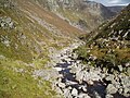
 Footpath, Corrie Fee. - geograph.org.uk - 456660.jpg 480 × 640; 96 KB
-
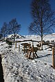
 Glen Doll Scotland (16).jpg 750 × 1,000; 276 KB
-
 Interesting sign - geograph.org.uk - 165812.jpg 640 × 479; 129 KB
-
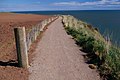
 Kingston - geograph.org.uk - 195722.jpg 640 × 411; 183 KB
-
 Little Driesh - geograph.org.uk - 229212.jpg 640 × 480; 76 KB
-
 North To Mount Keen - geograph.org.uk - 22810.jpg 640 × 480; 87 KB
-

-
 Path down from Burnt Hill - geograph.org.uk - 1016506.jpg 640 × 480; 51 KB
-
 Path on the Mayar - geograph.org.uk - 1197033.jpg 480 × 640; 97 KB
-
 Path, Burn of Cochlie - geograph.org.uk - 1777035.jpg 640 × 480; 140 KB
-

-
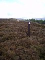
 Signpost on the Monega path - geograph.org.uk - 408117.jpg 640 × 480; 58 KB
-
 Stalkers path to Hunt Hill - geograph.org.uk - 1196645.jpg 640 × 480; 131 KB
-
 Stile near Inchdowrie - geograph.org.uk - 1744632.jpg 427 × 640; 261 KB
-
 The Minister's Path. - geograph.org.uk - 460817.jpg 480 × 640; 69 KB
-
 The path to Mayar - geograph.org.uk - 485288.jpg 480 × 640; 77 KB
-
 The path to the summit of Tom Buidhe. - geograph.org.uk - 412381.jpg 480 × 640; 81 KB
-
 Woodland Path on Capel Mounth - geograph.org.uk - 676218.jpg 640 × 480; 65 KB


.jpg)


