Category:Footpaths in Aberdeen
Jump to navigation
Jump to search

Subcategories
This category has the following 2 subcategories, out of 2 total.
D
- Deeside Way (88 F)
F
Media in category "Footpaths in Aberdeen"
The following 22 files are in this category, out of 22 total.
-
 A path down Brimmond Hill - geograph.org.uk - 612656.jpg 640 × 480; 81 KB
-
 A tree-lined path through Johnston Gardens - geograph.org.uk - 3152053.jpg 2,736 × 3,648; 2.39 MB
-
 Access path to riverside - geograph.org.uk - 1728829.jpg 1,600 × 1,200; 679 KB
-
 An unmetalled track in Hazlehead Park - geograph.org.uk - 1831046.jpg 640 × 480; 117 KB
-
-
 Bucksburn Valley Paths sign - geograph.org.uk - 441097.jpg 480 × 640; 107 KB
-
 Coastal footpath - geograph.org.uk - 447580.jpg 640 × 480; 119 KB
-
 Den Wood - geograph.org.uk - 10034.jpg 640 × 480; 168 KB
-
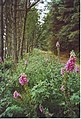
 Evening forest walk - geograph.org.uk - 421830.jpg 640 × 426; 170 KB
-
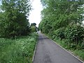
 Footpath - geograph.org.uk - 1539815.jpg 640 × 426; 105 KB
-
 Footpath - geograph.org.uk - 521930.jpg 640 × 480; 90 KB
-
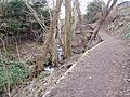 Footpath by stream down to Cults Hotel - geograph.org.uk - 1759582.jpg 1,600 × 1,200; 773 KB
-
 Footpath to Nowhere - geograph.org.uk - 1507484.jpg 640 × 426; 84 KB
-
 Footpath to Tillydrone Avenue - geograph.org.uk - 1477714.jpg 640 × 426; 110 KB
-
 Forest Track in Kingshill Wood - geograph.org.uk - 221360.jpg 435 × 640; 149 KB
-
 Gairnhill Wood - geograph.org.uk - 221366.jpg 640 × 437; 150 KB
-
 Leuchar Moss Forest - geograph.org.uk - 585012.jpg 640 × 480; 136 KB
-
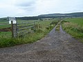
 Path adjacent to East Dyke - geograph.org.uk - 607092.jpg 640 × 480; 83 KB
-
 Path along the top of East Dyke - geograph.org.uk - 607089.jpg 480 × 640; 146 KB
-
 Path junction on Brimmond Hill - geograph.org.uk - 612625.jpg 640 × 480; 88 KB
-
 Path to a footbridge in Johnston Gardens - geograph.org.uk - 3152008.jpg 3,648 × 2,736; 3.22 MB
-
 Pathway towards site of Roman Camp - geograph.org.uk - 575416.jpg 640 × 480; 65 KB


