Category:Footpath GR13.7, Via Algarviana Albufeira to Ribeira de Alte extension
Jump to navigation
Jump to search

Media in category "Footpath GR13.7, Via Algarviana Albufeira to Ribeira de Alte extension"
The following 187 files are in this category, out of 187 total.
-
 .23-06-2017 Direction finger sign, Via Algarviana, Albufeira.JPG 3,456 × 4,608; 7.31 MB
-
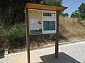 .23-06-2017 Map and directory displays, GR13.7, Via Algarviana, Albufeira.JPG 4,608 × 3,456; 6.07 MB
-
 05-06-2017 Estrada da Nora (4).JPG 4,608 × 3,456; 6.15 MB
-
 05-06-2017 Section of Via Algarviana long distance footpath (1).JPG 4,608 × 3,456; 5.51 MB
-
 05-06-2017 Section of Via Algarviana long distance footpath (2).JPG 4,608 × 3,456; 5.24 MB
-
 05-06-2017 Section of Via Algarviana long distance footpath (3).JPG 4,608 × 3,456; 7.21 MB
-
 05-06-2017 Section of Via Algarviana long distance footpath (4).JPG 4,608 × 3,456; 9.5 MB
-
 05-06-2017 Section of Via Algarviana long distance footpath (5).JPG 4,608 × 3,456; 6.2 MB
-
 05-06-2017 Waymarker, Estrada da Nora.JPG 4,608 × 3,456; 6.93 MB
-
 05-06-2017 Waymarker, Via Algarviana long distance footpath (1).JPG 3,456 × 4,608; 7.31 MB
-
 05-06-2017 Waymarker, Via Algarviana long distance footpath (2).JPG 3,456 × 4,608; 8.08 MB
-
 05-06-2017 Waymarker, Via Algarviana long distance footpath (3).JPG 4,608 × 3,456; 6.81 MB
-
 05-06-2017 Waymarker, Via Algarviana long distance footpath (4).JPG 4,608 × 3,456; 7.58 MB
-
 05-06-2017 Waymarker, Via Algarviana long distance footpath (5).JPG 4,608 × 3,456; 3.97 MB
-
 06-06-2017 Footpath sign, Via Algarviana long distance hiking trail, Ferreiras.JPG 3,456 × 4,608; 3.35 MB
-
 06-06-2017 Section of Via Algarviana long distance footpath, Ferreiras (1).JPG 4,608 × 3,456; 7.61 MB
-
 06-06-2017 Section of Via Algarviana long distance footpath, Ferreiras (2).JPG 4,608 × 3,456; 5.38 MB
-
 06-06-2017 Section of Via Algarviana long distance footpath, Ferreiras (3).JPG 4,608 × 3,456; 5.45 MB
-
 06-06-2017 Section of Via Algarviana long distance footpath, Ferreiras (4).JPG 4,608 × 3,456; 5.77 MB
-
 06-06-2017 Section of Via Algarviana long distance footpath, Ferreiras (5).JPG 4,608 × 3,456; 5.02 MB
-
 06-06-2017 Section of Via Algarviana long distance footpath, Ferreiras.JPG 4,608 × 3,456; 8.03 MB
-
 06-06-2017 Way-marker, Section of Via Algarviana long distance footpath, Ferreiras.JPG 3,169 × 4,371; 3.36 MB
-
 07-06-2017 Purple sandspurry (Spergula purpurea), Vale de Paraíso.JPG 4,608 × 3,456; 4.21 MB
-
 07-06-2017 Via Algarviana long distance hiking trail, Vale de Paraíso (1).JPG 4,608 × 3,456; 7.26 MB
-
 07-06-2017 Via Algarviana long distance hiking trail, Vale de Paraíso (10).JPG 4,608 × 3,456; 7.72 MB
-
 07-06-2017 Via Algarviana long distance hiking trail, Vale de Paraíso (11).JPG 4,608 × 3,456; 7.69 MB
-
 07-06-2017 Via Algarviana long distance hiking trail, Vale de Paraíso (2).JPG 4,608 × 3,456; 7.12 MB
-
 07-06-2017 Via Algarviana long distance hiking trail, Vale de Paraíso (3).JPG 4,608 × 3,456; 6.74 MB
-
 07-06-2017 Via Algarviana long distance hiking trail, Vale de Paraíso (4).JPG 4,608 × 3,456; 5.44 MB
-
 07-06-2017 Via Algarviana long distance hiking trail, Vale de Paraíso (5).JPG 3,456 × 4,608; 6.22 MB
-
 07-06-2017 Via Algarviana long distance hiking trail, Vale de Paraíso (6).JPG 4,608 × 3,456; 6.92 MB
-
 07-06-2017 Via Algarviana long distance hiking trail, Vale de Paraíso (7).JPG 4,608 × 3,456; 7.27 MB
-
 07-06-2017 Via Algarviana long distance hiking trail, Vale de Paraíso (8).JPG 4,608 × 3,456; 6.6 MB
-
 07-06-2017 Via Algarviana long distance hiking trail, Vale de Paraíso (9).JPG 4,608 × 3,456; 5.61 MB
-
 08-06-2017 Via Algarviana long distance hiking trail, Alfarrobeiras (4).JPG 4,608 × 3,456; 9.57 MB
-
 08-06-2017 Way-marker post, Via Algarviana long distance hiking trail, Alfarrobeiras (1).JPG 4,608 × 3,456; 7.87 MB
-
 08-06-2017 Way-marker post, Via Algarviana long distance hiking trail, Alfarrobeiras (2).JPG 4,608 × 3,456; 9.05 MB
-
 08-06-2017 Way-marker post, Via Algarviana long distance hiking trail, Alfarrobeiras (3).JPG 4,608 × 3,456; 7.04 MB
-

-
 08-06-2017 Way-marker post, Via Algarviana long distance hiking trail, Alfarrobeiras (5).JPG 4,608 × 3,456; 7.27 MB
-
 08-06-2017 Way-marker post, Via Algarviana long distance hiking trail, Alfarrobeiras (6).JPG 4,608 × 3,456; 8.41 MB
-
 08-06-2017 Way-marker post, Via Algarviana long distance hiking trail, Alfarrobeiras (7).JPG 3,456 × 4,608; 6.86 MB
-
 09-06-2017 GR13-7 Via Algarviana long distance hiking trail Caliços (1).JPG 4,608 × 3,456; 6.62 MB
-
 09-06-2017 GR13-7 Via Algarviana long distance hiking trail Caliços (2).JPG 4,608 × 3,456; 6.14 MB
-
 09-06-2017 GR13-7 Via Algarviana long distance hiking trail Caliços (3).JPG 4,608 × 3,456; 6.35 MB
-
 09-06-2017 GR13-7 Via Algarviana long distance hiking trail Caliços (4).JPG 4,608 × 3,456; 5.18 MB
-
 09-06-2017 GR13-7 Via Algarviana long distance hiking trail Caliços (5).JPG 4,608 × 3,456; 5.43 MB
-
 09-06-2017 GR13-7 Via Algarviana long distance hiking trail Caliços (6).JPG 3,456 × 4,608; 6.76 MB
-
 09-06-2017 GR13-7 Via Algarviana long distance hiking trail Caliços (7).JPG 4,608 × 3,456; 5.95 MB
-
 09-06-2017 Tourist Information Center, Albufeira.JPG 4,608 × 3,456; 4.59 MB
-
 1-12-2016, Rua da Estação, Ferreiras (2).JPG 4,608 × 3,456; 4.35 MB
-
 1-12-2016, Rua da Estação, Ferreiras (3).JPG 4,608 × 3,456; 5.09 MB
-
 1-12-2016, Rua da Estação, Ferreiras (4).JPG 4,608 × 3,456; 5.29 MB
-
 1-12-2016, Rua da Estação, Ferreiras.JPG 4,608 × 3,456; 4.71 MB
-
 11 November 2016, Albufeira, Parque Verde Urbano (1).JPG 4,608 × 3,456; 7.2 MB
-
 11 November 2016, Albufeira, Parque Verde Urbano (2).JPG 4,608 × 3,456; 7.01 MB
-
 11 November 2016, Albufeira, Parque Verde Urbano (6).JPG 4,608 × 3,456; 4.96 MB
-
 11 November 2016, Albufeira, Parque Verde Urbano (7).JPG 4,608 × 3,456; 6.33 MB
-
 11 November 2016, Albufeira, Parque Verde Urbano (8).JPG 4,608 × 3,456; 6.51 MB
-
 12-06-2017 A22 motorway, Cerro do Ouro, Albufeira (1).JPG 4,608 × 3,456; 3.92 MB
-
 12-06-2017 A22 motorway, Cerro do Ouro, Albufeira (2).JPG 4,608 × 3,456; 3.9 MB
-
 12-06-2017 Bridge over the A22 motorway, Cerro do Ouro, Albufeira (1).JPG 4,608 × 3,456; 5.75 MB
-
 12-06-2017 Bridge over the A22 motorway, Cerro do Ouro, Albufeira (2).JPG 4,608 × 3,456; 5.27 MB
-
 12-06-2017 Bridge over the A22 motorway, Cerro do Ouro, Albufeira (3).JPG 4,608 × 3,456; 5.71 MB
-
 12-06-2017 Bridge over the A22 motorway, Cerro do Ouro, Albufeira (4).JPG 4,608 × 3,456; 4.01 MB
-
 12-06-2017 Via Algarviana long distance hiking trail, Cerro do Ouro, Albufeira (1).JPG 4,608 × 3,456; 6.68 MB
-
 12-06-2017 Via Algarviana long distance hiking trail, Cerro do Ouro, Albufeira (2).JPG 4,608 × 3,456; 5.82 MB
-
 12-06-2017 Via Algarviana long distance hiking trail, Cerro do Ouro, Albufeira (3).JPG 4,608 × 3,456; 6.05 MB
-
 12-06-2017 Via Algarviana long distance hiking trail, Cerro do Ouro, Albufeira (4).JPG 3,456 × 4,608; 8.04 MB
-
 12-06-2017 Via Algarviana long distance hiking trail, Cerro do Ouro, Albufeira (5).JPG 4,608 × 3,456; 7.31 MB
-
 12-06-2017 Via Algarviana long distance hiking trail, Cerro do Ouro, Albufeira (6).JPG 4,608 × 3,456; 7.01 MB
-
 14-06-2017 Bridge under A2 motorway, Centieira, Albufeira (1).JPG 4,608 × 3,456; 3.99 MB
-
 14-06-2017 Bridge under A2 motorway, Centieira, Albufeira (2).JPG 4,608 × 3,456; 4.45 MB
-

-

-
 14-06-2017 Via Algarviana long distance hiking trail, Cerro do Ouro (1).JPG 4,608 × 3,456; 5.1 MB
-
 14-06-2017 Via Algarviana long distance hiking trail, Cerro do Ouro (2).JPG 4,608 × 3,456; 4.97 MB
-
 14-06-2017 Via Algarviana long distance hiking trail, Cerro do Ouro (3).JPG 4,608 × 3,456; 5.97 MB
-
 14-06-2017 Via Algarviana long distance hiking trail, Cerro do Ouro (4).JPG 4,608 × 3,456; 5.38 MB
-
 14-06-2017 Via Algarviana long distance hiking trail, Cerro do Ouro (5).JPG 4,608 × 3,456; 4.33 MB
-
 14-06-2017 Via Algarviana long distance hiking trail, Cerro do Ouro (7).JPG 3,456 × 4,608; 5.35 MB
-
 14-06-2017 Via Algarviana long distance hiking trail, Cerro do Ouro.JPG 4,608 × 3,456; 5.54 MB
-
 14-06-2017 Way-marker, Via Algarviana long distance hiking trail, Cerro do Ouro (1).JPG 4,608 × 3,456; 6.72 MB
-
 14-06-2017 Way-marker, Via Algarviana long distance hiking trail, Cerro do Ouro (2).JPG 4,608 × 3,456; 6.19 MB
-
 14-06-2017 Way-marker, Via Algarviana long distance hiking trail, Cerro do Ouro (5).JPG 4,608 × 3,456; 5.35 MB
-
 14-06-2017 Way-marker, Via Algarviana long distance hiking trail, Cerro do Ouro (6).JPG 3,456 × 4,608; 4.89 MB
-
 14-06-2017 Way-marker, Via Algarviana long distance hiking trail, Cerro do Ouro (7).JPG 4,608 × 3,456; 6.83 MB
-
 14-06-2017 Way-marker, Via Algarviana long distance hiking trail, Cerro do Ouro (8).JPG 4,608 × 3,456; 5.32 MB
-
 15-06-2017 Rua das Andorinhas, Ferreiras (1).JPG 4,608 × 3,456; 5.44 MB
-
 15-06-2017 Rua das Andorinhas, Ferreiras (2).JPG 4,608 × 3,456; 6.48 MB
-
 15-06-2017 Rua das Andorinhas, Ferreiras.JPG 4,608 × 3,456; 6.16 MB
-
 15-06-2017 Street name sign, Rua das Andorinhas, Ferreiras.JPG 4,608 × 3,456; 6.19 MB
-
 16-04-2017 Underpass on the EN125 road, Albufeira.JPG 4,608 × 3,456; 7.29 MB
-
 19-09-2017 Street name sign, Rua das Andorinhas, Ferreiras.JPG 4,608 × 3,456; 5.49 MB
-
 2016 Albufeira, Parque Verde Urbano Picnic area, 10 November.JPG 4,608 × 3,456; 7.29 MB
-
 2016 Albufeira, Parque Verde Urbano, 09 November.JPG 4,608 × 3,456; 6.17 MB
-
 2017-08-08 Via Algarviana long distance hiking trail, Estevais dos Moiros (3).JPG 4,608 × 3,456; 5.77 MB
-
 2017-08-08 Via Algarviana long distance hiking trail, Estevais dos Moiros (4).JPG 4,608 × 3,456; 6.71 MB
-
 2017-08-08 Via Algarviana long distance hiking trail, Estevais dos Moiros (5).JPG 4,608 × 3,456; 5.72 MB
-
 2017-08-08 Via Algarviana long distance hiking trail, Estevais dos Moiros (6).JPG 4,608 × 3,456; 6.44 MB
-
 2017-08-08 Via Algarviana long distance hiking trail, Estevais dos Moiros.JPG 3,456 × 4,608; 4.67 MB
-

-

-

-
 2017-10-11 Hiking footpath sign, GR13.7, Via Algarviana.JPG 3,456 × 4,608; 6.91 MB
-
 2017-10-11 Un-named farm track which is part of GR13 (2).JPG 4,608 × 3,456; 4.79 MB
-
 2017-10-11 Un-named farm track which is part of GR13 (3).JPG 4,608 × 3,456; 6.6 MB
-
 2018-03-22 Quarteira river, Amoreira, Albufeira (1).JPG 5,152 × 3,864; 8.76 MB
-
 2018-03-22 Quarteira river, Amoreira, Albufeira (3).JPG 5,152 × 3,864; 7.57 MB
-
 2018-03-22 Quarteira river, Amoreira, Albufeira (6).JPG 3,864 × 5,152; 8.9 MB
-
 2018-03-22 Quarteira river, Amoreira, Albufeira (7).JPG 5,152 × 3,864; 9.24 MB
-
 23-06-2017 A section of Footpath GR13 (1).JPG 4,608 × 3,456; 5.05 MB
-
 23-06-2017 A section of Footpath GR13 (2).JPG 4,608 × 3,456; 4.66 MB
-
 23-06-2017 A section of Footpath GR13 (4).JPG 4,608 × 3,456; 5.59 MB
-
 23-06-2017 A section of Footpath GR13 (5).JPG 4,608 × 3,456; 6.61 MB
-
 23-06-2017 A section of Footpath GR13.7, Cerro do Ouro.JPG 4,608 × 3,456; 7.73 MB
-
 23-06-2017 Entrance gateway to a Villa, Cerro do Ouro.JPG 4,608 × 3,456; 4.62 MB
-
 23-06-2017 Part of Footpath GR13 (1).JPG 4,608 × 3,456; 7.26 MB
-
 23-06-2017 Part of Footpath GR13 (2).JPG 4,608 × 3,456; 5.41 MB
-
 23-06-2017 Part of Footpath GR13 (3).JPG 4,608 × 3,456; 5.96 MB
-
 23-06-2017 Part of Footpath GR13 (4).JPG 4,608 × 3,456; 6.03 MB
-
 23-06-2017 Right turn way-marker, Footpath GR13.7, Cerro do Ouro.JPG 4,608 × 3,456; 5.06 MB
-
 23-06-2017 Way-marker on a section of Footpath GR13 (1).JPG 4,608 × 3,456; 7.12 MB
-
 23-06-2017 Way-marker on a section of Footpath GR13 (2).JPG 4,608 × 3,456; 5.28 MB
-
 23-06-2017 Way-marker on a section of Footpath GR13 (3).JPG 3,456 × 4,608; 5.15 MB
-
 23-06-2017 Way-marker on a section of Footpath GR13.JPG 4,608 × 3,456; 6.09 MB
-
 23-06-2017 Way-marker post on EN395 road, Cerro do Ouro.JPG 3,456 × 4,608; 5.41 MB
-
 23-06-2017 Waymarker post on EN395 road, Cerro do Ouro.JPG 4,608 × 3,456; 5.55 MB
-
 25-06-2017 Direction finger sign, GR13.7 Via Algarviana, Albufeira (2).JPG 3,456 × 4,608; 4.51 MB
-
 25-06-2017 Direction finger sign, GR13.7 Via Algarviana, Albufeira (4).JPG 3,456 × 4,608; 6 MB
-
 25-06-2017 Ford on the River Quarteira (1).JPG 4,608 × 3,456; 6.27 MB
-
 25-06-2017 Ford on the River Quarteira (2).JPG 3,456 × 4,608; 7.53 MB
-
 25-06-2017 Ford on the River Quarteira (3).JPG 4,608 × 3,456; 4.66 MB
-
 25-06-2017 Jeep safari crossing the River Quarteira (1).JPG 4,608 × 3,456; 6.83 MB
-
 25-06-2017 Jeep safari crossing the River Quarteira (2).JPG 3,456 × 4,608; 8.1 MB
-
 25-06-2017 Part of Footpath GR13 (1).JPG 3,456 × 4,608; 6.4 MB
-
 25-06-2017 Part of Footpath GR13 (2).JPG 4,608 × 3,456; 6.91 MB
-
 25-06-2017 Part of Footpath GR13 (3).JPG 4,608 × 3,456; 6.34 MB
-
 25-06-2017 Part of Footpath GR13 (4).JPG 4,608 × 3,456; 6.57 MB
-
 25-06-2017 Part of Footpath GR13 (5).JPG 4,608 × 3,456; 5.61 MB
-
 25-06-2017 Part of Footpath GR13 (6).JPG 4,608 × 3,456; 6.38 MB
-
 25-06-2017 Part of Footpath GR13 (7).JPG 4,608 × 3,456; 5.41 MB
-
 25-06-2017 Part of Footpath GR13 (8).JPG 4,608 × 3,456; 5.86 MB
-
 25-06-2017 Part of Footpath GR13 (9).JPG 4,608 × 3,456; 5.98 MB
-
 25-06-2017 Quarteira River, Paderne.JPG 4,608 × 3,456; 6.08 MB
-
 27-06-2017 Estrada dos Barreiros and footpath GR13.7, Alcaria, Albufeira.JPG 4,608 × 3,456; 6.04 MB
-
 27-06-2017 Irrigation pond in the countryside, Alcaria, Albufeira.JPG 4,608 × 3,456; 5.21 MB
-
 27-06-2017 Section of Footpath GR13, Alcaria, Albufeira (1).JPG 4,608 × 3,456; 6.76 MB
-
 27-06-2017 Section of Footpath GR13, Alcaria, Albufeira (2).JPG 3,456 × 4,608; 5.65 MB
-
 27-06-2017 Section of Footpath GR13, Alcaria, Albufeira (3).JPG 4,608 × 3,456; 5.64 MB
-
 27-06-2017 Section of Footpath GR13, Alcaria, Albufeira (4).JPG 4,608 × 3,456; 7.38 MB
-
 27-06-2017 Section of Footpath GR13, Alcaria, Albufeira (5).JPG 4,608 × 3,456; 6.58 MB
-
 27-06-2017 Section of Footpath GR13, Alcaria, Albufeira.JPG 4,608 × 3,456; 6.44 MB
-
 27-06-2017 Way-marker post Footpath GR13, Alcaria, Albufeira (1).JPG 4,608 × 3,456; 4.13 MB
-
 27-06-2017 Way-marker post Footpath GR13, Alcaria, Albufeira (2).JPG 4,608 × 3,456; 4.74 MB
-
 27-06-2017 Way-marker post Footpath GR13, Alcaria, Albufeira (3).JPG 4,608 × 3,456; 5.7 MB
-
 27-06-2017 Way-marker post Footpath GR13, Alcaria, Albufeira (4).JPG 4,608 × 3,456; 6.4 MB
-
 27-06-2017 Way-marker post Footpath GR13, Alcaria, Albufeira (5).JPG 4,608 × 3,456; 6.81 MB
-
 27-06-2017 Way-marker post Footpath GR13, Alcaria, Albufeira (6).JPG 4,608 × 3,456; 6.19 MB
-
 27-06-2017 Way-marker, Part of Footpath GR13.7, Alcaria, Albufeira.JPG 3,456 × 4,608; 7.33 MB
-
 28-06-2017 Derelict building, Alfarrobeiras, Albufeira (2).JPG 4,608 × 3,456; 6.88 MB
-
 28-06-2017 Section of Footpath GR13, Alfarrobeiras, Albufeira (1).JPG 4,608 × 3,456; 5.14 MB
-
 28-06-2017 Section of Footpath GR13, Alfarrobeiras, Albufeira (2).JPG 4,608 × 3,456; 6.84 MB
-
 28-06-2017 Section of Footpath GR13, Alfarrobeiras, Albufeira (3).JPG 4,608 × 3,456; 5.34 MB
-
 28-06-2017 Section of Footpath GR13, Alfarrobeiras, Albufeira (4).JPG 4,608 × 3,456; 5.98 MB
-
 28-06-2017 Section of Footpath GR13, Alfarrobeiras, Albufeira (5).JPG 4,608 × 3,456; 6.04 MB
-
 28-08-2017 Footpath finger sign, Rua 5 de Outubro, Paderne.JPG 3,456 × 4,608; 5.77 MB
-
 29-06-2017 A section of footpath GR13 (1).JPG 3,456 × 4,608; 5.25 MB
-
 29-06-2017 A section of footpath GR13 (2).JPG 3,456 × 4,608; 5.82 MB
-
 29-06-2017 A section of footpath GR13 (3).JPG 4,608 × 3,456; 6.54 MB
-
 29-06-2017 A section of footpath GR13 (4).JPG 4,608 × 3,456; 6.27 MB
-
 29-06-2017 A section of footpath GR13 (5).JPG 4,608 × 3,456; 5.09 MB
-
 29-06-2017 Way-marker post Footpath GR13, Paderne, Albufeira (2).JPG 4,608 × 3,456; 5.36 MB
-
 29-06-2017 Way-marker post Footpath GR13, Paderne, Albufeira.JPG 4,608 × 3,456; 6.06 MB
-
 Albufeira, East along Caminho dos Brejos, Caliços, 14 October 2016.JPG 4,608 × 3,456; 6.73 MB
-
 Alte 8 May 2015 (1).JPG 2,448 × 3,264; 3.54 MB
-
 EM1176, Paderne, 2 October 2015.JPG 5,152 × 3,864; 4.09 MB
-
 Estação de Albufeira • Ferreiras, 2011.07.02 02.jpg 2,136 × 1,424; 1.35 MB
-
 Estação de Albufeira ● Ferreiras, 2 October 2015 (3).JPG 5,152 × 3,864; 4.1 MB
-
 Farm track, Vale de Paraíso, Albufeira, 24 January 2016 (11).JPG 5,152 × 3,864; 8.09 MB
-
 Farm track, Vale de Paraíso, Albufeira, 24 January 2016 (2).JPG 5,152 × 3,864; 7.99 MB
-
 Footpath PR.1 Section 9, Paderne Castle Route, 13 October 2015 (1).JPG 5,152 × 3,864; 4.28 MB
-
 Footpath PR.1 Section 9, Paderne Castle Route, 13 October 2015 (2).JPG 5,152 × 3,864; 4.2 MB
-
 Footpath PR.1 Section 9, Paderne Castle Route, 13 October 2015 (4).JPG 5,152 × 3,864; 4.19 MB
-
 Looking west along Caminho dos Brejos, Caliços, Albufeira, 14 October 2016.JPG 4,608 × 3,456; 7.11 MB
-
 Route marker PR3 No.23 in Paderna on EM1176, Paderne, 2 October 2015.JPG 3,864 × 5,152; 4.41 MB
-
 Water fountain in Paderna on EM1176, Paderne, 2 October 2015.JPG 5,152 × 3,864; 4.05 MB


.JPG)
.JPG)
.JPG)
.JPG)
.JPG)
.JPG)

.JPG)
.JPG)
.JPG)
.JPG)
.JPG)

.JPG)
.JPG)
.JPG)
.JPG)
.JPG)


,_Vale_de_Para%C3%ADso.JPG)
.JPG)
.JPG)
.JPG)
.JPG)
.JPG)
.JPG)
.JPG)
.JPG)
.JPG)
.JPG)
.JPG)
.JPG)
.JPG)
.JPG)
.JPG)
.JPG)
.JPG)
.JPG)
.JPG)
.JPG)
.JPG)
.JPG)
.JPG)
.JPG)
.JPG)
.JPG)

.JPG)
.JPG)
.JPG)

.JPG)
.JPG)
.JPG)
.JPG)
.JPG)
.JPG)
.JPG)
.JPG)
.JPG)
.JPG)
.JPG)
.JPG)
.JPG)
.JPG)
.JPG)
.JPG)
.JPG)
.JPG)
.JPG)
,_Via_Algarviana_long_distance_hiking_trail,_Cerro_do_Ouro.JPG)

.JPG)
.JPG)
.JPG)
.JPG)
.JPG)
.JPG)

.JPG)
.JPG)
.JPG)
.JPG)
.JPG)
.JPG)
.JPG)
.JPG)


.JPG)
.JPG)
.JPG)
.JPG)

.JPG)
.JPG)
.JPG)

.JPG)
.JPG)
.JPG)
.JPG)
.JPG)
.JPG)
.JPG)
.JPG)
.JPG)
.JPG)


.JPG)
.JPG)
.JPG)
.JPG)

.JPG)
.JPG)
.JPG)


.JPG)
.JPG)
.JPG)
.JPG)
.JPG)
.JPG)
.JPG)
.JPG)
.JPG)
.JPG)
.JPG)
.JPG)
.JPG)
.JPG)
.JPG)
.JPG)


.JPG)
.JPG)
.JPG)
.JPG)
.JPG)

.JPG)
.JPG)
.JPG)
.JPG)
.JPG)
.JPG)

.JPG)
.JPG)
.JPG)
.JPG)
.JPG)
.JPG)

.JPG)
.JPG)
.JPG)
.JPG)
.JPG)
.JPG)


.JPG)


.JPG)
.JPG)
.JPG)
.JPG)
.JPG)
.JPG)


