Category:Footbridges in Somerset
Jump to navigation
Jump to search
Subcategories
This category has the following 10 subcategories, out of 10 total.
- Stepping stones in Somerset (4 F)
C
- Churchill footbridge, Bath (5 F)
F
K
- Kentsford Farm bridge (3 F)
P
- Palladian Bridge, Prior Park (44 F)
S
T
- Tellisford Bridge (3 F)
W
- Widcombe Footbridge (6 F)
Media in category "Footbridges in Somerset"
The following 77 files are in this category, out of 77 total.
-
 Bathpool - Colas 70812 ballast from Westbury.JPG 1,366 × 910; 613 KB
-
 Bathpool canal swing bridge.JPG 1,366 × 910; 574 KB
-

-

-
 Bridge across Wellow Brook - panoramio.jpg 2,048 × 1,536; 880 KB
-
 Bridge on Poets Walk Clevedon - panoramio.jpg 2,272 × 3,408; 4.32 MB
-
 Bridge over the Barle at Cornham Ford - geograph.org.uk - 616416.jpg 640 × 480; 109 KB
-
 Brook and Footbridge, The Parks, Minehead - geograph.org.uk - 304274.jpg 640 × 453; 124 KB
-
 Collins Bridge Over the River Yeo.jpg 3,804 × 2,352; 4.19 MB
-
 Dulverton, footbridge over stream - geograph.org.uk - 390781.jpg 640 × 427; 315 KB
-
 Flood damaged footbridge, at Bratton ford - geograph.org.uk - 3821009.jpg 1,024 × 768; 234 KB
-
 Foot bridge over a rhyne - geograph.org.uk - 117422.jpg 640 × 426; 145 KB
-
 Footbridge - geograph.org.uk - 184737.jpg 640 × 480; 155 KB
-
 Footbridge - geograph.org.uk - 340910.jpg 640 × 480; 71 KB
-
 Footbridge on the Old Rhyne - geograph.org.uk - 1768780.jpg 640 × 480; 98 KB
-
 Footbridge over Badgworthy Water - geograph.org.uk - 976409.jpg 640 × 427; 93 KB
-
 Footbridge over Cannington Brook - geograph.org.uk - 1373423.jpg 640 × 480; 158 KB
-

-
 Footbridge over Midford brook - geograph.org.uk - 778113.jpg 640 × 480; 98 KB
-
 Footbridge over Mill Stream, Taunton - geograph.org.uk - 1235388.jpg 640 × 480; 261 KB
-
 Footbridge over Mill Stream, Taunton - geograph.org.uk - 1235392.jpg 640 × 480; 230 KB
-
 Footbridge over River Barle - geograph.org.uk - 648767.jpg 640 × 427; 129 KB
-
 Footbridge over stream near Hollam Farm - geograph.org.uk - 679009.jpg 640 × 480; 127 KB
-
 Footbridge over the A358, Taunton - geograph.org.uk - 1413767.jpg 640 × 480; 118 KB
-
 Footbridge over the Doniford Stream - geograph.org.uk - 1651937.jpg 640 × 430; 124 KB
-
 Footbridge over the M5 - geograph.org.uk - 1419007.jpg 640 × 480; 146 KB
-
 Footbridge over the River Exe - geograph.org.uk - 679022.jpg 640 × 480; 121 KB
-
 Footbridge over the River Tone, Taunton - geograph.org.uk - 1235349.jpg 640 × 480; 247 KB
-
 Footbridges at Charterhouse - geograph.org.uk - 1236425.jpg 640 × 427; 144 KB
-
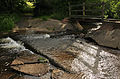 Ford and footbridge at Westermill Farm.jpg 3,841 × 2,513; 6.17 MB
-
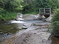
 Ford at Bratton with footbridge - geograph.org.uk - 1121970.jpg 640 × 480; 109 KB
-
 Ford in river Exe - geograph.org.uk - 526993.jpg 640 × 480; 123 KB
-
 French Weir - geograph.org.uk - 1249311.jpg 640 × 432; 159 KB
-
 French Weir, River Tone - geograph.org.uk - 106776.jpg 568 × 425; 107 KB
-
 French Weir, Taunton. - geograph.org.uk - 1196315.jpg 640 × 426; 112 KB
-
 Fyne Court nature trail 4 - geograph.org.uk - 1197325.jpg 640 × 480; 167 KB
-
 Garden bridge - geograph.org.uk - 178525.jpg 640 × 420; 131 KB
-
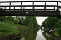
 Kennet and Avon Canal, Dundas Bridge - geograph.org.uk - 178529.jpg 640 × 424; 110 KB
-
 Kennet and Avon Canal, Dundas Bridge - geograph.org.uk - 480876.jpg 640 × 501; 96 KB
-
-
 Langport West - bridge over rhyne.jpg 1,024 × 768; 395 KB
-
 Lovers' Bridge near the watermill - geograph.org.uk - 527811.jpg 640 × 480; 134 KB
-
 Mini clapper bridge - geograph.org.uk - 748648.jpg 640 × 480; 144 KB
-
 Phipp's Bridge crosses the Yeo - geograph.org.uk - 366491.jpg 640 × 480; 128 KB
-
 Pilhay Bridge - geograph.org.uk - 96484.jpg 640 × 480; 92 KB
-
 River Horner Bossington.jpg 640 × 480; 150 KB
-
 Sheep on footbridge - geograph.org.uk - 648776.jpg 427 × 640; 116 KB
-
 Stawley, by Lutley Bridge - geograph.org.uk - 145764.jpg 640 × 427; 238 KB
-
 The foot bridge to Clicket - geograph.org.uk - 688176.jpg 640 × 426; 130 KB
-
 The Ford at Ford - geograph.org.uk - 511037.jpg 640 × 427; 117 KB
-

-
 Washford railway station MMB 02.jpg 2,400 × 1,600; 2.32 MB
-
 Weston-super-Mare Shrubbery Bridge.jpg 1,368 × 1,824; 901 KB
-
 Wimble Toot 21.jpg 5,152 × 3,864; 4.32 MB
-
 Wimble Toot 23.jpg 5,152 × 3,864; 4.43 MB
-
 Wimble Toot 24.jpg 5,152 × 3,864; 4.46 MB
-
 Wimble Toot 25.jpg 5,152 × 3,864; 4.47 MB
-

-
 Wookey Hole, footbridge in the park. - geograph.org.uk - 1206634.jpg 640 × 480; 278 KB
-
 An unfriendly footbridge - geograph.org.uk - 516084.jpg 640 × 480; 145 KB
-
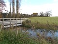
 Bridge on Macmillan Way - geograph.org.uk - 542804.jpg 640 × 480; 145 KB
-
 Footbridge over Bradley Brook - geograph.org.uk - 454585.jpg 480 × 640; 170 KB
-
 Footbridge over Lambrook Brook - geograph.org.uk - 682570.jpg 640 × 480; 133 KB
-

-
 Footbridge over River Parrett - geograph.org.uk - 680798.jpg 640 × 421; 143 KB
-
 Footbridge over the Mells River - geograph.org.uk - 325934.jpg 640 × 480; 110 KB
-
 Footbridge over the Mells River ^2 - geograph.org.uk - 325935.jpg 480 × 640; 87 KB
-
 Footbridge over the motorway - geograph.org.uk - 212360.jpg 600 × 439; 55 KB
-
 Footbridge over the River Frome - geograph.org.uk - 325985.jpg 640 × 480; 107 KB
-
 Footbridge, Yeovil Somerset - geograph.org.uk - 666619.jpg 640 × 480; 103 KB
-
 Footbridges and weir on the Yeo - geograph.org.uk - 278918.jpg 640 × 480; 118 KB
-
 Pill Bridge - geograph.org.uk - 214869.jpg 640 × 480; 74 KB
-
 Rickety Bridge. - geograph.org.uk - 120850.jpg 640 × 426; 185 KB
-
 Stathe Footbridge - geograph.org.uk - 344969.jpg 640 × 480; 104 KB
-

-
 Wellington, footbridge to Runnington - geograph.org.uk - 56161.jpg 427 × 640; 165 KB
-
 Wiveliscombe, footbridge over the Tone - geograph.org.uk - 164262.jpg 640 × 427; 236 KB


,_Yeovil_-_geograph.org.uk_-_1429932.jpg)


