Category:Footbridge (south) between Kowloon Bay Station and Lower Ngau Tau Kok Estate
Jump to navigation
Jump to search
| Object location | | View all coordinates using: OpenStreetMap |
|---|
Subcategories
This category has only the following subcategory.
Media in category "Footbridge (south) between Kowloon Bay Station and Lower Ngau Tau Kok Estate"
The following 4 files are in this category, out of 4 total.
-
 HK 牛頭角下邨 Lower Ngau Tau Kok Estate footbridge covered stairs Nov-2015 DSC.JPG 2,592 × 1,944; 2.82 MB
-
 HK 牛頭角下邨 Lower Ngau Tau Kok Estate view Kwun Tong Road Telford MTR logo Nov-2015 DSC.JPG 2,592 × 1,944; 2.33 MB
-
 Lower Ngau Tau Kok BK89 2008.jpg 3,072 × 2,304; 1.14 MB
-
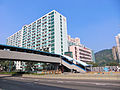
 Lower NTK(II)E 04.jpg 3,264 × 2,448; 1.76 MB


E_04.jpg)