Category:Floor plans of schools
Jump to navigation
Jump to search
This category contains floor plans. A floor plan is a drawing, usually to scale, of the relationships between rooms, spaces and other physical features at one level of a structure.
For other architectural drawings like elevations and sections please use the right subcategories of Category:Architectural drawings by type.
Subcategories
This category has the following 3 subcategories, out of 3 total.
C
G
T
Media in category "Floor plans of schools"
The following 131 files are in this category, out of 131 total.
-

-
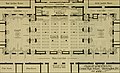
 Annual report of the New Jersey State Board of Education (1874) (14579964069).jpg 2,304 × 1,416; 492 KB
-
 Bennington College Commons Building Floor Plan.jpg 696 × 929; 62 KB
-
 Bowen State School plan, June 2015.jpg 1,087 × 711; 100 KB
-
 Campus layout of Osmania Medical College.jpg 4,032 × 3,024; 2.93 MB
-
 Cascade-F-WCC.jpg 3,068 × 1,684; 700 KB
-
 Cascade-FP-WCC.jpg 1,744 × 3,104; 680 KB
-
 Collège Carnot, à Fontainebleau, plan du premier étage.jpg 2,592 × 1,847; 2.04 MB
-
 Collège Carnot, à Fontainebleau, plan du rez-de-chaussée.jpg 2,532 × 2,061; 1.5 MB
-
 Consolidated Enfield High School Site Plans.png 1,222 × 768; 521 KB
-
 Convitto Nifo di Sessa Aurunca, piantina numerizzata.jpg 1,600 × 896; 180 KB
-
 Don Vicente Rama Memorial National High School map.svg 1,222 × 810; 86 KB
-
 Druitt Town Public School Plan, 1879 (3901874287).jpg 1,500 × 923; 1.05 MB
-

-

-

-

-

-

-

-

-

-

-

-

-

-

-

-

-

-

-

-
 Gorey School, Ireland; ground plans and architectural detail Wellcome V0012703.jpg 2,105 × 3,296; 2.73 MB
-
 Greater Latrobe Sr High School 1966 first floor plan.jpg 989 × 1,280; 274 KB
-
 Greater Latrobe Sr High School 1966 ground floor plan.jpg 1,700 × 2,200; 433 KB
-
 Gymnasium St. Augustin zu Grimma 2015.jpg 3,170 × 2,153; 1.82 MB
-
 Gymnasium Filder Benden, Grundriss, 2011-09.svg 3,300 × 2,300; 10 KB
-
 GymnasiumStralsundPlan1839.jpg 2,706 × 2,216; 825 KB
-

-

-

-
 Zimmerm-Sch am Holstenthor (1).JPG 2,159 × 1,779; 816 KB
-
 Zimmerm-Sch am Holstenthor (2).JPG 2,045 × 1,628; 686 KB
-
 HUSB 1914, Band 1, Abbildung 231 und 232, Volksschule Bullenhuser Damm.jpg 1,494 × 1,434; 203 KB
-

-

-
 HUSB 1890, Abbildung 173, Seite 115, Volksschule Eppendorfer Weg.jpg 1,480 × 1,503; 269 KB
-
 HUSB 1914, Bd 1, S 179, Abb 226-227, Volksschule Rübenkamp.jpg 2,148 × 1,157; 469 KB
-
 HUSB 1914, Band 1, Abbildung 237, Hilfsschule in der Finkenau - Grundriss.jpg 1,043 × 1,015; 187 KB
-
 HUSB 1890, Abbildung 166, Seite 112, Volksschule Hammer Landstraße.jpg 1,458 × 945; 132 KB
-
 Hamburg und seine Bauten 1914, Band 1, Abbildung 305 - Heilwig-Schule, Keller.jpg 1,253 × 1,218; 302 KB
-
 Hamburg und seine Bauten 1914, Band 1, Abbildung 306 - Heilwig-Schule, Erdgeschoss.jpg 1,299 × 1,233; 234 KB
-

-
 HUSB 1890, Abbildung 212, Seite 137, Schule Karl-Theodor-Straße.jpg 1,392 × 842; 177 KB
-

-
 HUSB 1914, Band 1, Abbildung 224, Volksschule II Lutterothstraße - Erdgeschoss.jpg 1,132 × 1,220; 174 KB
-
 HUSB 1890, S. 116, Volksschule Hohe Weide und Moorkamp.jpg 1,687 × 882; 302 KB
-
 HUSB 1890, S. 127, Realschule der evangelisch-reformierten Gemeinde.jpg 1,348 × 1,694; 420 KB
-

-
 HUSB 1890, Abbildung 168, Seite 113, Volksschule Seilerstraße.jpg 1,752 × 940; 187 KB
-
 HUSB 1914, Band 1, Abb 210, Volksschule Telemannstraße, Grundriss.jpg 938 × 1,514; 243 KB
-
 HUSB 1914, Band 1, Abbildung 236, Volksschule Tieloh - Grundriss.jpg 1,056 × 924; 141 KB
-
 HUSB 1914, Band 1, Abbildung 218, Volksschule Brackdamm - Erdgechoss.jpg 1,204 × 1,186; 158 KB
-
 HUSB 1914, Band 1, Abb 202, Volksschule Kantstraße und Schellingstraße.jpg 1,198 × 1,182; 269 KB
-

-
 HUSB 1914, Band 1, Abbildung 216, Volksschule Schleidenstraße - Erdgeschoss.jpg 1,244 × 1,106; 175 KB
-
 Hamburg und seine Bauten 1890, Volksschule Frankenstraße - Grundrisse.jpg 1,041 × 1,527; 281 KB
-
 HUSB 1914, Band 1, Abb 208, Volksschule von Essenstraße, Grundriss.jpg 964 × 1,528; 252 KB
-
-
 WilhelmGymn 1883-85 (1).JPG 1,499 × 1,283; 439 KB
-

-
 Heart Lake Floor Plan.jpeg 591 × 570; 58 KB
-
 Herrenberg Deutsche Schule 1653 b.jpg 1,532 × 1,204; 526 KB
-
 High-school buildings and grounds (1922) (14596283770).jpg 2,976 × 1,806; 520 KB
-
 High-school buildings and grounds (1922) (14596291420).jpg 2,992 × 1,786; 448 KB
-
 High-school buildings and grounds (1922) (14596360048).jpg 3,008 × 1,746; 311 KB
-
 HUSB 1914, Band 1, Abb 267, 268, Hansaschule in Bergedorf, Grundrisse.jpg 2,114 × 836; 309 KB
-
 HUSB 1914, Band 1, Abb 267, Hansaschule in Bergedorf, Erdgeschoss.jpg 1,175 × 836; 185 KB
-
 HUSB 1914, Band 1, Abb 268, Hansaschule in Bergedorf, Obergeschoss.jpg 958 × 836; 127 KB
-
 HUSB 1914, Band 1, Abbildung 212, Volksschule Lutterothstraße, Erdgeschoss.jpg 1,136 × 724; 172 KB
-
 HUSB 1914, Band 1, Abbildung 222, Volksschule Holstenwall - Grundriss.jpg 1,148 × 450; 124 KB
-
 HUSB 1914, Band 1, Abbildung 258, Realgymnasium Armgartstraße.jpg 1,209 × 501; 121 KB
-
 HUSB 1914, Band 1, Abbildung 260, Heinrich-Hertz-Realgymnasium, Erdgeschoss.jpg 1,024 × 790; 178 KB
-

-
 Iter Direction.png 551 × 525; 111 KB
-
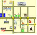
 K. International School Map.jpg 940 × 680; 245 KB
-
 Lehrerseminar Backnang Grundriss Erdgeschoss (1910) Zentralblatt Abbildung 10.png 2,464 × 1,174; 84 KB
-
-

-

-
 Liverpool Public School Plan (3901873695).jpg 1,500 × 1,262; 2.25 MB
-
 Location Map of Orita Sinclair School of Design & Music.jpg 1,288 × 1,000; 675 KB
-
 Map Jedburgh Grammar School 2022.jpg 6,000 × 8,000; 7.47 MB
-
 MapOfRongotaiCollege.png 1,372 × 1,927; 3.53 MB
-
 Lycée national de Nancy, projet de restauration et d'agrandissement.png 1,825 × 675; 1.26 MB
-
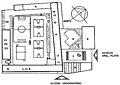
 Original Reform School 1st Floor.png 481 × 675; 376 KB
-
 Original Reform School 2nd Floor.png 482 × 611; 312 KB
-

-
 Plan by Alfred Waterhouse for St. Margaret's School, Bushey.jpg 1,342 × 2,053; 219 KB
-
 Plan of Blayney Public School, 1886 (3907733313).jpg 2,000 × 1,374; 561 KB
-
 Plan of Lambton Public School, 1889 (3907733133).jpg 2,000 × 1,263; 293 KB
-
 Plan of Lambton Public School, 1889 (3908512604).jpg 2,000 × 1,254; 528 KB
-
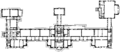
 Planop4.jpg 382 × 272; 20 KB
-
 PlanoUPVM.jpg 1,024 × 683; 164 KB
-
 Plans de la nouvelle école du Sacré-Cœur d'Ixelles (1936).jpg 666 × 531; 78 KB
-
 Planta Alta del Edificio del CETED.jpg 1,443 × 766; 163 KB
-
 Planta Baja del Edificio del CETED.jpg 1,497 × 972; 206 KB
-
 PRMTHS, Grundriss, 2017-07-22.svg 1,052 × 744; 5.58 MB
-

-
 RaumplanStiftsgymnasiumMelk.jpg 762 × 504; 130 KB
-
 Reigate Grammar School Reigate Surrey Plan.png 885 × 591; 117 KB
-
 Report (1883) (14800979993).jpg 2,638 × 2,978; 387 KB
-
 Grund riss.jpg 990 × 1,496; 114 KB
-
 Schenley High School, 1916, Basement Floor Plan.png 2,181 × 1,365; 890 KB
-
 Schenley High School, 1916, First Floor Plan.png 2,227 × 1,446; 971 KB
-
 Schenley High School, 1916, Ground Floor Plan.png 2,146 × 1,177; 800 KB
-
 Schenley High School, 1916, Second Floor Plan.png 2,169 × 1,227; 826 KB
-

-
 Skyline High School Floor Map.png 1,368 × 1,308; 140 KB
-
 St aug3.JPG 692 × 327; 109 KB
-
 St Helen's Free School, Paddington, London; the elevation, a Wellcome V0013630.jpg 2,345 × 3,611; 2.67 MB
-
 St. Andrew's College, Grahamstown General Plan.jpg 1,991 × 1,625; 891 KB
-
 STHS Map.svg 744 × 1,052; 3.07 MB
-
 Heusteigschule, Grundriss Erdgeschoss.jpg 2,280 × 658; 288 KB
-
 Union high floor plan.jpg 2,352 × 3,123; 1.53 MB
-
 Upper Floor Plan of Woodham CTC.gif 700 × 500; 17 KB
-
 Warren Public School (4931127890).jpg 1,500 × 973; 459 KB
-
 Young Public School Plan, 1883 (3901871705).jpg 1,000 × 1,577; 2.03 MB
-
 École Carrépuis.jpg 1,024 × 781; 71 KB
-
 Κατόψεις σχεδίων συγκροτήματος Γλαράκη.jpg 769 × 560; 84 KB
-
 石牌中山大學新校舍草圖案.jpg 1,837 × 2,802; 1.66 MB
.jpg)
_(14579964069).jpg)


.jpg)
,_Flatbush_Avenue,_Brooklyn,_Kings_County,_NY_HABS_NY,24-BROK,4-_(sheet_2_of_18).png)
,_Flatbush_Avenue,_Brooklyn,_Kings_County,_NY_HABS_NY,24-BROK,4-_(sheet_3_of_18).png)
,_Flatbush_Avenue,_Brooklyn,_Kings_County,_NY_HABS_NY,24-BROK,4-_(sheet_4_of_18).png)
.jpg)
.jpg)
.jpg)
.jpg)
.jpg)
.jpg)
.png)
.jpg)
.jpg)


.JPG)
.JPG)


.JPG)


_(14596283770).jpg)
_(14596291420).jpg)
_(14596360048).jpg)


_Zentralblatt_Abbildung_10.png)
_Zentralblatt_Abbildung.png)
.jpg)


.jpg)
.jpg)
.jpg)


.jpg)


_(14779183111).jpg)


_(14800979993).jpg)


.jpg)
.jpg)


_Zentralblatt_Abbildung_9.png)
_Zentralblatt_Abbildung_8.png)