Category:Flookburgh
Jump to navigation
Jump to search
English: Flookburgh is an ancient village on the Cartmel peninsula in northern England. Being close to Morecambe Bay, fishing plays a big part in its village life. Cockle and shrimp fishermen still venture out onto the sands every day, using specially adapted tractors.
village in Cumbria (formerly Lancashire), England  | |||||
| Upload media | |||||
| Instance of | |||||
|---|---|---|---|---|---|
| Location | Lower Holker, South Lakeland, Cumbria, North West England, England | ||||
 | |||||
Subcategories
This category has the following 4 subcategories, out of 4 total.
Media in category "Flookburgh"
The following 46 files are in this category, out of 46 total.
-
 B5277 at Flookburgh village boundary - geograph.org.uk - 5685056.jpg 640 × 480; 30 KB
-
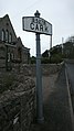 Cark Fingerpost opposite station - panoramio.jpg 1,728 × 3,072; 1.66 MB
-
 Cocklers trolleys - geograph.org.uk - 1548744.jpg 640 × 480; 47 KB
-
 Cockles, Flookburgh - geograph.org.uk - 1548790.jpg 480 × 640; 48 KB
-
 Cumbria Coastal Way - geograph.org.uk - 1548763.jpg 480 × 640; 101 KB
-
 Ducky's Park Farm - geograph.org.uk - 1548767.jpg 640 × 480; 69 KB
-
 Entering Flookburgh on the B5278 - geograph.org.uk - 5462179.jpg 1,024 × 767; 190 KB
-
 Entrance to Lakeland Leisure Park - geograph.org.uk - 1548765.jpg 640 × 480; 90 KB
-
 Flookburgh - geograph.org.uk - 4883980.jpg 640 × 427; 74 KB
-
 Flookburgh village centre - geograph.org.uk - 3370054.jpg 3,342 × 2,223; 1.64 MB
-

-
 House in Flookburgh - geograph.org.uk - 3829325.jpg 640 × 473; 52 KB
-
 Kingdom Hall, Cark Station - panoramio.jpg 3,072 × 1,728; 1.8 MB
-
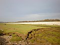
 Low Marsh - geograph.org.uk - 1548746.jpg 640 × 480; 59 KB
-
 Main Drain, Flookburgh - geograph.org.uk - 3469846.jpg 480 × 640; 130 KB
-
 Market Cross, Flookburgh - geograph.org.uk - 1548788.jpg 640 × 480; 62 KB
-
 Market Street, Flookburgh - geograph.org.uk - 5685058.jpg 640 × 481; 46 KB
-

-
 Moor Lane - geograph.org.uk - 1548766.jpg 640 × 480; 47 KB
-
 Old Station Hotel - panoramio.jpg 3,072 × 1,728; 1.49 MB
-
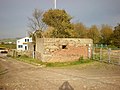 Pillbox - geograph.org.uk - 1548764.jpg 640 × 480; 83 KB
-
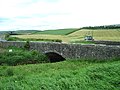 Priest Bridge - geograph.org.uk - 446930.jpg 640 × 480; 102 KB
-
 Railway at Flookburgh, Cumbria - geograph.org.uk - 3562264.jpg 1,024 × 768; 273 KB
-
 Renault 155.54 Turbo with pirate flag.jpg 3,488 × 2,616; 2.19 MB
-
 Scenery at Morecambe Bay.jpg 800 × 600; 381 KB
-
 Sea defences west of Leisure Park - geograph.org.uk - 1548748.jpg 640 × 480; 54 KB
-
 Strand Bridge, Cumbria.jpg 640 × 480; 65 KB
-
 The caravan park at Cark - geograph.org.uk - 422013.jpg 640 × 480; 121 KB
-
 Wesley House 1904 - panoramio.jpg 3,072 × 1,728; 1.72 MB
-
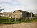 West Plain Farm - geograph.org.uk - 1548761.jpg 640 × 480; 69 KB
-
 Western end of Main Street Flookburgh - geograph.org.uk - 1759079.jpg 640 × 456; 108 KB
-
 Cark Airfield - geograph.org.uk - 353987.jpg 640 × 479; 137 KB
-
 Cowp Scar, Flotsam ^ - geograph.org.uk - 354606.jpg 640 × 430; 54 KB
-
 Footpath to Applebury Hill Farm - geograph.org.uk - 444366.jpg 640 × 480; 94 KB
-
 Lakeland model village at Flookburgh - geograph.org.uk - 727195.jpg 640 × 480; 153 KB
-
 Lancaster to Barrow Railway - geograph.org.uk - 444368.jpg 640 × 480; 155 KB
-
 Lancaster to Barrow Railway - geograph.org.uk - 444372.jpg 640 × 480; 158 KB
-
 Low Marsh - geograph.org.uk - 354617.jpg 640 × 483; 79 KB
-
 New housing, Ella's Orchard - geograph.org.uk - 444374.jpg 640 × 480; 131 KB
-
 Sand Gate - geograph.org.uk - 354685.jpg 640 × 484; 77 KB
-
 St. Cuthbert's Church, Flookburgh - geograph.org.uk - 116572.jpg 640 × 480; 96 KB
-

-
 The main street, Flookburgh - geograph.org.uk - 444378.jpg 640 × 480; 127 KB
-
 The main street, Flookburgh - geograph.org.uk - 444381.jpg 640 × 480; 135 KB
-
 Village Square - geograph.org.uk - 354014.jpg 640 × 479; 117 KB
-
 West Plain Farm - geograph.org.uk - 353959.jpg 640 × 479; 129 KB


