Category:Floodplains in the United States
Jump to navigation
Jump to search
Wikimedia category | |||||
| Upload media | |||||
| Instance of | |||||
|---|---|---|---|---|---|
| Category combines topics | |||||
 | |||||
Countries of North America: Canada · Guatemala · Nicaragua · United States of America‡
‡: partly located in North America
‡: partly located in North America
Subcategories
This category has the following 9 subcategories, out of 9 total.
*
B
H
Media in category "Floodplains in the United States"
The following 19 files are in this category, out of 19 total.
-
 Alaska Floodplain 1902.jpg 700 × 579; 293 KB
-
 Bessemer 44 BO 26 from US Route 220.jpg 6,016 × 4,000; 6.51 MB
-
 Flood plain report- Polk County, Oregon (IA CAT75658187).pdf 1,285 × 1,643, 18 pages; 1.1 MB
-
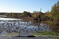
 Field in the Lake Channel - panoramio.jpg 3,488 × 2,616; 3.86 MB
-
 James River floodplain above Eagle Rock.jpg 6,016 × 4,000; 6.45 MB
-

-
 Laramie River floodplain 1949.jpg 700 × 569; 284 KB
-
 Mississippi floodplain.jpg 2,190 × 1,448; 939 KB
-
 Mississippi River Plain at Missouri-Illinois Border (7235180094).jpg 4,000 × 3,000; 2.06 MB
-
 Petrified Forest National Park banner.jpg 4,288 × 613; 2.02 MB
-
 RedRiverMeandersArkansas1.jpg 3,055 × 3,580; 5.09 MB
-
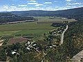 Schoharie County.jpg 4,032 × 3,024; 3.28 MB
-
 Silver Maple Floodplain Forest at Missiquoi National Wildlife Refuge. (14098293649).jpg 4,752 × 3,168; 15.02 MB
-
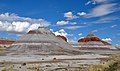 The PEFO Tepees.jpg 4,288 × 2,536; 7.73 MB
-
 The Red River Flood Plain.jpg 4,800 × 4,797; 4.26 MB
-
 Wabash River Meanders Grayville, Illinois.jpg 2,515 × 2,303; 3.42 MB
-
 Wabash River Meanders, Grayville, Illinois Topo.jpg 2,509 × 2,656; 5.24 MB
-
 Wapello, Iowa on the Iowa River (7981524012).jpg 4,000 × 3,000; 1.97 MB
-
 Willamette Floodplain.jpg 300 × 197; 18 KB


.jpg)


.jpg)


.jpg)
