Category:Floodplains in Texas
Jump to navigation
Jump to search
States of the United States: Alabama · Alaska · Arizona · California · Colorado · Connecticut · Georgia · Hawaii · Idaho · Illinois · Indiana · Kentucky · Maine · Massachusetts · Minnesota · Montana · Nebraska · Nevada · New Hampshire · North Carolina · North Dakota · Ohio · Oklahoma · Oregon · South Carolina · South Dakota · Texas · Utah · Vermont · Virginia · Washington · Wisconsin · Wyoming
Media in category "Floodplains in Texas"
The following 12 files are in this category, out of 12 total.
-
 Aerial - Colorado River and Emma Long Metropolitan Park 01.jpg 4,288 × 2,848; 8.87 MB
-
 FEDLINK - United States Federal Collection (IA CAT71342230).pdf 1,104 × 1,522, 98 pages; 4.44 MB
-

-

-
 Dallas Texas skyline overlooking the Trinity River in spring 2024.png 15,890 × 5,150; 100.23 MB
-
 Little Red River Hall County Texas 2015.jpg 5,616 × 3,519; 4 MB
-
 Little Red River Texas 2015.jpg 5,616 × 3,744; 11.12 MB
-
 Little Red River Valley Hall County Texas.jpg 5,616 × 3,744; 5.29 MB
-
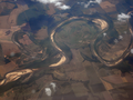 Meander bends and oxbow.png 3,072 × 2,304; 8.88 MB
-
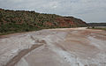
 North Fork Red River 2015.jpg 5,616 × 2,875; 9.25 MB
-
 North Fork Red River 2015b.jpg 5,341 × 2,840; 7.58 MB
-
 Salt Fork Brazos River FM651 Texas.jpg 3,984 × 2,656; 5.59 MB


