Category:Flooding of the Lake Champlain basin and Richelieu River in 2011
Jump to navigation
Jump to search
| Upload media | |||||
| Instance of | |||||
|---|---|---|---|---|---|
| Location |
| ||||
| Point in time |
| ||||
 | |||||
Media in category "Flooding of the Lake Champlain basin and Richelieu River in 2011"
The following 17 files are in this category, out of 17 total.
-
 24hr Rain accumulation 2011-05-26 severe weather NE US.png 744 × 549; 348 KB
-
 Car reportage SRC-inondations Richelieu 2011.jpg 3,648 × 2,736; 4.66 MB
-
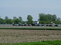 Champs inondés et route Saint-Blaise-sur-Richelieu.JPG 3,648 × 2,736; 4.69 MB
-
 Champs inondés Saint-Blaise-sur-Richelieu.JPG 3,648 × 2,736; 4.37 MB
-
 Fermeture du pont Gouin.JPG 3,648 × 2,736; 4.99 MB
-
 Inondation St-Jean-sur-Richelieu.JPG 3,648 × 2,736; 4.37 MB
-
 Inondations 2011 St-Jean-sur-Richelieu.jpg 3,648 × 2,736; 6.74 MB
-
 Lake Champlain water level at Rouse Point (may 23).png 600 × 465; 19 KB
-
 Lake Champlain water level at Rouse Point.png 600 × 465; 19 KB
-
 Maisons inondées Saint-Paul-de-lle-aux-Noix.jpg 3,648 × 2,736; 4.85 MB
-
 Operation Lotus St-Jean-sur-Richelieu 2011.jpg 3,648 × 2,736; 6.64 MB
-
 Pont Gouin canal Chambly 2011-05-23.JPG 3,648 × 2,736; 4.65 MB
-
 Richelieu flood IR 2011-05-08.jpg 720 × 360; 202 KB
-
 Richelieu flood visible image 2011-05-08.jpg 720 × 360; 182 KB
-
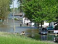
 Rue inondée Saint-Paul-de-lîle-aux-noix.JPG 2,736 × 3,648; 4.66 MB
-
 St-Jean-sur-Richelieu.jpg 2,736 × 3,648; 5.58 MB
-
 Village inondé près Saint Blaise-sur-Richelieu 2011-5-23.JPG 3,648 × 2,736; 4.96 MB


.png)


