Category:Flood level signs in the United States
Jump to navigation
Jump to search
Countries of the Americas: United States of America
Media in category "Flood level signs in the United States"
The following 50 files are in this category, out of 50 total.
-
 1993-flood1.jpg 1,400 × 973; 430 KB
-

-
 Apalachicola River boat ramp, Bristol Landing.jpg 5,184 × 3,456; 9 MB
-
 Black Rock Mill, sign (21601355666).jpg 1,080 × 1,920; 830 KB
-
 Broadmoor7July06PaintedWaterlineBricks.jpg 2,592 × 1,944; 1.86 MB
-
 BroadmoorBrickFloodlinepaintwavesJuly06.jpg 2,592 × 1,944; 1.84 MB
-
 Catina Street House with Flood Depth Gage New Orleans.jpg 2,112 × 2,816; 3.36 MB
-
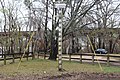
 Cheraw Pee Dee pole flood level.jpg 2,464 × 2,464; 1.55 MB
-
 Chipola River Park 1998 High Water Mark sign.jpg 3,264 × 2,448; 3.03 MB
-
 Edgewood Park Gentilly New Orleans Franklin Avenue 1st April 2019 09.jpg 3,888 × 5,184; 7.27 MB
-
 FEMA - 30685 - Flood high water mark in Missouri.jpg 1,944 × 2,896; 4.01 MB
-
 Flood heights markers at Marietta.jpg 2,816 × 2,112; 1.34 MB
-
 Flood level sign in Fort Wayne, Indiana.jpg 3,872 × 2,592; 4.08 MB
-
 Flood Levels, Manatee Springs State Park.JPG 5,184 × 3,456; 10.43 MB
-
 Flood marker in Radium Springs Garden, Jul 2020.jpg 5,184 × 3,456; 6.32 MB
-
 Flood Markers in Aripeka.jpg 1,818 × 1,228; 795 KB
-

-
 FloodLevels.jpg 2,029 × 3,436; 1,020 KB
-
 FloodMarker.jpg 457 × 619; 92 KB
-
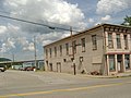
 Ginn's Furniture Store in Milton.jpg 2,816 × 1,584; 2.18 MB
-
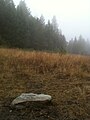 Glacial lake missoula high water mark rock 4200 ft trail.jpg 1,536 × 2,048; 1.08 MB
-
 Glacial lake missoula high water mark rock 4200 ft.jpg 2,048 × 1,536; 2.33 MB
-
-
 High Water Mark sign along Little River in Snowville Phillips WX4SNO.jpg 2,736 × 3,648; 3.5 MB
-
 Hurricane Ike Water Line Downtown Galveston TX.jpg 3,872 × 2,592; 2.32 MB
-
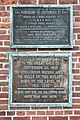 Hurricane water levels at Old Market House Providence.jpg 1,600 × 2,400; 950 KB
-
 Ike High Water Marker (4784121229).jpg 854 × 1,286; 389 KB
-
 Iowa River Record High Water Level Flood Sign (43141025591).jpg 4,398 × 2,851; 5.64 MB
-
 KC-floods.jpg 2,075 × 1,465; 520 KB
-
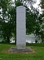
 LakeviewTotemFloodpole.jpg 1,944 × 2,592; 2.08 MB
-
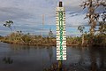
 Manatee Springs State Park Florida flood levels01.jpg 2,448 × 3,264; 3.46 MB
-
 MidCity10May06WeveHadItUpToHere.jpg 2,592 × 1,944; 1.37 MB
-
 Milton Floodwaters 2.JPG 1,600 × 1,200; 541 KB
-
 New Orleans 2007 47.jpg 2,816 × 2,112; 1.41 MB
-
 O'Leno State Park, flood level post.jpg 5,184 × 3,456; 10.16 MB
-
 Ochlockonee River Flood sign, Franklin County.jpg 5,184 × 3,456; 6.62 MB
-
 PontchartrainBaptistHeHasRisenAndSoWillWe.jpg 2,816 × 2,112; 1.45 MB
-
 Radford High Water Mark sign Phillips WX4SNO.jpg 1,679 × 2,242; 1.46 MB
-
 Redrivergrandforkscairn.jpg 480 × 640; 87 KB
-
 SE Farm Recreation Area boat ramp.jpg 3,264 × 2,448; 2.84 MB
-
 Shikellamy State Park Marina House.JPG 1,536 × 2,048; 649 KB
-
 SPH&TM Katrina.jpg 827 × 1,859; 1.1 MB
-
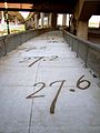
 Stormlevelsgalveston.jpg 2,304 × 4,096; 3 MB
-
 Tsunami Height 1964 Crescent City CA.jpg 768 × 1,024; 655 KB
-
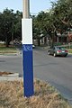
 US 19 and Hernando CR 476 Hurricane Marker.jpg 800 × 540; 87 KB
-
 Water height sign in Clyde T. Hopkins Municipal park.jpg 5,184 × 3,456; 11.14 MB
-
 Water levels on the rise (2449396516).jpg 720 × 758; 406 KB
-
 WaterlineMarkerDavisParkwayEditorB.jpg 1,365 × 2,048; 1.25 MB
-
 WestendLevelPole14Nov.jpg 1,944 × 2,592; 1.83 MB
-
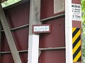 Zook's Mill Covered Bridge Agnes Sign 3264px.jpg 3,264 × 2,448; 2.97 MB


.jpg)


.jpg)
.jpg)


.jpg)


