Category:Flixton, Greater Manchester
Jump to navigation
Jump to search
village in the Metropolitan Borough of Trafford, Greater Manchester, England | |||||
| Upload media | |||||
| Instance of | |||||
|---|---|---|---|---|---|
| Location | Trafford, Greater Manchester, North West England, England | ||||
 | |||||
English: Flixton is a ward in the Metropolitan Borough of Trafford
Subcategories
This category has the following 7 subcategories, out of 7 total.
A
- Abbotsfield Park, Urmston (13 F)
F
- Flixton House (5 F)
- Flixton railway station (8 F)
S
- Shaw Hall, Flixton (3 F)
T
Media in category "Flixton, Greater Manchester"
The following 200 files are in this category, out of 283 total.
(previous page) (next page)-
 "Bowden View", Shawe Road, Urmston.jpg 4,032 × 3,024; 3.72 MB
-
 "Brentwood Flats", Flixton Road, Urmston.jpg 4,032 × 3,024; 3.79 MB
-
 "Clifton Villa", Westbourne Road, Urmston.jpg 4,032 × 3,024; 2.37 MB
-
 "Greenfield Terrace", Derwent Road, Woodsend, Urmston.jpg 4,032 × 3,024; 3.94 MB
-
 "Peel Terrace", Stretford Road, Urmston.jpg 4,032 × 3,024; 2.28 MB
-
 "Reade House", Western Road, Urmston.jpg 4,032 × 3,024; 3.91 MB
-
 "Ringmore", Brook Road, Urmston.jpg 4,032 × 3,024; 2.74 MB
-
 "Shaldon", Brook Road, Urmston.jpg 4,032 × 3,024; 2.13 MB
-
 'Bole Hill', Carrington Road, Urmston.jpg 4,032 × 3,024; 3.54 MB
-
 'Broad Oak', Crofts Bank Road, Urmston.jpg 3,024 × 4,032; 3.95 MB
-
 'Cottington', Old Crofts Bank, Urmston.jpg 4,032 × 3,024; 5.43 MB
-
 'Davyhulme House', Davyhulme Road, Urmston.jpg 4,032 × 3,024; 1.89 MB
-
 'Dee Mount', Flixton Road, Urmston.jpg 4,032 × 3,024; 2.47 MB
-
 'Duck Cottage', Flixton Road, Urmston.jpg 3,024 × 4,032; 2.33 MB
-
 'Edgefield Villas', Church Road, Flixton, Urmston.jpg 3,024 × 4,032; 2.19 MB
-
 'Edgewell Villas', Church Road, Flixton, Urmston.jpg 4,032 × 3,024; 2.45 MB
-
 'Ennenda', 97 Church Road, Urmston.jpg 3,024 × 4,032; 4.6 MB
-
 'Faburn Villa', Flixton Road, Urmston.jpg 4,032 × 3,024; 2.66 MB
-
 'Fern Acre', Crofts Bank Road, Urmston.jpg 4,032 × 3,024; 4.36 MB
-
 'Glenmaye' & 'Mayfield', Crofts Bank Road, Urmston.jpg 4,032 × 3,024; 2.18 MB
-
 'Halsteads', Marlborough Road, Urmston.jpg 4,032 × 3,024; 3.22 MB
-
 'Lulworth', Marlborough Road, Urmston.jpg 3,024 × 4,032; 3.32 MB
-
 'Market 41', Railway Road, Urmston.jpg 4,032 × 3,024; 2.99 MB
-
 'Mount Melfort' & 'Innisfallen', Church Road, Urmston.jpg 4,032 × 3,024; 2.46 MB
-
 'Ormeau Lodge', Church Road, Urmston.jpg 3,024 × 4,032; 4.08 MB
-
 'Priors Lee', 93 Church Road, Urmston.jpg 3,024 × 4,032; 3.59 MB
-
 'Raslie', Flixton Road, Urmston.jpg 3,024 × 4,032; 2.78 MB
-
 'Red House', 91 Church Road, Urmston.jpg 3,024 × 4,032; 3.79 MB
-
 'Rostherne Villa & Carlton Villa', Crofts Bank Road, Urmston.jpg 4,032 × 3,024; 2.57 MB
-
 'The Hollies', Davyhulme Road, Urmston.jpg 4,032 × 3,024; 5.1 MB
-
 'The Hollies', The Village, Flixton, Urmston.jpg 4,032 × 3,024; 4.9 MB
-
 'The Knoll', 109 Church Road, Urmston.jpg 4,032 × 3,024; 4.73 MB
-
 'The Old School', Davyhulme Road, Urmston.jpg 4,032 × 3,024; 2.96 MB
-
 'The Roost' & 'The Brackens', Stretford Road, Urmston.jpg 4,032 × 3,024; 4.28 MB
-
 1960s Carrington road flixton.jpg 1,948 × 1,370; 347 KB
-
 3rd Davyhulme Scout Group, 57 Conway Road, Urmston.jpg 4,032 × 3,024; 4.48 MB
-
 A6144 Near Ackers Farm - geograph.org.uk - 1338017.jpg 640 × 480; 170 KB
-
 Abbotsfield Park Tennis Courts, Urmston.jpg 4,032 × 3,024; 4.45 MB
-
 Acre Hall Primary School - geograph.org.uk - 26744.jpg 640 × 480; 79 KB
-
 Acre Hall Primary School - geograph.org.uk - 3364534.jpg 640 × 480; 91 KB
-
 Adrak, Flixton Road, Urmston.jpg 3,024 × 4,032; 2.48 MB
-
 AK Tyres, Higher Road, Urmston.jpg 4,032 × 3,024; 2.81 MB
-
 Allotment shed - geograph.org.uk - 938958.jpg 640 × 428; 72 KB
-
 Allotments looking East - geograph.org.uk - 938978.jpg 640 × 428; 83 KB
-
 Annual Nags Head Christmas Tree Sales, Urmston.jpg 4,032 × 3,024; 1.97 MB
-
 Apsley Terrace, 394-402 Flixton Road, Urmston.jpg 4,032 × 3,024; 3.06 MB
-
 Autumn morning on Davyhulme Road, Urmston.jpg 4,032 × 3,024; 5.11 MB
-
 B&Q Manchester - Trafford Park, Redclyffe Raod, Stretford.jpg 4,032 × 3,024; 1.7 MB
-
 Barrows Bakery, Church Road, Urmston.jpg 4,032 × 3,024; 2.97 MB
-
 Benchmark - geograph.org.uk - 50063.jpg 640 × 480; 94 KB
-
 Benchmark Locator, Waypoint B52846, 66 Crofts Bank Road, Urmston.jpg 3,024 × 4,032; 4.24 MB
-
 Bent Lanes - geograph.org.uk - 38839.jpg 640 × 480; 52 KB
-
 Beyond Education Tutoring, 175 Broadway, Urmston.jpg 4,032 × 3,024; 2.88 MB
-
 Bole hill carrington road flixton manchester.JPG 2,272 × 1,704; 1.78 MB
-
 Bowfell Road (B5158) - geograph.org.uk - 3364847.jpg 640 × 480; 107 KB
-
 Boysnope Park Golf Club - geograph.org.uk - 33927.jpg 640 × 480; 107 KB
-
 BrewChimp Urmston, Church Road, Urmston.jpg 4,032 × 3,024; 2.46 MB
-
 Brighton Grove street signs, Urmston.jpg 3,024 × 4,032; 3.54 MB
-
 Brighton Grove, Urmston.jpg 4,032 × 3,024; 4.26 MB
-
 Brownfield Site by Trafford Golf Centre, Stretford.jpg 3,024 × 4,032; 2.75 MB
-
 Brownfield Site, Trafford Golf Centre, Stretford.jpg 4,032 × 3,024; 4.39 MB
-
 Burner Heating Spares & The Pawdressers Grooming Salon, Higher Road, Urmston.jpg 4,032 × 3,024; 1.94 MB
-
 Bus stop and a row of shops - geograph.org.uk - 5401370.jpg 6,000 × 4,000; 4.07 MB
-
 Carlton Crescent, Urmston.jpg 4,032 × 3,024; 2.83 MB
-
 Carlton Road, Urmston.jpg 4,032 × 3,024; 3.27 MB
-
 Carrington road garage flixton.jpg 1,402 × 1,004; 174 KB
-

-
 Cavendish Sportswear & Trafford Horticulture, Higher Road, Urmston.jpg 4,032 × 3,024; 3.45 MB
-
 Cheeky Cherubs, 1 Victoria Parade, Urmston.jpg 4,032 × 3,024; 3.41 MB
-
 Children's Play Area. - geograph.org.uk - 1388243.jpg 640 × 379; 66 KB
-
 Church Road past - geograph.org.uk - 1427855.jpg 640 × 480; 117 KB
-
 Church Road to The Grove Passage, Flixton, Urmston.jpg 3,024 × 4,032; 5.98 MB
-
 Coberley Avenue, Urmston.jpg 4,032 × 3,024; 2.11 MB
-
 Coming soon..."Market 41", Urmston.jpg 4,032 × 3,024; 3.67 MB
-
 Coming soon...'Market 41', Railway Road, Urmston.jpg 4,032 × 3,024; 3 MB
-
 Coming soon...'Trafford Waters'.jpg 4,032 × 3,024; 1.82 MB
-
 Coming soon...Syriana (Levantine Cuisine), Crofts Bank Road, Urmston.jpg 3,024 × 4,032; 3.03 MB
-
 Coming soon...Trafford Waters.jpg 4,032 × 3,024; 1.64 MB
-
 Conway House (left) & Rhuddlan (right), Marlborough Road, Urmston.jpg 4,032 × 3,024; 2.37 MB
-
 Copper Hatch, Flixton Road, Urmston (For Sale).jpg 3,024 × 4,032; 2.82 MB
-
 Costa Coffee & Beyond, Trafford City, Trafford Way, Stretford.jpg 4,032 × 3,024; 2.88 MB
-
 Cranford Gardens, Urmston.jpg 4,032 × 3,024; 5.08 MB
-
 Crofts Bank Road Shops, Urmston.jpg 4,032 × 3,024; 4.03 MB
-
 Crossing of footpaths near Flixton - geograph.org.uk - 5403712.jpg 6,000 × 4,000; 6.65 MB
-
 Cucumber Recruitment, 173 Broadway, Urmston.jpg 4,032 × 3,024; 2.84 MB
-
 Daisy Daisy Flowers, The Village, Flixton, Urmston.jpg 2,943 × 2,207; 2.45 MB
-
 Davyhulme Park Golf Club - Club House - geograph.org.uk - 1974716.jpg 3,264 × 2,448; 1.98 MB
-
 Davyhulme Road & Norrey's Urn, Urmston.jpg 3,024 × 4,032; 5.1 MB
-
 Davyhulme Road - geograph.org.uk - 3364552.jpg 640 × 480; 82 KB
-
-
 Derelict Acregate Golf Clubhouse, William Wroe Golf Course, Pennybridge Lane, Urmston.jpg 4,032 × 3,024; 3.81 MB
-
 Derelict Bar Area, William Wroe Golf Course, Pennybridge Lane, Urmston.jpg 3,024 × 4,032; 3.59 MB
-
 Dodds shop flixton manchester.jpg 3,000 × 2,037; 714 KB
-
 Domestic Road, Davyhulme Road, Urmston.jpg 4,032 × 3,024; 5.66 MB
-
 Dutton's Pond - geograph.org.uk - 2791443.jpg 640 × 480; 403 KB
-
 Dutton's Pond, Flixton - geograph.org.uk - 2791442.jpg 640 × 480; 446 KB
-
 Dutton's Pond, Flixton - geograph.org.uk - 2791446.jpg 640 × 480; 433 KB
-
 Duttons Pond - geograph.org.uk - 45104.jpg 640 × 480; 190 KB
-
 Duttons Pond Flixton Manchester.jpg 3,267 × 2,082; 1.42 MB
-
 Eden Hall Drive, Urmston.jpg 4,032 × 3,024; 2.96 MB
-
 Empire Barbers, 24 Higher Road, Urmston.jpg 3,024 × 4,032; 1.83 MB
-
 Extravagant Fireworks, Princess Road, Urmston.jpg 4,032 × 3,024; 2.19 MB
-
 Farm track near Towns Gate - geograph.org.uk - 5403531.jpg 6,000 × 4,000; 4.52 MB
-
 Filey Avenue, Urmston.jpg 4,032 × 3,024; 2.49 MB
-
 Flixton (Trafford Council Ward).png 1,400 × 1,270; 277 KB
-
 Flixton - Bent Lane - geograph.org.uk - 1338601.jpg 640 × 480; 159 KB
-
 Flixton - Bent Lane At Selby Drive - geograph.org.uk - 1338599.jpg 640 × 480; 171 KB
-
 Flixton - Moorside Road - geograph.org.uk - 1338595.jpg 640 × 480; 177 KB
-
 Flixton - Moorside Road Shopping Parade - geograph.org.uk - 1338594.jpg 640 × 480; 175 KB
-
 Flixton - Part Of Woodsend Park - geograph.org.uk - 1338586.jpg 640 × 480; 191 KB
-
 Flixton - Redcar Avenue - geograph.org.uk - 1338608.jpg 640 × 480; 190 KB
-
 Flixton - Roedean Gardens - geograph.org.uk - 1338588.jpg 640 × 480; 155 KB
-
 Flixton - Selby Drive - geograph.org.uk - 1338602.jpg 640 × 480; 148 KB
-
-
 Flixton - Woodbridge Road - geograph.org.uk - 1338589.jpg 640 × 480; 207 KB
-
 Flixton - Woodbridge Road Side Access - geograph.org.uk - 1338591.jpg 640 × 480; 177 KB
-
 Flixton - Woodhouse Road - geograph.org.uk - 1338604.jpg 640 × 480; 152 KB
-
 Flixton - Woodhouse Road - geograph.org.uk - 1338606.jpg 640 × 480; 147 KB
-
 Flixton - Woodsend Road - geograph.org.uk - 1338598.jpg 640 × 480; 175 KB
-
 Flixton Academy of Performing Arts (1).JPG 4,320 × 3,240; 3.52 MB
-
 Flixton Academy of Performing Arts (2).JPG 4,320 × 3,240; 3.4 MB
-
 Flixton Bridge - geograph.org.uk - 1427903.jpg 640 × 480; 122 KB
-
 Flixton Bridge - geograph.org.uk - 50061.jpg 640 × 480; 71 KB
-
 Flixton Cricket Club - Ground - geograph.org.uk - 3667720.jpg 1,600 × 1,200; 243 KB
-
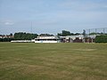 Flixton Cricket Club - Pavilion - geograph.org.uk - 3667704.jpg 1,600 × 1,200; 302 KB
-
 Flixton Girls School - geograph.org.uk - 421003.jpg 640 × 480; 91 KB
-
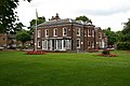
 Flixton House - geograph.org.uk - 5403716.jpg 6,000 × 4,000; 6.11 MB
-
 Flixton House, Flixton, Greater Manchester.jpg 3,297 × 2,207; 1.94 MB
-
 Flixton Junior School - geograph.org.uk - 21986.jpg 640 × 480; 119 KB
-
 Flixton Old Rectory.png 1,020 × 757; 691 KB
-
 Flixton Park - geograph.org.uk - 5400258.jpg 6,000 × 4,000; 4.27 MB
-
 Flixton Road (B5158) - geograph.org.uk - 2312988.jpg 640 × 480; 237 KB
-
 Flixton Road - geograph.org.uk - 1345600.jpg 640 × 480; 92 KB
-
 Flixton Road - geograph.org.uk - 2677026.jpg 640 × 480; 74 KB
-
 Flixton road flixton manchester.jpg 1,442 × 1,030; 269 KB
-
 Flixton Road Shops, Urmston - 52464724761.jpg 4,032 × 3,024; 2.87 MB
-
 Flixton Road Shops, Urmston.jpg 4,032 × 3,024; 3.71 MB
-
 Flixton Road, Flixton - geograph.org.uk - 1388275.jpg 640 × 480; 107 KB
-
 Flixton Road, Flixton - geograph.org.uk - 1388318.jpg 640 × 480; 98 KB
-
 FlixtonHouse.jpg 640 × 426; 147 KB
-
 Flooding at The William Wroe Golf Course - geograph.org.uk - 2758751.jpg 4,399 × 2,397; 7.69 MB
-
 Floribunda, 118 Flixton Road, Urmston.jpg 3,024 × 4,032; 2.76 MB
-
 Footpath To Hulmes Bridge Ferry - geograph.org.uk - 2311239.jpg 640 × 480; 337 KB
-
 Footpath to Towns Gate - geograph.org.uk - 5402660.jpg 6,000 × 4,000; 4.39 MB
-
 Footpath Under The Embankment - geograph.org.uk - 2791439.jpg 640 × 480; 541 KB
-
 Forest Close, Woodsend - geograph.org.uk - 3364537.jpg 640 × 480; 67 KB
-
 Former First For Tyres premises, Higher Road, Urmston.jpg 3,024 × 4,032; 2.51 MB
-
 Former Goddard & Staines, Higher Road, Urmston.jpg 4,032 × 3,024; 2.15 MB
-
 Former Kirkham's Store, Stretford Road, Urmston.jpg 4,032 × 3,024; 3.62 MB
-
 Former William Wroe Golf Course.jpg 4,032 × 2,268; 3.4 MB
-
 Glebe Road, Urmston.jpg 3,024 × 4,032; 2.37 MB
-
 Goodness Zero Waste, 10 Crofts Bank Road, Urmston.jpg 3,024 × 4,032; 2.96 MB
-
 Green Hill Flixton Manchester.jpg 3,003 × 1,971; 1,019 KB
-
 Haldi Indian Restaurant, Victoria Parade, Urmston.jpg 4,032 × 3,024; 2.97 MB
-
 Hayeswater Centre, Hayeswater Road, Urmston.jpg 4,032 × 3,024; 4.45 MB
-
 Hayley's Scran Van, Taylor Road, Stretford.jpg 4,032 × 3,024; 2.92 MB
-
 High Tension Junction Marker, Old Crofts Bank Road, Urmston.jpg 4,032 × 3,024; 2.76 MB
-

-
 Horses grazing - geograph.org.uk - 1427888.jpg 640 × 480; 111 KB
-
 Houses off Riverside Drive - geograph.org.uk - 3364867.jpg 640 × 480; 70 KB
-
 Houses on Bent Lanes - geograph.org.uk - 3364638.jpg 640 × 480; 60 KB
-
 Houses on Bowfell Road - geograph.org.uk - 3364843.jpg 640 × 480; 73 KB
-
 Houses on Davyhulme Road - geograph.org.uk - 3364550.jpg 640 × 480; 65 KB
-
 Houses on Merwell Road - geograph.org.uk - 2681563.jpg 1,600 × 854; 298 KB
-
 Houses on Merwell Road - geograph.org.uk - 3364507.jpg 640 × 480; 60 KB
-
 Hulme's Bridge Ferry - geograph.org.uk - 2388539.jpg 4,537 × 3,697; 901 KB
-
 Hulme's Bridge Ferry. - geograph.org.uk - 4339.jpg 640 × 480; 60 KB
-
 Ilkley Drive, Urmston.jpg 4,032 × 3,024; 3.85 MB
-
 Irlam Road - geograph.org.uk - 2312837.jpg 640 × 480; 239 KB
-
 Irlam Road - geograph.org.uk - 3364532.jpg 640 × 480; 83 KB
-
 Jack Lane Farm - geograph.org.uk - 5402674.jpg 6,000 × 4,000; 3.68 MB
-
 Jack Lane Nature Reserve - geograph.org.uk - 5402668.jpg 6,000 × 4,000; 6.95 MB
-
 John R. Tollitt Funeral Service, Seren House, Atkinson Rd, Urmston.jpg 4,032 × 3,024; 1.94 MB
-
 Kingdom Hall of Jehovah's Witnesses, Higher Road, Urmston.jpg 4,032 × 3,024; 2.57 MB
-
 Kobella Beauty Salon & Coral Bookmakers, Flixton Road Shops, Urmston.jpg 4,032 × 3,024; 2.13 MB
-
 L&J News - Hullaballoo-ns, Stretford Road, Urmston.jpg 3,024 × 4,032; 3.22 MB
-
 Lafferty's Farm - geograph.org.uk - 2791545.jpg 640 × 480; 532 KB
-
 Lansdowne Road North, Flixton - geograph.org.uk - 3364515.jpg 640 × 480; 82 KB
-
 Larkrise - The Village, Flixton.jpg 4,032 × 3,024; 2.65 MB
-
 Lime Avenue to Abbotsfield Park Passage, Urmston.jpg 3,024 × 4,032; 3.09 MB
-
 Links Rise to Rossett Drive passage, Urmston.jpg 3,024 × 4,032; 3.56 MB
-

-
 Longfield Drive, Urmston.jpg 4,032 × 3,024; 4.89 MB
-
-
 Looking Towards Flixton - geograph.org.uk - 2791456.jpg 640 × 480; 415 KB
-
 Lowood Avenue, Urmston.jpg 3,024 × 4,032; 3.23 MB
-
 Manchester to Liverpool rail track - geograph.org.uk - 1388370.jpg 640 × 480; 124 KB
-
 Manchester to Liverpool rail track - geograph.org.uk - 1388382.jpg 640 × 480; 124 KB
-
 Market 41, Railway Road, Urmston.jpg 4,032 × 3,024; 4.81 MB
-
 Marlborough Road, Urmston.jpg 3,024 × 4,032; 4.64 MB
-
 Mersey Valley Farmland - geograph.org.uk - 1381507.jpg 640 × 480; 90 KB
-
 Mersey Valley Pasture Land - geograph.org.uk - 1381537.jpg 640 × 480; 92 KB
-
 Mersey Valley Rough Pasture - geograph.org.uk - 1381514.jpg 640 × 480; 86 KB
-
 Moorside Road - geograph.org.uk - 1428090.jpg 640 × 480; 98 KB
-
 Morris Hall, Atkinson Road, Urmston.jpg 3,024 × 4,032; 3.78 MB
-
 Nags Head Roundabout War Memorial, Urmston.jpg 4,032 × 3,024; 1.64 MB
-
 Nags Head Roundabout, Urmston.jpg 4,032 × 3,024; 2.09 MB
-
 No cars allowed - geograph.org.uk - 1388408.jpg 640 × 480; 95 KB
-
 Old carrington road flixton manchester.jpg 2,855 × 3,995; 1.09 MB
-
 Old gateposts on William Wroe Golf Course, Urmston.jpg 4,032 × 3,024; 6.11 MB


_-_geograph.org.uk_-_3364847.jpg)


,_Crofts_Bank_Road,_Urmston.jpg)

_%26_Rhuddlan_(right),_Marlborough_Road,_Urmston.jpg)
.jpg)


.png)


.JPG)
.JPG)


_-_geograph.org.uk_-_2312988.jpg)


