Category:Flat Fell
Jump to navigation
Jump to search
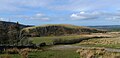
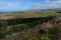
English: Flat Fell is a hill in the civil parish of Ennerdale and Kinniside, in the Copeland district, in the county of Cumbria, England.
mountain in United Kingdom  | |||||
| Upload media | |||||
| Instance of | |||||
|---|---|---|---|---|---|
| Located in protected area | |||||
| Location | Lake District, North Yorkshire, Yorkshire and the Humber, England | ||||
| Elevation above sea level |
| ||||
| Parent peak | |||||
 | |||||
Media in category "Flat Fell"
The following 8 files are in this category, out of 8 total.
-
 Flat Fell - geograph.org.uk - 1127069.jpg 640 × 480; 81 KB
-
 Flat Fell - geograph.org.uk - 1621392.jpg 640 × 480; 81 KB
-
 Flat Fell - geograph.org.uk - 47565.jpg 640 × 480; 74 KB
-
 Flat Fell cairn - geograph.org.uk - 1055622.jpg 640 × 480; 94 KB
-
 Flat fell east face.jpg 1,024 × 493; 220 KB
-
 Flatfell.JPG 2,656 × 1,768; 1.99 MB
-
 Flatfell2.JPG 2,656 × 1,768; 2.05 MB
-
 From Flat Fell - geograph.org.uk - 1621389.jpg 640 × 480; 77 KB


