Category:Fishbourne, West Sussex
Jump to navigation
Jump to search
Deutsch: Fishbourne ist ein Dorf in der englischen Grafschaft West Sussex ca. 3 km von Chichester entfernt.
English: Fishbourne is a village and civil parish in the Chichester District of West Sussex, England and is situated two miles (3.2 km) west of Chichester. The name derives from fissaburna/fiseborne/fysshburn, all meaning "stream with fish". There is a Fishbourne located in New Jersey, USA which was founded by people from West Sussex.
Norsk bokmål: Fishbourne er en landsby i West Sussex, mellom Chichester og Bosham. Navnet kommer fra en bekk (angelsaksisk bourne) hvor det er godt fiske.
village and civil parish in Chichester, West Sussex, England, UK  | |||||
| Upload media | |||||
| Instance of | |||||
|---|---|---|---|---|---|
| Location | Chichester, West Sussex, South East England, England | ||||
| Population |
| ||||
| Area |
| ||||
 | |||||
Subcategories
This category has the following 6 subcategories, out of 6 total.
B
- The Bull's Head, Fishbourne (3 F)
F
Media in category "Fishbourne, West Sussex"
The following 200 files are in this category, out of 238 total.
(previous page) (next page)-
 484001 Car 231 Fishbourne.jpg 2,048 × 1,366; 712 KB
-

-
 A good crop of nettles - geograph.org.uk - 5503144.jpg 1,024 × 768; 285 KB
-
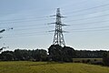
 A pylon by the railway - geograph.org.uk - 4756080.jpg 640 × 399; 36 KB
-
 A259 Fishbourne - geograph.org.uk - 1288266.jpg 640 × 480; 96 KB
-
 A259 Fishbourne - geograph.org.uk - 1288272.jpg 640 × 480; 95 KB
-
 A259 Fishbourne - geograph.org.uk - 1288295.jpg 640 × 480; 118 KB
-
 A259 leaving Chichester - geograph.org.uk - 3119466.jpg 640 × 428; 104 KB
-

-
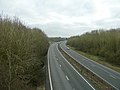 A27 bypassing the village of Fishbourne - geograph.org.uk - 3286630.jpg 4,000 × 3,000; 3.4 MB
-
 A27 Chichester Bypass - geograph.org.uk - 3703594.jpg 1,600 × 1,047; 448 KB
-
 A27 looking west - geograph.org.uk - 3141066.jpg 640 × 480; 89 KB
-
 A27 north of Fishbourne - geograph.org.uk - 2862758.jpg 640 × 430; 31 KB
-
 A27(T) north of Polthooks Farm and looking west - geograph.org.uk - 2754332.jpg 1,024 × 768; 126 KB
-
 A27(T) north of Polthooks Farm looking east - geograph.org.uk - 2754339.jpg 1,024 × 768; 191 KB
-
 A27, approaching Fishbourne Roundabout - geograph.org.uk - 6538507.jpg 1,024 × 681; 117 KB
-
 A27, Chichester bypass - geograph.org.uk - 3180354.jpg 640 × 398; 35 KB
-
 A27, Chichester bypass - geograph.org.uk - 3180357.jpg 640 × 430; 31 KB
-
 A27, Chichester bypass - geograph.org.uk - 3180359.jpg 640 × 430; 47 KB
-
 A27, Chichester bypass - geograph.org.uk - 3674046.jpg 640 × 430; 70 KB
-
 Acute bend in stream on the southern edge of Fishbourne - geograph.org.uk - 3293312.jpg 4,000 × 3,000; 3.31 MB
-
 Barn just off Blackboy Lane - geograph.org.uk - 661172.jpg 640 × 480; 40 KB
-
 Barns, Bethwines Farm - geograph.org.uk - 6488814.jpg 1,024 × 531; 73 KB
-
 Bethwines Farm Fishbourne - geograph.org.uk - 3286648.jpg 4,000 × 3,000; 3.43 MB
-

-
 Blackboy Lane - geograph.org.uk - 6645105.jpg 763 × 1,024; 133 KB
-

-
 Bourne Close PO19 3QJ - geograph.org.uk - 4860972.jpg 4,608 × 3,456; 5.53 MB
-
 Bus stop in Fishbourne - geograph.org.uk - 3571243.jpg 1,024 × 767; 111 KB
-
 Church of St Peter and St Mary Fishbourne - geograph.org.uk - 3293317.jpg 4,000 × 3,000; 3.26 MB
-

-

-

-
 Churchyard and Church Hall, Fishbourne - geograph.org.uk - 5487811.jpg 1,024 × 768; 182 KB
-

-
 Clay Lane approaching its bridge over the A27 - geograph.org.uk - 3286657.jpg 4,000 × 3,000; 3.55 MB
-
 Clay Lane bridge over A27 - geograph.org.uk - 3562673.jpg 1,024 × 768; 130 KB
-
 Clay Lane Bridge, A27 - geograph.org.uk - 2862753.jpg 640 × 430; 34 KB
-
 Clay Lane Bridge, A27 - geograph.org.uk - 6538503.jpg 1,024 × 810; 159 KB
-

-
 Clay Lane on the outskirts of Fishbourne - geograph.org.uk - 3286645.jpg 4,000 × 3,000; 3.5 MB
-
 Clay Lane passing under the A27 road bridge - geograph.org.uk - 3286584.jpg 4,000 × 3,000; 3.73 MB
-

-
 Confluence of streams at Fishbourne - geograph.org.uk - 3286500.jpg 4,000 × 3,000; 3.39 MB
-

-
 Cottages, Salthill Road, Fishbourne - geograph.org.uk - 6181958.jpg 1,600 × 1,200; 543 KB
-
 Cross-field path to Fishbourne church - geograph.org.uk - 5198133.jpg 2,592 × 1,936; 1.69 MB
-
 Cupid on a dolphin - detail - geograph.org.uk - 3496493.jpg 1,333 × 1,000; 1.18 MB
-
 Cupid on dolphin mosaic - geograph.org.uk - 3496488.jpg 1,333 × 1,000; 1.28 MB
-
 Cycle path sculpture at Fishbourne - geograph.org.uk - 48319.jpg 640 × 427; 130 KB
-
 Dead Tree beside Old Park Lane - geograph.org.uk - 6553530.jpg 3,464 × 2,006; 1,022 KB
-

-
 Dog walker by entrance to The Lodge - geograph.org.uk - 4861223.jpg 4,608 × 3,456; 4.26 MB
-
 Dog walker in woods near Beggars Roost - geograph.org.uk - 4861372.jpg 4,608 × 3,456; 6.56 MB
-
 Dolphin Close, Fishbourne - geograph.org.uk - 813859.jpg 640 × 480; 50 KB
-

-
 Drainage ditch - geograph.org.uk - 4861011.jpg 4,608 × 3,456; 6.28 MB
-
 Drainage Ditch Near Fishbourne - geograph.org.uk - 1373781.jpg 640 × 360; 79 KB
-
 Eastwards along the tracks from Fishbourne - geograph.org.uk - 5434367.jpg 1,728 × 1,152; 1.4 MB
-
 Embanked road near Fishbourne - geograph.org.uk - 3119744.jpg 640 × 480; 94 KB
-

-
 Entrance at Gothic Barns - geograph.org.uk - 2755842.jpg 1,024 × 768; 257 KB
-
 Entrance to Fishbourne Railway Station - geograph.org.uk - 3502652.jpg 1,391 × 1,600; 557 KB
-

-
 Entrance to Polthooks Farm - geograph.org.uk - 3286652.jpg 4,000 × 3,000; 3.31 MB
-
 Exhibit at Fishbourne - geograph.org.uk - 2216210.jpg 640 × 427; 246 KB
-
 Farmland, Bethwines Farm - geograph.org.uk - 4756096.jpg 640 × 426; 32 KB
-
 Field drain - geograph.org.uk - 6488818.jpg 1,024 × 681; 103 KB
-
 Finger post, Fishbourne - geograph.org.uk - 1743732.jpg 640 × 480; 200 KB
-

-

-
 Fishbourne - Cycle Hire and Repair Shop - geograph.org.uk - 1373849.jpg 640 × 480; 121 KB
-

-
 Fishbourne Harbour, aerial 2017 - geograph.org.uk - 5441679.jpg 800 × 533; 71 KB
-
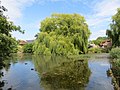 Fishbourne Mill Pond, West Sussex showing weeping willow at east end of pond (2205o).jpg 4,000 × 3,000; 3.46 MB
-
 Fishbourne Mill Pond, West Sussex, parent swan with last remaining cygnet (2185o).jpg 4,000 × 3,000; 3.06 MB
-
 Fishbourne Mill Pond, West Sussex, sluice gate (2201o).jpg 3,000 × 4,000; 4.19 MB
-
 Fishbourne Mill Pond, West Sussex, view from the east end of the pond (2195o) (2197o).jpg 4,000 × 3,000; 3.37 MB
-
 Fishbourne Mill Pond, West Sussex, view from the east end of the pond (2195o).jpg 4,000 × 3,000; 4.48 MB
-
 Fishbourne nature reserve - geograph.org.uk - 6181998.jpg 1,600 × 1,200; 512 KB
-
 Fishbourne Primary School fete - geograph.org.uk - 5434369.jpg 640 × 427; 56 KB
-
 Fishbourne railway station, Sussex - geograph.org.uk - 4262814.jpg 1,024 × 768; 217 KB
-
 Fishbourne Roman Palace, Covered excavation - geograph.org.uk - 3496480.jpg 1,000 × 1,333; 1.11 MB
-
 Fishbourne Roman Palace, Hypocaust - geograph.org.uk - 3496476.jpg 1,199 × 1,000; 1.01 MB
-
 Fishbourne Roman Palace, West Sussex - geograph.org.uk - 3895882.jpg 4,000 × 3,000; 6.74 MB
-
 Fishbourne Village Sign, close-up - geograph.org.uk - 813866.jpg 480 × 640; 58 KB
-
 Fishbourne, UK - panoramio.jpg 1,536 × 2,048; 838 KB
-
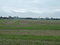
 Flat farmland - geograph.org.uk - 4756082.jpg 640 × 368; 27 KB
-
 Footbridge in the reed beds - geograph.org.uk - 3289492.jpg 4,000 × 3,000; 3.78 MB
-
 Footbridge, Fishbourne Meadows - geograph.org.uk - 523426.jpg 640 × 408; 148 KB
-
 Footpath 3053 joins cycle route around Fishbourne Palace - geograph.org.uk - 3286555.jpg 4,000 × 3,000; 3.32 MB
-

-
 Footpath to Fishbourne Mill - geograph.org.uk - 5198121.jpg 2,592 × 1,936; 1.51 MB
-
 Ford on River Lavant - geograph.org.uk - 3119505.jpg 640 × 480; 189 KB
-

-
 Garden centre west of Fishbourne - geograph.org.uk - 3571251.jpg 1,024 × 768; 99 KB
-

-
 Green in Deeside Avenue - geograph.org.uk - 656388.jpg 640 × 480; 74 KB
-
 Green in middle of Deeside Avenue - geograph.org.uk - 656698.jpg 640 × 480; 109 KB
-
 Harbour View Cottages, Main Road - geograph.org.uk - 813872.jpg 640 × 480; 68 KB
-

-

-
 Houses along Old Park Lane - geograph.org.uk - 6553532.jpg 3,315 × 2,099; 994 KB
-
 Jamie Oliver's delight - geograph.org.uk - 661216.jpg 640 × 480; 48 KB
-
 Jogging to Bosham - geograph.org.uk - 4861029.jpg 4,608 × 3,456; 5.7 MB
-
-

-
 Leggett's farm - geograph.org.uk - 6182007.jpg 1,600 × 1,200; 573 KB
-
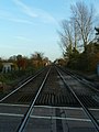
 Level crossing at Fishbourne - geograph.org.uk - 3972061.jpg 1,536 × 1,152; 1.33 MB
-
 Long straight footpath with poplars - geograph.org.uk - 2755233.jpg 768 × 1,024; 236 KB
-
 Looking down Salthill Road - geograph.org.uk - 656353.jpg 640 × 480; 85 KB
-

-

-

-

-

-

-

-
 Looking west down Barker Close - geograph.org.uk - 661118.jpg 640 × 480; 55 KB
-
 Mill Pond at Fishbourne - geograph.org.uk - 3289525.jpg 4,000 × 3,000; 3.4 MB
-
 Mill pond, Fishbourne - geograph.org.uk - 3119743.jpg 640 × 480; 160 KB
-
 Modern housing at Fishbourne - geograph.org.uk - 661194.jpg 640 × 480; 53 KB
-
 Muddy footpath, Fishbourne - geograph.org.uk - 1743711.jpg 640 × 481; 175 KB
-
 New home in Newport Drive - geograph.org.uk - 661112.jpg 640 × 480; 54 KB
-
 North Wing, Fishbourne Roman Palace - geograph.org.uk - 6270886.jpg 640 × 480; 299 KB
-
 Old Park and the road to Fishbourne - geograph.org.uk - 2755846.jpg 1,024 × 768; 197 KB
-
 Old Park Lane - geograph.org.uk - 4861236.jpg 4,608 × 3,456; 4.69 MB
-
 Old Park Lane looking north - geograph.org.uk - 2755230.jpg 768 × 1,024; 204 KB
-
 Old Park Lane with footpath ahead - geograph.org.uk - 2755227.jpg 1,024 × 768; 231 KB
-

-
 Ordnance Survey Cut Mark - geograph.org.uk - 2879074.jpg 3,264 × 2,448; 1.37 MB
-
 Ordnance Survey Flush Bracket 2463 - geograph.org.uk - 2879059.jpg 3,264 × 2,448; 2.36 MB
-
 Ploughed Field - geograph.org.uk - 4862179.jpg 4,608 × 3,456; 5.45 MB
-
 Pond at Fishbourne - geograph.org.uk - 6181968.jpg 1,600 × 1,200; 676 KB
-
 Pylon - geograph.org.uk - 4756085.jpg 640 × 426; 35 KB
-
 Pylon by West Coastway Line - geograph.org.uk - 6488816.jpg 1,024 × 681; 75 KB
-
 Pylon by West Coastway Line - geograph.org.uk - 6580971.jpg 1,024 × 684; 68 KB
-
 Pylon in field - geograph.org.uk - 6639061.jpg 1,024 × 684; 77 KB
-
 Pylon in field - geograph.org.uk - 6645101.jpg 1,024 × 684; 97 KB
-
 Pylon near Fishbourne - geograph.org.uk - 6621607.jpg 1,024 × 684; 103 KB
-
 Railway line to Chichester - geograph.org.uk - 3972064.jpg 1,536 × 1,152; 1.01 MB
-
 Railway line to Fishbourne Station - geograph.org.uk - 2755217.jpg 768 × 1,024; 186 KB
-
 Railway warning in Bourne Close - geograph.org.uk - 655848.jpg 640 × 480; 70 KB
-

-
 Salt Hill Road Bridge, A27 - geograph.org.uk - 6538505.jpg 1,024 × 681; 118 KB
-
 Salthill Rd - geograph.org.uk - 6488806.jpg 1,024 × 734; 139 KB
-
 Salthill Rd - geograph.org.uk - 6645108.jpg 1,024 × 684; 176 KB
-
 Salthill Road bridge over A27 Chichester by-pass - geograph.org.uk - 3562672.jpg 1,024 × 768; 109 KB
-
 Salthill Road PO19 3QX - geograph.org.uk - 4861004.jpg 4,608 × 3,456; 4.15 MB
-
 Salthill Road, Fishbourne - geograph.org.uk - 4263025.jpg 1,024 × 731; 210 KB
-
 Scaffolding in Blackboy Lane - geograph.org.uk - 661191.jpg 640 × 480; 112 KB
-
 Secure store at crossroads - geograph.org.uk - 657285.jpg 640 × 480; 106 KB
-
 Sign for the Woolpack - geograph.org.uk - 1721494.jpg 576 × 640; 103 KB
-
 Signpost at junction north of Stonewall Farm - geograph.org.uk - 2755234.jpg 1,024 × 768; 263 KB
-
 Signpost near Gothic Farm - geograph.org.uk - 2755836.jpg 1,024 × 768; 213 KB
-
 Spring stream by footpath 555 - geograph.org.uk - 3293299.jpg 4,000 × 3,000; 3.4 MB
-
 Spring water heading for the Fishbourne Channel - geograph.org.uk - 3289510.jpg 4,000 × 3,000; 3.45 MB
-
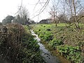
 Stream at Fishbourne - geograph.org.uk - 6181974.jpg 1,600 × 1,200; 617 KB
-
 Sweeping curve, A27 - geograph.org.uk - 3674041.jpg 640 × 430; 47 KB
-
 Telephone box in Salthill Road - geograph.org.uk - 657094.jpg 640 × 480; 104 KB
-
 Thatched cottage on Mill Lane Fishbourne - geograph.org.uk - 3289535.jpg 4,000 × 3,000; 3.34 MB
-
 The A27(T) bridge at Fishbourne looking east - geograph.org.uk - 2812347.jpg 1,024 × 768; 185 KB
-
 The A27(T) bridge at Fishbourne looking west - geograph.org.uk - 2812344.jpg 1,024 × 768; 181 KB
-
 The Brighton to Portsmouth line - geograph.org.uk - 3286573.jpg 4,000 × 3,000; 3.4 MB
-
 The Bull's Head inn at Fishbourne - geograph.org.uk - 3972067.jpg 1,536 × 1,152; 949 KB
-
 The Bull's Head inn, Fishbourne - geograph.org.uk - 3571246.jpg 1,024 × 768; 104 KB
-

-

-
 The church hall, Fishbourne - geograph.org.uk - 5503138.jpg 1,024 × 768; 212 KB
-
 The drive to Polthooks Farm from Clay Lane - geograph.org.uk - 2754335.jpg 1,024 × 768; 193 KB
-

-
 The junction of Old Park Lane with the A259 - geograph.org.uk - 2755221.jpg 1,024 × 768; 174 KB
-
 The Ploughed Field - geograph.org.uk - 4285843.jpg 3,985 × 2,241; 5.07 MB
-
 The Woolpack, Fishbourne - geograph.org.uk - 1721523.jpg 640 × 480; 92 KB
-
 Trees on Old Park Lane - geograph.org.uk - 3464331.jpg 3,264 × 2,448; 4.31 MB
-
 Trio of Pekin or similar ducks on Fishbourne Mill Pond, West Sussex (2240o).jpg 4,000 × 3,000; 3.9 MB
-
 Twitten from Old Park Lane - geograph.org.uk - 4861023.jpg 3,456 × 4,608; 6.39 MB
-
 Under the A27 - geograph.org.uk - 523485.jpg 640 × 479; 139 KB
-
 View Towards Chichester - geograph.org.uk - 6407518.jpg 4,680 × 3,120; 7.76 MB
-
 View Towards Fishbourne - geograph.org.uk - 6407514.jpg 3,540 × 2,360; 7.67 MB
-
 Village sign, Fishbourne - geograph.org.uk - 1721557.jpg 470 × 640; 107 KB
-
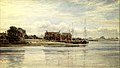 Watercolour of Dell Quay near Fishbourne by Arthur Evershed, 1907.jpg 2,046 × 1,156; 418 KB
-
 West Coastway Railway - geograph.org.uk - 523488.jpg 640 × 479; 185 KB
-
 Wind break by footpath 234 - geograph.org.uk - 3464327.jpg 3,264 × 2,448; 3.66 MB
-
 Woods near Beggars Roost - geograph.org.uk - 4861398.jpg 4,608 × 3,456; 6.44 MB
-
 A peaceful spot^ - geograph.org.uk - 658542.jpg 640 × 480; 50 KB
-

-
 Beautiful cottages at Fishbourne. - geograph.org.uk - 658557.jpg 640 × 480; 68 KB
-
 Bethwines Close - geograph.org.uk - 661184.jpg 640 × 480; 59 KB
-

-
 Clay Lane in Fishbourne - geograph.org.uk - 661071.jpg 640 × 480; 64 KB
-
 Clay lane, Fishbourne - geograph.org.uk - 661065.jpg 640 × 480; 107 KB
-
 Cottages in Blackboy Lane - geograph.org.uk - 661181.jpg 640 × 480; 60 KB
-
 Cut through to Deeside Avenue - geograph.org.uk - 656369.jpg 640 × 480; 103 KB
-

-
 Ditch in Blackboy Lane - geograph.org.uk - 661132.jpg 640 × 480; 63 KB
-
 End of footpath from Chichester - geograph.org.uk - 658571.jpg 640 × 480; 89 KB
-
 Farm animals by the A27 - geograph.org.uk - 661209.jpg 640 × 480; 41 KB
-
 Farmhouse in Clay Lane - geograph.org.uk - 661222.jpg 640 × 480; 45 KB
-
 Farmland at Bethwine's - geograph.org.uk - 661224.jpg 640 × 480; 52 KB


_north_of_Polthooks_Farm_and_looking_west_-_geograph.org.uk_-_2754332.jpg)
_north_of_Polthooks_Farm_looking_east_-_geograph.org.uk_-_2754339.jpg)


_in_Fishbourne_-_geograph.org.uk_-_5435341.jpg)


.jpg)


.jpg)
.jpg)


.jpg)
.jpg)
.jpg)
_(2197o).jpg)
.jpg)


_bridge_at_Fishbourne_looking_east_-_geograph.org.uk_-_2812347.jpg)
_bridge_at_Fishbourne_looking_west_-_geograph.org.uk_-_2812344.jpg)


_-_geograph.org.uk_-_2323011.jpg)


.jpg)


