Category:Fire-damaged buildings in England
Jump to navigation
Jump to search
Subcategories
This category has the following 25 subcategories, out of 25 total.
!
1
- 1 and 2 Sowton Lane (16 F)
A
- Accrington Conservative Club (10 F)
B
- Belmont Row Works, Birmingham (14 F)
- St Wandregesilius, Bixley (56 F)
- Brading Methodist Church (14 F)
C
- Clandon House - after the fire (18 F)
D
- St Columba's Church, Dover (4 F)
E
- Eastbourne Pier fire (130 F)
- St Barnabas' Church, Erdington (18 F)
G
H
- Hastings Pier (2010 fire) (69 F)
N
- Spring Cottage, Nelson (6 F)
R
S
W
- Wapping First School (3 F)
Media in category "Fire-damaged buildings in England"
The following 193 files are in this category, out of 193 total.
-
 051 Building 3.jpg 4,104 × 3,165; 16.75 MB
-
 3-Com and Kodak office - Buncefield - geograph.org.uk - 391950.jpg 640 × 480; 115 KB
-
 42 Holdenhurst Road, Bournemouth (June 2022, with August 2020 Fire Damage) (1).jpg 2,800 × 1,800; 1.19 MB
-
 42 Holdenhurst Road, Bournemouth (June 2022, with August 2020 Fire Damage) (2).jpg 2,400 × 1,600; 996 KB
-

-

-

-
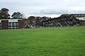
 Aftermath of Brigshaw's Sports Hall fire.jpg 709 × 531; 47 KB
-
-
-

-
 Albion Mill fire, Stockport 1893 (2).jpg 659 × 880; 190 KB
-
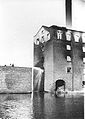 Albion Mill fire, Stockport 1893 (3).jpg 659 × 925; 286 KB
-
 Albion Mill fire, Stockport 1893.jpg 642 × 474; 150 KB
-
 All Saints Church, Fleet (fire damaged).JPG 3,456 × 5,184; 9.25 MB
-

-
 AllSaints Fleet FireDamage.JPG 5,184 × 3,456; 10.02 MB
-
 AllSaintsChurchFleet GableAfterFile.jpg 3,456 × 5,184; 7.01 MB
-
 AllSaintsChurchFleet SouthSideAfterFile.jpg 3,456 × 5,184; 8.54 MB
-
 Battersby Hat Works, Offerton after a fire 1906 (2).jpg 635 × 481; 90 KB
-
 Battersby Hat Works, Offerton after a fire 1906.jpg 659 × 461; 117 KB
-
 Bierley Kingates Barn snow 2.JPG 4,000 × 3,000; 4.68 MB
-
 Bierley Kingates Barn snow.JPG 4,000 × 3,000; 4.55 MB
-
 Birnbeck Pier.jpg 960 × 960; 163 KB
-
 Boak Building,remains.jpg 2,592 × 1,936; 2.06 MB
-
 Bradford Mill Fire 2011.jpg 2,048 × 1,536; 687 KB
-
 Buildings on the harbourfront, St Ives, June 2021.jpg 4,032 × 3,024; 7.49 MB
-

-

-
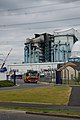
 Buncefield Oil Storage Depot - geograph.org.uk - 334054.jpg 640 × 473; 120 KB
-

-
 Burned house, Broad Lane, Bracknell - geograph.org.uk - 126235.jpg 640 × 480; 91 KB
-
 Burned out cottage - geograph.org.uk - 762443.jpg 640 × 480; 106 KB
-
 Burned Out Shops, Wimborne - geograph.org.uk - 1439423.jpg 640 × 455; 112 KB
-
 Burnt out church - geograph.org.uk - 1132208.jpg 640 × 427; 84 KB
-
 Burnt out church after the fire - geograph.org.uk - 947230.jpg 640 × 497; 95 KB
-
 Burnt out house on Pollard Lane - geograph.org.uk - 5278807.jpg 1,024 × 768; 312 KB
-

-

-
 Burnt-out factory building, Slaithwaite - geograph.org.uk - 3606351.jpg 2,000 × 1,500; 1.42 MB
-

-

-
 Cherwell Valley Services, M40 - geograph.org.uk - 1859583.jpg 3,488 × 2,616; 2.13 MB
-
 Chigwell, Former Grange Farm house - geograph.org.uk - 961589.jpg 640 × 480; 134 KB
-
 Christmas ruined, Godwinscroft - geograph.org.uk - 92460.jpg 640 × 481; 134 KB
-

-

-

-

-

-
 Detail of Northgate Tower Buncefield fire.jpg 894 × 1,137; 366 KB
-
 Easton Lodge 1847 fire ~ The Illustrated London News.jpg 1,000 × 1,000; 587 KB
-
 Easton Lodge 1918 fire ~ The Illustrated London News.jpg 2,186 × 1,469; 1.63 MB
-
 EastvilleFire.jpg 635 × 516; 197 KB
-
 Edgehill College - Bideford - fire 1920.jpg 3,114 × 1,899; 2.23 MB
-

-
 Falmouth Beach Hotel Ruins.jpg 1,280 × 960; 401 KB
-
 Fire at Bredbury - geograph.org.uk - 3624381.jpg 640 × 444; 117 KB
-
 Fire at Bredbury - geograph.org.uk - 3634787.jpg 640 × 480; 146 KB
-
 Fire Damage at Carleton High School - geograph.org.uk - 1020619.jpg 640 × 427; 79 KB
-
 Fire Damage at Carleton High School - geograph.org.uk - 1020657.jpg 640 × 427; 67 KB
-
 Fire damage at Ferrybridge Power Station - geograph.org.uk - 4105452.jpg 1,600 × 1,190; 483 KB
-
 Fire damage at Ferrybridge Power Station - geograph.org.uk - 4108301.jpg 1,064 × 1,600; 555 KB
-
 Fire damage at Ferrybridge Power Station - geograph.org.uk - 4108305.jpg 1,600 × 1,580; 746 KB
-
 Fire damage at Ferrybridge Power Station - geograph.org.uk - 4108318.jpg 1,600 × 1,064; 640 KB
-
 Fire damage at the Lane Arms - geograph.org.uk - 1635625.jpg 640 × 480; 244 KB
-

-
 Fire damage St Albans church close up - geograph.org.uk - 947238.jpg 427 × 640; 68 KB
-
 Fire Damaged Black Lion Public House - geograph.org.uk - 1268675.jpg 640 × 480; 115 KB
-

-
 Fire damaged building Dartmouth.jpg 2,800 × 1,863; 2.09 MB
-

-
-
 Fire damaged George Lamb Memorial Hall - geograph.org.uk - 4433587.jpg 1,600 × 1,062; 649 KB
-
 Fire damaged George Lamb Memorial Hall - geograph.org.uk - 4433590.jpg 1,600 × 1,062; 685 KB
-
 Fire damaged George Lamb Memorial Hall - geograph.org.uk - 4433592.jpg 1,600 × 1,062; 773 KB
-
 Fire damaged George Lamb Memorial Hall - geograph.org.uk - 4433593.jpg 1,600 × 1,062; 632 KB
-
 Fire damaged George Lamb Memorial Hall - geograph.org.uk - 4433595.jpg 1,600 × 1,062; 676 KB
-
 Fire Damaged Pub - geograph.org.uk - 153292.jpg 640 × 429; 42 KB
-
 Fire-damaged Clubhouse - geograph.org.uk - 888790.jpg 640 × 481; 110 KB
-
 Fire-damaged house in Highfield Road (geograph 4659111).jpg 3,648 × 2,736; 4.1 MB
-
 Fire-damaged shop, Walton Village, Liverpool.JPG 3,456 × 4,608; 3.42 MB
-
 Flats at 118 and 120 Pankhurst Avenue, Brighton (February 2020).JPG 3,000 × 2,000; 1.91 MB
-
 Flats at 120 Pankhurst Avenue, Brighton (February 2020) (1).JPG 2,000 × 1,800; 1.1 MB
-
 Flats at 120 Pankhurst Avenue, Brighton (February 2020) (2).JPG 2,400 × 1,600; 1.05 MB
-
 Flats at 120 Pankhurst Avenue, Brighton (May 2020).JPG 1,800 × 1,200; 870 KB
-

-

-

-

-
 Gamnel Farm, Bulbourne Road, Tring - After the fire - geograph.org.uk - 1220981.jpg 2,448 × 3,264; 3.9 MB
-
 Godshill High Street.JPG 4,000 × 3,000; 4.77 MB
-
 Godshill Stone Cross Cottage after fire 2.JPG 4,000 × 3,000; 4.83 MB
-
 Godshill Stone Cross Cottage after fire 3.JPG 4,000 × 3,000; 4.78 MB
-
 Godshill Stone Cross Cottage after fire.JPG 4,000 × 3,000; 4.85 MB
-
 Godshill Stone Cross Cottage repairs after fire.JPG 3,712 × 2,088; 3.14 MB
-

-

-
 Haldon Thatch - geograph.org.uk - 1219070.jpg 640 × 470; 100 KB
-
 Harrow Court - fire extinguised.jpg 565 × 588; 93 KB
-

-
 Highfield Mills - geograph.org.uk - 317477.jpg 640 × 480; 52 KB
-
 Htspe (Thamesfield House) Buncefield fire.jpg 1,280 × 960; 732 KB
-
 Hungerford - Bridge Street - geograph.org.uk - 828622.jpg 640 × 478; 81 KB
-
 Inspecting the fire damage at the Royal Clarence Hotel.jpg 5,152 × 3,864; 3.15 MB
-
 King's Head Hotel, Darlington fire 1.jpg 2,302 × 1,543; 3.52 MB
-
 King's Head Hotel, Darlington fire 2.jpg 2,759 × 1,832; 3.03 MB
-
 King's Head Hotel, Darlington fire 3.jpg 1,600 × 1,200; 629 KB
-
 Kingsdon Inn a week later - geograph.org.uk - 1744463.jpg 640 × 480; 110 KB
-
 Kingsdon Inn fire evening 4th March 2010 - geograph.org.uk - 1737061.jpg 2,592 × 1,944; 1.22 MB
-
 Longbridges Fire.jpg 622 × 472; 115 KB
-
 Lunways Inn (or Roman Post) - geograph.org.uk - 99196.jpg 640 × 480; 57 KB
-
 Nevill Pavilion, Royal Tunbridge Wells.jpg 796 × 496; 60 KB
-
 Newcastle-under-Lyme, rebuilding after fire on High Street - geograph.org.uk - 5274432.jpg 4,032 × 3,024; 2.29 MB
-
 Newport Royal Exchange houses after fire.JPG 4,000 × 3,000; 4.48 MB
-
 North Street, Midhurst, after 2023 Angel Hotel fire 01.jpg 4,000 × 3,000; 3.1 MB
-
 North Street, Midhurst, after 2023 Angel Hotel fire 02.jpg 4,000 × 3,000; 3.17 MB
-
 North Street, Midhurst, after 2023 Angel Hotel fire 03.jpg 4,000 × 3,000; 2.68 MB
-
 North Street, Midhurst, after 2023 Angel Hotel fire 04.jpg 4,000 × 3,000; 3.13 MB
-
 North Street, Midhurst, after 2023 Angel Hotel fire 05.jpg 4,000 × 3,000; 3.95 MB
-
 Northgate Building Buncefield fire 2.jpg 1,078 × 738; 309 KB
-
 Off Brunswick Hill - geograph.org.uk - 1381660.jpg 640 × 426; 220 KB
-
 Radford Semele Church - geograph.org.uk - 764029.jpg 640 × 480; 122 KB
-

-
 St Nicholas Church Radford Semele after fire.jpg 2,272 × 1,704; 1.03 MB
-
 Raine Club Fire, Jan20 ALP in the Sky.jpg 2,424 × 3,232; 2.39 MB
-
 Raine Club Fire, Jan20 HFRS Appliances.jpg 3,232 × 2,424; 4.36 MB
-
 Raine Club Fire, Jan20 HFRS FIU Transit 01.jpg 3,232 × 2,424; 3.51 MB
-
 Raine Club Fire, Jan20 HFRS FIU Transit 02.jpg 3,232 × 2,424; 4.33 MB
-
 Raine Club Fire, Jan20 Overview L.jpg 3,232 × 2,424; 3.6 MB
-
 Raine Club Fire, Jan20 Overview R.jpg 3,232 × 2,424; 3.57 MB
-
 Raine Club Fire, Jan20 Site Overview Central.jpg 3,232 × 2,424; 4.41 MB
-
 Raine Club Fire, Jan20 Smouldering Remains.jpg 3,232 × 2,424; 4.18 MB
-
 Recently burnt-out church, Ropley - geograph.org.uk - 4073998.jpg 640 × 480; 109 KB
-

-
 Remains of dome at former Gaiety amusement arcade, Ventnor, Isle of Wight, England.jpg 4,000 × 3,000; 4.77 MB
-
 Royal Clarence Hotel after fire.jpg 6,630 × 2,701; 3.22 MB
-

-
 Ryde Castle after fire in March 2012 2.JPG 4,000 × 3,000; 4.86 MB
-
 Ryde Castle after fire in March 2012 3.JPG 4,000 × 3,000; 4.57 MB
-
 Ryde Castle after fire in March 2012.JPG 4,000 × 3,000; 4.57 MB
-
 Sadly Beach huts - no more, Sutton on Sea (geograph 2100850).jpg 3,296 × 2,472; 1.9 MB
-
 Scaffolding-clad building, Clacton Road (A133) - geograph.org.uk - 3956369.jpg 1,044 × 783; 178 KB
-
 Smiths Motors after the fire - geograph.org.uk - 1853211.jpg 640 × 480; 163 KB
-
 Sneds Hill, Telford - geograph.org.uk - 97157 (cropped).jpg 595 × 446; 38 KB
-
 Sneds Hill, Telford - geograph.org.uk - 97157.jpg 640 × 480; 46 KB
-
 St Peter's Church, Ropley - geograph.org.uk - 5350008.jpg 640 × 427; 80 KB
-

-

-

-
 The Buffalo Arms - geograph.org.uk - 761732.jpg 640 × 427; 65 KB
-
 The Buffalo Arms - geograph.org.uk - 761737.jpg 640 × 427; 60 KB
-
 The Buffalo Arms - geograph.org.uk - 762379.jpg 640 × 427; 84 KB
-
 The Cavalier (35043316501).jpg 5,746 × 3,006; 8.35 MB
-
 The Cavalier (35133941496).jpg 6,000 × 4,000; 12.46 MB
-
 The centre will arise - geograph.org.uk - 1549473.jpg 640 × 427; 71 KB
-
 The demise of Fleetwood's pier - geograph.org.uk - 957359.jpg 640 × 480; 149 KB
-
 The demise of Fleetwood's pier - geograph.org.uk - 957374.jpg 640 × 480; 154 KB
-
-

-
-
 The Former Chequers Inn - geograph.org.uk - 1548493.jpg 640 × 480; 81 KB
-
 The former Cock Inn, Stocking Pelham - geograph.org.uk - 842488.jpg 640 × 434; 60 KB
-
 The King's Head - geograph.org.uk - 980167.jpg 640 × 427; 82 KB
-
 The King's Head - geograph.org.uk - 980171.jpg 640 × 427; 90 KB
-
 The Kings Head at Morton - geograph.org.uk - 672148.jpg 640 × 427; 94 KB
-
 The Old Thatched Inn - geograph.org.uk - 933681.jpg 640 × 480; 70 KB
-
 The remains of Fleetwood pier - geograph.org.uk - 962491.jpg 480 × 640; 111 KB
-

-

-
 The School House, Stanton.jpg 3,886 × 2,591; 1.42 MB
-
 The Three Gardners, Strood - geograph.org.uk - 1360036.jpg 640 × 480; 112 KB
-
 University of Southampton Mountbatten building after fire 2.jpg 2,288 × 1,712; 1.93 MB
-
 University of Southampton Mountbatten building after fire 3.jpg 2,288 × 1,712; 2.38 MB
-
 University of Southampton Mountbatten building after fire 4.jpg 2,288 × 1,712; 2.13 MB
-
 University of Southampton Mountbatten building after fire 5.jpg 2,288 × 1,712; 1.91 MB
-
 University of Southampton Mountbatten building after fire 6.jpg 2,288 × 1,712; 1.82 MB
-
 University of Southampton Mountbatten building after fire.jpg 2,288 × 1,712; 1.9 MB
-
 View of Houses from Capstone Hill - geograph.org.uk - 713422.jpg 640 × 480; 87 KB
-
 Walsall-old-factory-fire.damage..jpg 625 × 772; 136 KB
-
 We are not amused, Dawlish Warren - geograph.org.uk - 984809.jpg 640 × 480; 66 KB
-
 Fire at a fenland church - geograph.org.uk - 1757006.jpg 2,848 × 2,136; 3.05 MB
-
 Open to the heavens - geograph.org.uk - 1756942.jpg 2,848 × 2,136; 2.89 MB
-
-
 Was it arson^ - geograph.org.uk - 1757028.jpg 2,848 × 2,136; 3 MB
-
 Will it will rise from the ashes^ - geograph.org.uk - 1757021.jpg 2,848 × 2,136; 2.94 MB
-
 Wimborne St Giles church after fire.png 1,132 × 1,874; 3.58 MB
-
 Winch Hill Farm - geograph.org.uk - 1615996.jpg 640 × 480; 134 KB
-
 Woodham Comprehensive Fire.jpg 433 × 594; 203 KB
-
 Woodham CTC Auckland Fire Damage.jpg 447 × 299; 26 KB
-
 Woolworth's, Manchester - geograph-2182393-by-David-Dixon.jpg 897 × 597; 276 KB
-
 York Minster after the fire - geograph.org.uk - 97529.jpg 500 × 416; 46 KB
-
 Burnt-out building - geograph.org.uk - 521546.jpg 640 × 480; 110 KB


_(1).jpg)
_(2).jpg)


.jpg)
.jpg)

.JPG)


.jpg)


_-_geograph.org.uk_-_1248657.jpg)
_-_geograph.org.uk_-_1248688.jpg)


_(25041201159).jpg)


.jpg)

.JPG)
_(1).JPG)
_(2).JPG)
.JPG)


_Buncefield_fire.jpg)


_-_geograph.org.uk_-_99196.jpg)


.jpg)

_Micheldever_Hants_-_geograph.org.uk_-_160972.jpg)


.jpg)
_-_geograph.org.uk_-_3956369.jpg)

.jpg)


.jpg)
.jpg)


