Category:Finsbury Park (district)
Appearance
area in north London, England | |||||
| Upload media | |||||
| Instance of | |||||
|---|---|---|---|---|---|
| Named after | |||||
| Location | |||||
 | |||||
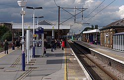
Finsbury Park is an area in north London, England which grew up around an important railway interchange at the junction of the London Boroughs of Islington, Haringey and Hackney. It is not to be confused with Finsbury, which is 3.3 miles (5.3 km) further south in the London Borough of Islington
- For the nearby park of the same name, see Category:Finsbury Park.
Subcategories
This category has the following 14 subcategories, out of 14 total.
C
F
- Finsbury Park Road (7 F)
- Finsbury Park TMD (2 F)
- Fonthill Road, London (17 F)
N
- North London Central Mosque (1 P, 8 F)
O
P
S
T
Media in category "Finsbury Park (district)"
The following 22 files are in this category, out of 22 total.
-
DP2 Finsbury Park MPD(8163582878).jpg 795 × 573; 256 KB
-
Finsbury Park - geograph.org.uk - 3533.jpg 640 × 480; 45 KB
-
Finsbury Park graffiti (5764029841).jpg 3,072 × 2,304; 1.58 MB
-
Flats by the railway, Finsbury Park - geograph.org.uk - 4571196.jpg 1,600 × 1,064; 240 KB
-
Houses, Finsbury park - geograph.org.uk - 3767834.jpg 640 × 430; 54 KB
-
Little free library at Finsbury Park, London.png 2,448 × 2,448; 6.95 MB
-
Main Eastern Line at Finsbury Park - geograph.org.uk - 293884.jpg 640 × 436; 87 KB
-
Moray Road, Finsbury Park - geograph.org.uk - 975432.jpg 640 × 480; 137 KB
-
New River and West Reservoir - geograph.org.uk - 61272.jpg 482 × 640; 104 KB
-
New River Path - geograph.org.uk - 170361.jpg 640 × 480; 168 KB
-
Old Friend (4604061321).jpg 1,624 × 1,505; 1.07 MB
-
Sobell Leisure Centre - geograph.org.uk - 3972.jpg 640 × 480; 108 KB
-
St Paul, Wightman Road, London N4 - geograph.org.uk - 667314.jpg 640 × 440; 52 KB
-
The Old Dairy (geograph 2242035).jpg 640 × 480; 102 KB
-
The Old Dairy - Cooling and Country Delivery (geograph 2242045).jpg 640 × 480; 122 KB
-
The Old Dairy - Grazing and Milking (geograph 2242956).jpg 640 × 480; 134 KB
-
The Old Dairy - making Butter (geograph 2242982).jpg 480 × 640; 119 KB


