Category:Finghall
Jump to navigation
Jump to search
village in United Kingdom  | |||||
| Upload media | |||||
| Instance of | |||||
|---|---|---|---|---|---|
| Location | Richmondshire, North Yorkshire, Yorkshire and the Humber, England | ||||
 | |||||
Subcategories
This category has the following 2 subcategories, out of 2 total.
F
- Finghall railway station (19 F)
S
- St Andrew's Church, Finghall (5 F)
Media in category "Finghall"
The following 79 files are in this category, out of 79 total.
-
 Akebar Park caravan site - geograph.org.uk - 5855205.jpg 1,024 × 768; 99 KB
-
 Barn conversion on Chapel Lane - geograph.org.uk - 4328017.jpg 1,024 × 683; 160 KB
-
 Benchmark on Chapel Lane house - geograph.org.uk - 4328012.jpg 683 × 1,024; 264 KB
-
 Country on the Western Edge of Finghall Village - geograph.org.uk - 6486305.jpg 5,184 × 3,456; 7.57 MB
-

-

-
 Daffodil corner - geograph.org.uk - 6423482.jpg 5,184 × 3,888; 6.38 MB
-
 Daffodils at a junction on West Moor Lane - geograph.org.uk - 6093272.jpg 1,600 × 1,200; 530 KB
-
 Finghall Methodist Church - geograph.org.uk - 1955660.jpg 683 × 1,024; 160 KB
-

-
 Footpath descending down the side of the valley - geograph.org.uk - 1956464.jpg 800 × 1,200; 418 KB
-

-
 Footpath to West Moor - geograph.org.uk - 4487218.jpg 4,000 × 2,660; 4.66 MB
-
 Gate and footpath - geograph.org.uk - 1956460.jpg 800 × 533; 173 KB
-
 Gate leading from footpath onto track - geograph.org.uk - 1956435.jpg 800 × 533; 166 KB
-
 Hargill House, Finghall - geograph.org.uk - 4487209.jpg 4,000 × 2,660; 4.21 MB
-
 Hargill Lane, Finghall - geograph.org.uk - 5565812.jpg 5,184 × 3,456; 7.4 MB
-

-
 Inaccessible footpath - geograph.org.uk - 1955668.jpg 800 × 533; 123 KB
-

-
 Lane junction and 164 metre spot height - geograph.org.uk - 6093261.jpg 1,024 × 768; 194 KB
-
 Lindale Holiday Park - geograph.org.uk - 263824.jpg 640 × 480; 53 KB
-
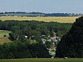
 Looking Towards Finghall Village.jpg 640 × 480; 92 KB
-
 Lyndon Shaw Engineering - geograph.org.uk - 4487215.jpg 4,000 × 2,660; 3.61 MB
-
 No Man's Moor Lane - geograph.org.uk - 6093258.jpg 1,600 × 1,200; 441 KB
-
 Queen's Head, Finghall - geograph.org.uk - 5565815.jpg 5,184 × 3,456; 7.05 MB
-
 Queens Head, Finghall - geograph.org.uk - 4487202.jpg 4,000 × 2,660; 2.7 MB
-
 Rose Cottage, Finghall - geograph.org.uk - 4487204.jpg 4,000 × 2,660; 3.92 MB
-
 Sheds Beside The A684 - geograph.org.uk - 287456.jpg 640 × 480; 103 KB
-
 Sheep fields at Hang Bank - geograph.org.uk - 6093267.jpg 1,024 × 768; 131 KB
-
 Silage field near Spruce Gill Farm - geograph.org.uk - 5533491.jpg 640 × 365; 62 KB
-
 Small pond at side of golf course - geograph.org.uk - 1956476.jpg 800 × 533; 185 KB
-
 Spruce Gill Farm - geograph.org.uk - 5533485.jpg 640 × 376; 34 KB
-
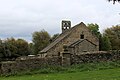 St. Andrew's Church, Finghall (1) - geograph.org.uk - 5564957.jpg 5,184 × 3,456; 7.07 MB
-
 St. Andrew's Church, Finghall (2) - geograph.org.uk - 5564963.jpg 5,184 × 3,456; 6.88 MB
-
 The beginning of a short public footpath - geograph.org.uk - 1955661.jpg 800 × 1,200; 349 KB
-
 The Queen's Head - geograph.org.uk - 284151.jpg 640 × 480; 96 KB
-
 The Queen's Head, Finghall - geograph.org.uk - 6423468.jpg 4,185 × 3,137; 2.26 MB
-
 Track across The Glebe - geograph.org.uk - 5565822.jpg 5,184 × 3,456; 7.3 MB
-
 Tractor at work near Finghall - geograph.org.uk - 5855207.jpg 1,024 × 768; 165 KB
-
 Tree on the south side of West Moor Lane - geograph.org.uk - 6093277.jpg 1,600 × 1,200; 340 KB
-
 Unthank Farm and the Wild Wood - geograph.org.uk - 2537214.jpg 800 × 531; 97 KB
-
 View along bridleway towards Finghall - geograph.org.uk - 1956409.jpg 800 × 533; 123 KB
-

-
 View from the Wensleydale Railway - geograph.org.uk - 2537218.jpg 800 × 531; 86 KB
-
 View from the Wensleydale Railway - geograph.org.uk - 2537230.jpg 800 × 531; 93 KB
-
 West Moor Lane heading for Finghall - geograph.org.uk - 6486313.jpg 5,177 × 2,804; 5.78 MB
-
 West Moor Lane hedgerow - geograph.org.uk - 5311246.jpg 1,024 × 683; 320 KB
-
 West Moor Lane, Finghall - geograph.org.uk - 5565817.jpg 5,184 × 3,456; 5.53 MB
-
 A Track Towards Swarble Hill - geograph.org.uk - 287651.jpg 640 × 480; 101 KB
-
 A Wood Below Wild Hill - geograph.org.uk - 287457.jpg 640 × 480; 117 KB
-
 Baled And Bagged - geograph.org.uk - 287491.jpg 640 × 480; 87 KB
-
 Bright Red Berries - geograph.org.uk - 287473.jpg 640 × 480; 101 KB
-
 Cocked Hat Farm, near Finghall - geograph.org.uk - 139386.jpg 640 × 480; 54 KB
-
 Derelict woodland, near Marnforth Farm - geograph.org.uk - 139385.jpg 640 × 480; 187 KB
-
 Eastfield House Farm - geograph.org.uk - 284181.jpg 640 × 480; 97 KB
-
 Fields To Newton-le-Willows - geograph.org.uk - 284155.jpg 640 × 480; 93 KB
-
 Folly Or Ruin^ - geograph.org.uk - 287460.jpg 640 × 480; 85 KB
-

-

-
 Lindale Lodge - geograph.org.uk - 151227.jpg 640 × 480; 80 KB
-
 Lyndon Shaw Engineering - geograph.org.uk - 287438.jpg 640 × 480; 79 KB
-
 On Foot From Newton-le-Willows. - geograph.org.uk - 287448.jpg 640 × 480; 108 KB
-
 Pond near Newton-le-Willows, North Yorks - geograph.org.uk - 139392.jpg 640 × 480; 100 KB
-

-
 Sand Hill Farm near Newton-le-Willows - geograph.org.uk - 139391.jpg 640 × 480; 100 KB
-
 Sloping To The Plain - geograph.org.uk - 287470.jpg 640 × 480; 86 KB
-
 Sloping To The Trees - geograph.org.uk - 287443.jpg 640 × 480; 93 KB
-
 Stubbing Nook, near Newton-le-Willows - geograph.org.uk - 139393.jpg 640 × 480; 48 KB
-
 The A684 - geograph.org.uk - 287452.jpg 640 × 480; 102 KB
-
 The Patina Of Age - geograph.org.uk - 287653.jpg 640 × 480; 98 KB
-
 The Road To Hunton - geograph.org.uk - 287440.jpg 640 × 480; 88 KB
-
 The Road To Hutton Hill - geograph.org.uk - 287647.jpg 640 × 480; 107 KB
-
 The Road To Scotton - geograph.org.uk - 284163.jpg 640 × 480; 83 KB
-
 The Road To Thornton Steward - geograph.org.uk - 287439.jpg 640 × 480; 83 KB
-
-
 Thornton Steward water works - geograph.org.uk - 151226.jpg 640 × 480; 57 KB
-
 Towards Burton Park - geograph.org.uk - 287649.jpg 640 × 480; 114 KB
-
 Trees On The Horizon - geograph.org.uk - 287474.jpg 640 × 480; 98 KB


_-_geograph.org.uk_-_5564957.jpg)
_-_geograph.org.uk_-_5564963.jpg)


