Category:Fingerposts in Staffordshire
Jump to navigation
Jump to search
Ceremonial counties of England: Bedfordshire · Berkshire · Buckinghamshire · Cambridgeshire · Cheshire · Cornwall · Cumbria · Derbyshire · Devon · Dorset · Durham · East Riding of Yorkshire · East Sussex · Essex · Gloucestershire · Greater London · Greater Manchester · Hampshire · Herefordshire · Hertfordshire · Kent · Lancashire · Leicestershire · Lincolnshire · Merseyside · Norfolk · North Yorkshire · Northamptonshire · Northumberland · Nottinghamshire · Oxfordshire · Rutland · Shropshire · Somerset · South Yorkshire · Staffordshire · Suffolk · Surrey · Tyne and Wear · Warwickshire · West Midlands · West Sussex · West Yorkshire · Wiltshire · Worcestershire
City-counties: Bristol ·
Former historic counties:
Other former counties:
City-counties: Bristol ·
Former historic counties:
Other former counties:
Media in category "Fingerposts in Staffordshire"
The following 35 files are in this category, out of 35 total.
-
 Albion Street, sign - geograph.org.uk - 1527666.jpg 640 × 427; 90 KB
-

-

-

-
 Church of St Modwen, Burton upon Trent (geograph 3845262).jpg 1,024 × 768; 186 KB
-
 Canal finger post - geograph.org.uk - 673151.jpg 640 × 480; 63 KB
-

-
 Canal Signpost, Fazeley Junction - geograph.org.uk - 713293.jpg 508 × 640; 170 KB
-

-

-
 Clearing below Oat Hill - geograph.org.uk - 158213.jpg 640 × 409; 55 KB
-
 Fazeley Junction and Tollhouse, Staffordshire - geograph.org.uk - 1749201.jpg 1,024 × 586; 393 KB
-
 Fingerpost near Blackbrook - geograph.org.uk - 458562.jpg 640 × 427; 93 KB
-
 Great Haywood Junction, Staffordshire - geograph.org.uk - 1480706.jpg 640 × 480; 135 KB
-
 Great Haywood Junction, Staffordshire - geograph.org.uk - 1481000.jpg 640 × 478; 152 KB
-
 Hoar Cross - geograph.org.uk - 198840.jpg 640 × 480; 93 KB
-
 Longnor Market Hall - geograph.org.uk - 598297.jpg 640 × 480; 77 KB
-
 Lower Hattons Path - geograph.org.uk - 648315.jpg 480 × 640; 66 KB
-
 Old signpost at Hulme Road junction - geograph.org.uk - 893658.jpg 640 × 480; 93 KB
-
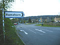 Ramshorn Signpost.JPG 2,304 × 1,728; 1.16 MB
-
-
 Signpost - geograph.org.uk - 845181.jpg 640 × 368; 49 KB
-
 Signpost to Consul Forge - geograph.org.uk - 1286908.jpg 640 × 480; 98 KB
-
 Street Sign in Church Street. - geograph.org.uk - 998866.jpg 640 × 481; 101 KB
-
 The Ellenhall junction - geograph.org.uk - 921401.jpg 640 × 480; 70 KB
-

-
 Woodhayes, fingerpost - geograph.org.uk - 1111049.jpg 640 × 480; 112 KB
-
-
 Burnhill Green signpost - geograph.org.uk - 748077.jpg 640 × 480; 49 KB
-
 Heart of England Way signpost - geograph.org.uk - 77008.jpg 480 × 640; 125 KB
-

-
 Junction of the A519 and Pinfold Lane - geograph.org.uk - 251142.jpg 640 × 480; 117 KB
-
 Signpost to Back o' th' Brook - geograph.org.uk - 456725.jpg 427 × 640; 144 KB
-
 Signpost to Bridgenorth, Shropshire - geograph.org.uk - 415824.jpg 459 × 640; 67 KB
-


.jpg)


_and_Kinver_-_geograph.org.uk_-_938792.jpg)


