Category:Files by User:Augusta 89
Jump to navigation
Jump to search
Media in category "Files by User:Augusta 89"
The following 200 files are in this category, out of 283 total.
(previous page) (next page)-
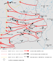
1301 Franco Mongol Offensive Levant-fr.svg 1,877 × 2,137; 89 KB
-
1914 albania-fr.svg 1,071 × 2,000; 162 KB
-
2024 - Aire de Sant'Omobono - Temple républicain A.jpg 3,264 × 2,448; 2.7 MB
-
2024 - Aire de Sant'Omobono - Vue sur l'emplacement du temple archaïque.jpg 4,000 × 3,000; 3.9 MB
-
2024 - Aire de Sant'Omobono - Vue sur temple archaïque depuis la Via Luigi Petroselli.jpg 4,000 × 3,000; 4.24 MB
-
2024 - Aire de Sant'Omobono - Vue temple républicain depuis Via Luigi Petroselli.jpg 4,000 × 3,000; 3.83 MB
-
2024 - Aire de Sant'Omobono - Vue élargie sur l'emplacement du temple archaïque.jpg 3,264 × 2,448; 2.66 MB
-
2024 - Aire de Sant'Omobono - Zoom sur temple républicain depuis Vico Jugario.jpg 4,000 × 3,000; 5.1 MB
-
2024 Aire de Sant'Omobono - Vue depuis l'angle nord-ouest de la Via Luigi Petroselli.jpg 3,264 × 2,448; 2.23 MB
-
2024 Aire de Sant'Omobono - Vue depuis l'angle sud-ouest de la Via Luigi Petroselli.jpg 3,264 × 2,448; 2.4 MB
-
2024 Aire de Sant'Omobono - Zoom illustration.jpg 3,430 × 2,412; 1.92 MB
-
2024 Aire de Sant'Omobono - Zoom plan.jpg 3,918 × 1,281; 837 KB
-
2024 Aire de Sant'Omobono.jpg 4,000 × 3,000; 3 MB
-
Aeolian Islands map-fr.svg 735 × 536; 597 KB
-
Blason de la ville d'Aisey sur Seine.svg 600 × 660; 165 KB
-
Alliances militaires en Europe 1914-1918-fr.svg 998 × 593; 97 KB
-
Altimetria Italia-fr.svg 700 × 700; 34 KB
-
Amérique du sud en 1821-fr.svg 3,527 × 3,897; 114 KB
-
Ancient greek dialects (-400)-fr.svg 660 × 555; 574 KB
-
Antemnae.svg 1,935 × 1,128; 72 KB
-
Blason de la ville d'Antheuil (21).svg 600 × 660; 139 KB
-
Aral map-fr.svg 991 × 680; 1.04 MB
-
Arc de Berà - Base de la façade orientale - Lésènes.svg 3,499 × 2,604; 23 KB
-
Arc de Berà - Epoque des chapiteaux-fr.svg 1,682 × 749; 20 KB
-
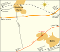
Arc de Berà - Localisation-fr.svg 1,701 × 1,448; 42 KB
-
Austria-Hungary-fr.svg 1,898 × 1,385; 85 KB
-
Avranches - Plan du XVIIIe siècle.svg 2,925 × 2,355; 29 KB
-
Bataille de Lipari - Préparatifs et mouvements-fr.svg 1,214 × 656; 193 KB
-
Batalla Tajo(220aC)-Fases batalla 1-2-3-fr.svg 1,631 × 564; 153 KB
-
Batalla Tajo(220aC)-Movimientos previos 1-2-3-fr.svg 1,608 × 787; 151 KB
-
Battle of Berezina map-fr.svg 512 × 385; 26 KB
-
Battle of Cape Ecnomus-fr.svg 7,056 × 6,390; 37 KB
-
Battle of Drepana-fr.svg 6,964 × 7,036; 135 KB
-
Bayeux - Plan à l'époque romaine.svg 3,489 × 2,352; 78 KB
-
Belgique hydrographie.svg 1,449 × 1,178; 35 KB
-
Belgrade Offensive Map-fr.svg 839 × 1,186; 262 KB
-
Blason de la ville d'Aigremont (Yonne).svg 600 × 660; 18 KB
-
Blason de la ville d'Échannay.svg 600 × 660; 69 KB
-
Blason de la ville de Beire-le-Châtel.svg 601 × 659; 8 KB
-
Blason de la ville de Bessey-lès-Cîteaux.svg 600 × 660; 11 KB
-
Blason de la ville de Broindon.svg 600 × 660; 26 KB
-
Blason de la ville de Butteaux (89).svg 600 × 660; 48 KB
-
Blason de la ville de Chaugey.svg 600 × 660; 77 KB
-
Blason de la ville de Cirey-lès-Pontailler (Côte-d'Or).svg 600 × 660; 31 KB
-
Blason de la ville de Rouvray (Côte-d'Or).svg 600 × 660; 5 KB
-
Blason de la ville de Brannay (89).svg 600 × 660; 43 KB
-
Bretagne-Pays de la Loire - Empire romain - Capitale de cités et cités.svg 3,479 × 1,869; 130 KB
-
Bulgaria-Theodore Svetoslav-fr.svg 3,280 × 2,473; 527 KB
-
Bulgarian acquisitions, treaty IX 1915-fr.svg 1,414 × 1,583; 115 KB
-
Cameroon boundary changes-fr.svg 1,996 × 1,805; 750 KB
-
Campañas Meseta Anibal (221-220 aC)-fr.svg 924 × 762; 578 KB
-
Capri and Ischia map-fr.svg 752 × 508; 599 KB
-
Carib Territory-fr.svg 1,406 × 1,116; 27 KB
-
Carpetani Location.svg 924 × 762; 589 KB
-
Carte d'occupation France 1815.svg 2,000 × 1,898; 392 KB
-
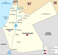
Carte de la Palestine et de la Transjordanie sous mandat britannique-fr.svg 3,368 × 3,177; 449 KB
-
Carte de la retraite de Garibaldi (1849)-fr.svg 3,418 × 4,067; 250 KB
-
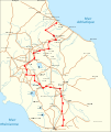
Carte de la Via Nomentana-fr.svg 3,470 × 4,763; 266 KB
-
Carte de localisation - Sites de Heurtries II et La Gohaigne (Quetteville).svg 3,367 × 3,620; 144 KB
-
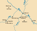
Carte des villes voisines de Salduie pendant l'Antiquité.svg 1,724 × 1,469; 29 KB
-
Carte du maquis de Saint-Mards-en-Othe.svg 3,495 × 2,452; 60 KB
-
Carte Gabon-fr.svg 1,200 × 1,115; 123 KB
-
CastillaLeon 1360-fr.svg 1,927 × 1,426; 406 KB
-
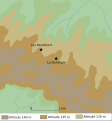
Castro de la Mesa de Miranda map-fr.svg 961 × 1,290; 17 KB
-
Celts in Europe-fr.svg 933 × 690; 165 KB
-
Centre du Front de l'Est du 22 juin au 29 aout 1944.svg 2,082 × 2,406; 221 KB
-
Channel Islands location map-fr.svg 2,071 × 2,533; 20 KB
-
Charente-Maritime - Principaux axes routiers.svg 3,463 × 3,477; 185 KB
-
China - Song Dynasty-fr.svg 840 × 825; 1.01 MB
-
China - Southern Song Dynasty-fr.svg 840 × 825; 1.09 MB
-
China LCC topographic map - Without border.svg 576 × 496; 4.76 MB
-
Colinas Cartagena-fr.svg 1,124 × 802; 21 KB
-
Colonne votive de Lisieux - Retranscription de l'inscription.svg 3,531 × 825; 26 KB
-
Communauté d'agglomération Orléans Val de Loire.svg 2,211 × 2,005; 88 KB
-
Concord Expedition and Patriot Messengers-fr.svg 1,019 × 426; 245 KB
-
Concord Retreat-fr.svg 1,024 × 428; 330 KB
-
Convoy PQ-17 map 1942 (noms des navires)-fr.svg 970 × 1,095; 186 KB
-
Danzig West Preussen Reichsgau-fr.svg 3,002 × 3,749; 593 KB
-
Distribution of pottery Neolithic sites in southern Levant-fr.svg 1,984 × 2,952; 87 KB
-
Dives - Plan de l'usine et des cités ouvrières.svg 3,238 × 3,008; 128 KB
-
Dives - Usine Tréfimétaux - Bénéfices nets (1894-1925).svg 3,891 × 4,180; 36 KB
-
Dives - Usine Tréfimétaux - Production (1894-1911).svg 3,234 × 2,549; 20 KB
-
Dives - Usine Tréfimétaux - Profit brut avant impôts (1971-1981)).svg 3,532 × 3,761; 19 KB
-
Dives - Usine Tréfimétaux - Répartition des emplois (1982).svg 3,072 × 2,609; 50 KB
-
Drainage basin of the Rio Guadiana-fr.svg 1,490 × 894; 201 KB
-
Duché de Normandie.svg 1,877 × 1,576; 85 KB
-
Emperor Taizong's campaign against Xiyu states-fr.svg 1,026 × 674; 629 KB
-
Equipe type AJA 2011-2012.svg 356 × 492; 18 KB
-
Eretum - plaines inondables-fr.svg 3,535 × 5,098; 34 KB
-
España bizantina 5-fr.svg 798 × 444; 299 KB
-
First locations California Gold Rush (1814-1843)-fr.svg 500 × 475; 321 KB
-
First Punic War (264 BC)-fr.svg 1,112 × 712; 397 KB
-
First Punic War Sicily 1 264-262BC-fr.svg 852 × 639; 167 KB
-
First Punic War Sicily 2 261-259BC-fr.svg 1,826 × 1,369; 258 KB
-
First Punic War Sicily 3 258-256BC-fr.svg 799 × 599; 237 KB
-
First Punic War Sicily 4 255BC-fr.svg 1,935 × 1,451; 128 KB
-
First Punic War Sicily 5 253-251BC-fr.svg 1,970 × 1,477; 294 KB
-
First Punic War Sicily 6 250-249BC-fr.svg 800 × 600; 255 KB
-
First Punic War Sicily 7 248-241BC-fr.svg 1,976 × 1,482; 169 KB
-
Fonctionnement du corvus-fr.svg 2,682 × 2,357; 25 KB
-
Forum de Nerva d'après Giuseppe Antonio Guattani en 1805.svg 3,249 × 1,648; 24 KB
-
Forum of Nerva - Temple of Minerva-fr.svg 3,511 × 2,275; 176 KB
-
Frénouville - Borne milliaire romaine - Découverte en 1804.svg 3,432 × 1,044; 15 KB
-
Gadeiras314-fr.svg 975 × 1,356; 298 KB
-
Governate of Dalmatia 1941-1943-fr.svg 2,303 × 1,933; 297 KB
-
Greater-Croatia-fr.svg 1,487 × 1,147; 116 KB
-
Greece (ancient) Euboea (relief-cropped) - Villes-fr.svg 964 × 750; 978 KB
-
Gétulie sous le règne de Juba II-fr.svg 3,501 × 2,456; 245 KB
-
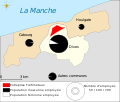
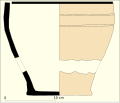
Heurtries II (Quetteville) - Mobilier céramique.svg 3,299 × 2,807; 15 KB
-
Heurtries II (Quetteville) - Plan d'ensemble.svg 3,279 × 1,625; 143 KB
-
Heurtries II (Quetteville) - Plan du bâtiment principal.svg 2,668 × 3,437; 14 KB
-
Iberia Bronze-fr.svg 924 × 762; 191 KB
-
Invasion normande de la Sicile-fr.svg 1,344 × 740; 55 KB
-
Italian East Africa (1938–1941) fr.svg 1,010 × 904; 65 KB
-
Italian-social-republic-and-civil-war-fr.svg 993 × 1,500; 917 KB
-
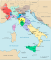
Italy 1494-fr.svg 3,634 × 4,308; 733 KB
-
Italy and Illyria 1084 AD-fr.svg 964 × 1,206; 139 KB
-
Itinéraire d'Antonin - Juliobona à Durocassis - Reproduction.svg 3,489 × 719; 12 KB
-
June 1 1794 Order of Battle Map-fr.svg 654 × 1,116; 106 KB
-
Karte Helvetik 1-fr.svg 2,478 × 1,549; 584 KB
-
Karte Helvetik 3-fr.svg 2,478 × 1,549; 585 KB
-
Karte Helvetik 4-fr.svg 2,478 × 1,549; 575 KB
-
Karte Mediation-fr.svg 2,478 × 1,549; 607 KB
-
Khartli-Kakheti and Imereti-fr.svg 800 × 550; 3.76 MB
-
Khartli-Kakheti-fr.svg 800 × 550; 3.76 MB
-
Kursk 1943 Plan-fr.svg 2,000 × 2,706; 258 KB
-
La Gohaigne (Quetteville) - Mobilier céramique 2.svg 3,197 × 2,727; 11 KB
-
La Gohaigne (Quetteville) - Mobilier céramique.svg 3,342 × 1,827; 17 KB
-
La Gohaigne (Quetteville) - Mobilier métallique.svg 3,354 × 875; 225 KB
-
La Gohaigne (Quetteville) - Plan d'ensemble.svg 3,147 × 2,444; 135 KB
-
LaLargaMarcha19341935-fr.svg 1,124 × 955; 498 KB
-
Blason famille fr Lamy.svg 600 × 660; 17 KB
-
Las Cogotas map-fr.svg 1,479 × 1,149; 60 KB
-
Le conquiste di Giorgio Maniace-fr.svg 1,041 × 1,243; 39 KB
-
Lexoviens - Frontières du territoire.svg 3,298 × 2,900; 89 KB
-
Limes romain - Province de Maurétanie Tingitane-fr.svg 3,464 × 2,760; 143 KB
-
Limes Tripolitanus - Route frontière IIIe siècle.svg 3,433 × 1,953; 100 KB
-
Linguistic map of Wallonia-fr.svg 646 × 359; 128 KB
-
Lisieux - Plan à l'époque médiévale.svg 3,347 × 2,729; 40 KB
-
Localisation de l'abbaye de Vauluisant.svg 938 × 540; 30 KB
-
Location map of Weissruthenien-fr.svg 1,414 × 2,248; 134 KB
-
Map Battle of the Nile 1798-fr.svg 610 × 880; 1.19 MB
-
Map of Abbey of Saint Scholastica, Subiaco-fr.svg 3,518 × 3,019; 242 KB
-
Map of Case Black-fr.svg 1,557 × 2,280; 1.19 MB
-
Map of Eparchies of Serbian Orthodox Church (Orthodox Ohrid Archbishopric)-fr.svg 1,410 × 1,141; 175 KB
-
Map of Eparchies of Serbian Orthodox Church-fr.svg 1,327 × 1,195; 291 KB
-
Map of Eretum-fr.svg 3,552 × 4,739; 125 KB
-
Map of Fontaines Salées archeological site.svg 1,463 × 1,044; 39 KB
-
Map of Mausoleum of Agrippa Menenius Lanatus.svg 3,025 × 2,210; 22 KB
-
Map of Montenegro World War Two-fr.svg 1,791 × 1,657; 70 KB
-
Map of Parlement (Ancien Régime)-fr.svg 1,535 × 1,481; 193 KB
-
Map of Sagunto Castle - fr.svg 3,428 × 1,803; 90 KB
-
Map of siege of Saguntum-fr.svg 1,982 × 1,222; 68 KB
-
Map of the Canary Islands-fr.svg 3,152 × 1,400; 829 KB
-
Map of Ulpia Serdica.svg 1,714 × 1,346; 510 KB
-
Map-Francophonie Afrique du Nord et Moyen-Orient-fr.svg 1,052 × 744; 95 KB
-
Map-Francophonie Afrique-fr.svg 661 × 606; 182 KB
-
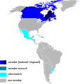
Map-Francophonie Amérique-fr.svg 707 × 745; 506 KB
-
Map-Francophonie Asie et Pacifique-fr.svg 1,052 × 744; 425 KB
-
Mapa llengües paleohispàniques-fr.svg 836 × 676; 175 KB
-
Marcia di Annibale (218-202 aC)-fr.svg 2,052 × 1,637; 670 KB
-
Marquesas location map.svg 4,357 × 4,301; 2.67 MB
-
Matochkin Strait-fr.svg 451 × 635; 392 KB
-
Maurétanie tingitane - Colonies et municipes romains.svg 3,525 × 4,161; 105 KB
-
Maurétanie tingitane - Villes, voies et limes.svg 3,539 × 2,858; 147 KB
-
Mozart family Grand Tour Map-fr.svg 1,947 × 1,533; 122 KB
-
Mur d'Aurélien - Deux niveaux (archers et baliste).svg 4,611 × 7,940; 60 KB
-
Mur d'Aurélien - Dimensions, composition et galerie.svg 5,434 × 6,907; 21 KB
-
Mur d'Aurélien - Dimensions, composition et position des archers.svg 5,434 × 6,907; 19 KB
-
Mur d'Aurélien - Points de passage des aqueducs.svg 1,481 × 1,424; 43 KB
-
Musée archéologique de Murcie - Salle XII-fr.svg 3,489 × 2,574; 13 KB
-
Nomentum - Nécropole-fr.svg 3,469 × 2,607; 71 KB
-
Normandie - Bas-Empire romain - Cités et capitales des cités.svg 3,532 × 2,104; 287 KB
-
Normandie - Evêchés de la province ecclésiastique de Rouen - Haut Moyen Âge.svg 3,532 × 2,104; 264 KB
-
Normandie - Haut-Empire romain - Cités et capitales des cités.svg 3,532 × 2,104; 297 KB
-
Normandie - Présence de la divinité Mercure.svg 3,345 × 2,282; 168 KB
-
Norway 1000 AD-fr.svg 716 × 789; 2.29 MB
-
Novaya Zemlya-fr.svg 448 × 631; 10 KB
-
Occupation de la Yougoslavie par l'Axe, 1941-43.svg 1,494 × 2,051; 193 KB
-
Oisseau-le-Petit - Plan du fanum.svg 3,094 × 3,217; 31 KB
-
Operation Cerberus-fr.svg 1,091 × 777; 184 KB
-
P.U.K - Restructuration et licenciements en juillet 1983.svg 1,796 × 1,797; 145 KB
-
Palazzo Massimo plan 1er-fr.svg 3,554 × 1,960; 27 KB
-
Palazzo Massimo plan RDC-fr.svg 3,297 × 1,770; 59 KB
-
PanhandleMap-USA-states.svg 958 × 602; 192 KB
-
Parc archéologique européen de Bliesbruck-Reinheim - Plan des différents quartiers.svg 3,490 × 2,291; 152 KB
-
Parc archéologique européen de Bliesbruck-Reinheim - Quartier ouest.svg 3,398 × 1,287; 73 KB
-
Parc archéologique européen de Bliesbruck-Reinheim - Villa de Reinheim.svg 3,432 × 4,476; 57 KB
-
Parc archéologique européen de Bliesbruck-Reinheim - Vue d'ensemble-fr.svg 3,493 × 5,079; 114 KB
-
Plan Ara Pacis Augustae.svg 850 × 780; 5 KB


