Category:Figurative maps
Jump to navigation
Jump to search
Deutsch: Kartenwerke mit Abbildungen von Menschen oder Personen
Subcategories
This category has the following 6 subcategories, out of 6 total.
Pages in category "Figurative maps"
This category contains only the following page.
Media in category "Figurative maps"
The following 55 files are in this category, out of 55 total.
-
 1833 Eagle Map of the U.S..JPG 1,744 × 1,384; 1.58 MB
-
 1889 - The Man of Commerce - a map of the United States of America.jpg 12,000 × 7,538; 11.79 MB
-
 1895 pictorial map of North America as Uncle Sam.jpg 2,703 × 3,834; 2.05 MB
-
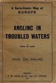
 1899 satirical map of Europe - Angling in troubled waters - by Fred W. rose.tiff 9,704 × 7,238; 200.98 MB
-
 A new map designed for 1870 LCCN2003690601.jpg 8,320 × 6,998; 9.12 MB
-
 Allegorisk karta över Östersjön i form av färjkarlen Charon.tif 3,113 × 4,657; 82.98 MB
-

-
 Angling in Troubled Waters A Serio-Comic Map of Europe.jpg 7,557 × 5,452; 9.36 MB
-
 Angling in troubled waters – a serio-comic map of Europe - Kungliga Biblioteket - 2818247-thumb.png 12,010 × 9,183; 517.45 MB
-
 Bernhard Gillam The Trouble In Cuba 1895 Cornell CUL PJM 1123 01.jpg 6,252 × 8,237; 10.42 MB
-
 Angling in troubled waters- a serio-comic map of Europe. (IA bp 14539).pdf 743 × 1,095, 3 pages; 5.23 MB
-
 Buch Hiob. bitter - Allegorical print.jpg 1,766 × 1,468; 3.78 MB
-
 Buch vonden Konigen.jpg 1,362 × 1,628; 3.05 MB
-
 Burglechner Aquila Tirolensis.jpg 2,186 × 2,906; 863 KB
-
 Carte des états désunis d'Europe - Kungliga Biblioteket - 10348540-thumb.png 10,307 × 7,703; 382.93 MB
-
 Choe Nam-seon's Korean peninsula tiger.jpg 323 × 532; 27 KB
-
 Das heutige Europa - T.B. LCCN2009631645.tif 1,536 × 1,015; 1.49 MB
-
 De Wormer in de vorm van een vogel.jpeg 2,500 × 1,752; 673 KB
-
 Denmark (8249904483).jpg 1,677 × 2,000; 2.94 MB
-
 Karte der Steiermark als Brustschild des Doppeladlers.jpg 4,710 × 5,196; 24.33 MB
-
 Elkanah Tisdale, The Gerry-Mander Map, 1813 Cornell CUL PJM 1034 01.jpg 3,000 × 4,929; 4.05 MB
-
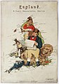
 England (8250970956).jpg 1,678 × 2,000; 3.43 MB
-
 Fool's Cap Map of the World.jpg 4,000 × 3,056; 2.46 MB
-
 France (8249903255).jpg 1,668 × 2,000; 3.03 MB
-
 Fred W Rose Angling in troubled waters.jpg 3,947 × 2,828; 2.97 MB
-
 Fred. W. Rose The Avenger An Allegorical War Map for 1877 1877 Cornell CUL PJM 1080 01.jpg 9,002 × 7,137; 12.83 MB
-
 Geography Bewitched - England.jpg 4,139 × 5,258; 6.69 MB
-
 Geography Bewitched - Scotland.jpg 4,117 × 5,214; 7.38 MB
-

-
 Germany (8250972622).jpg 1,672 × 2,000; 3.1 MB
-
 Holland and Belgium (8250972876).jpg 1,659 × 2,000; 2.77 MB
-
 Humoristische Karte Europa 1870.jpg 3,555 × 3,049; 5.61 MB
-
 Ireland (8249902941).jpg 1,658 × 2,000; 3.5 MB
-
 James Montgomery Flagg The World As Seen By Him 1905 Cornell CUL PJM 1148 01 (cropped).jpg 3,648 × 3,628; 3.87 MB
-
 James Montgomery Flagg The World As Seen By Him 1905 Cornell CUL PJM 1148 01.jpg 5,433 × 6,676; 7.78 MB
-
 Lilian Lancaster England map.jpg 1,405 × 2,000; 294 KB
-
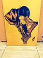 Mama Africa oil canvas.jpg 1,504 × 2,016; 686 KB
-

-
 Matthias Burglechner - Aquila Tirolensis.jpg 971 × 1,310; 672 KB
-
-
-

-

-

-
 Pictorial Map of Italy.1868.jpg 5,475 × 6,560; 33.5 MB
-
 Prussia (8250972470).jpg 2,000 × 1,706; 2.87 MB
-
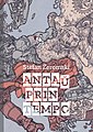 Stefan Zeromski Antauprintempo.jpg 708 × 1,000; 219 KB
-
 The Man of Commerce - Anthropomorphic map.png 1,630 × 1,024; 2.85 MB
-
 This porcineograph LCCN00650089 (cropped).jpg 1,712 × 1,278; 1.07 MB
-
 This Porcineograph.jpg 7,479 × 9,999; 17.86 MB
-
 Tiroler Adler Alpenländische Galerie Kempten Mattes (32).jpg 1,944 × 2,592; 1.87 MB
-
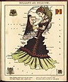
 Wales (8249902781).jpg 1,681 × 2,000; 2.79 MB
-
 William Mecham Modern St. George and The Dragon 1888 Cornell CUL PJM 1100 01.jpg 4,299 × 6,250; 6.98 MB
-
 Karte Zürich Löwe.jpg 1,288 × 1,384; 1.09 MB
-
 Мапа світу, облямована одягом блазня, 1590 р.jpg 1,013 × 721; 430 KB


.jpg)


.jpg)


.jpg)

.jpg)


.jpg)
.jpg)
.jpg)

.jpg)
.jpg)


.jpg)


.jpg)


.jpg)

.jpg)
.jpg)


