Category:Fields in the Borough of Redcar and Cleveland
Jump to navigation
Jump to search
Media in category "Fields in the Borough of Redcar and Cleveland"
The following 45 files are in this category, out of 45 total.
-

-
 Arable Field Near Dunsdale Farm - geograph.org.uk - 484316.jpg 427 × 640; 93 KB
-
 Dingledow Road - geograph.org.uk - 1633316.jpg 427 × 640; 319 KB
-
 Dog Rose and Sheep, South Lane Farm - geograph.org.uk - 193449.jpg 640 × 480; 93 KB
-
 East End of Errington Woods - geograph.org.uk - 469255.jpg 640 × 427; 51 KB
-
 Evening View Across the Square - geograph.org.uk - 339299.jpg 640 × 427; 58 KB
-
 Farmland north of Church Lane - geograph.org.uk - 870670.jpg 640 × 480; 128 KB
-
 Field and Wall Near Mill Farm - geograph.org.uk - 545117.jpg 640 × 427; 74 KB
-
 Field boundary near Boulby Mine - geograph.org.uk - 518894.jpg 640 × 480; 82 KB
-
 Field Near Craggs Hall Farm - geograph.org.uk - 670502.jpg 640 × 427; 59 KB
-
 Field Near Foxrush Farm - geograph.org.uk - 1401819.jpg 640 × 427; 59 KB
-
 Field Near Manor Farm - geograph.org.uk - 1401826.jpg 427 × 640; 78 KB
-

-
 Field of snow near Highcliff Wood - geograph.org.uk - 1632184.jpg 640 × 480; 35 KB
-
 Field of snow near Highcliffe Farm - geograph.org.uk - 1632212.jpg 640 × 480; 33 KB
-
 Field off Fishponds Road - geograph.org.uk - 101331.jpg 640 × 482; 59 KB
-
 Field, Scugdale Farm - geograph.org.uk - 137639.jpg 640 × 480; 78 KB
-
 Field, Tofts Farm - geograph.org.uk - 131522.jpg 640 × 480; 24 KB
-
 Fields East of Brotton - geograph.org.uk - 337748.jpg 640 × 426; 71 KB
-
 Fields North of Langbaurgh Ridge - geograph.org.uk - 475852.jpg 640 × 427; 54 KB
-
 Fields West of Lazenby Bank - geograph.org.uk - 565197.jpg 640 × 427; 66 KB
-

-
 Foxdale Farm, Guisborough - geograph.org.uk - 340356.jpg 640 × 404; 50 KB
-
 Frosty Trees Near Pinchinthorpe - geograph.org.uk - 698579.jpg 640 × 427; 87 KB
-
 Hawthorn, Brant Gate Path - geograph.org.uk - 285812.jpg 640 × 383; 93 KB
-
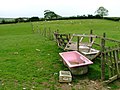
 Horse Training, High Farm - geograph.org.uk - 159736.jpg 640 × 480; 61 KB
-
 Ivy-covered tree - geograph.org.uk - 1650807.jpg 480 × 640; 215 KB
-
 Just the field in this square - geograph.org.uk - 128768.jpg 640 × 480; 77 KB
-
 Longbeck railway station MMB 08.jpg 3,936 × 2,523; 3.67 MB
-

-
 Lowcross Farm - geograph.org.uk - 620545.jpg 640 × 427; 86 KB
-
 Muddy Field Entrance - geograph.org.uk - 716872.jpg 640 × 427; 105 KB
-
 Newton under Roseberry - geograph.org.uk - 911478.jpg 640 × 480; 424 KB
-
 Old Railway bridge morth of site of Staithes Viaduct, North Yorkshire (23482224141).jpg 3,072 × 2,304; 1.37 MB
-
 Partially Baled Field, Near Upsall - geograph.org.uk - 544030.jpg 640 × 427; 82 KB
-
 Pasture, Off Belmangate - geograph.org.uk - 289024.jpg 640 × 384; 74 KB
-
 Sheep Pasture, Highcliffe Farm - geograph.org.uk - 479681.jpg 600 × 480; 71 KB
-
 Sheep Pasture, Lodge Farm - geograph.org.uk - 191427.jpg 640 × 480; 84 KB
-
 Sheep Pasture, Windy Hill Farm - geograph.org.uk - 152418.jpg 640 × 384; 36 KB
-
 View from Sandy Lane - geograph.org.uk - 155281.jpg 640 × 480; 70 KB
-
 View from Sandy Lane towards Redcar - geograph.org.uk - 330655.jpg 640 × 426; 68 KB
-
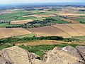
 View from the top - geograph.org.uk - 582896.jpg 640 × 432; 77 KB
-
 View to Roseberry Topping - geograph.org.uk - 330695.jpg 640 × 426; 85 KB
-
 View West From Skippers Lane - geograph.org.uk - 139701.jpg 640 × 480; 57 KB
-
 Warmland west of Kilton Thorpe Lane - geograph.org.uk - 679854.jpg 640 × 480; 103 KB


.jpg)


