Category:Fields in Pontefract
Jump to navigation
Jump to search
Media in category "Fields in Pontefract"
The following 68 files are in this category, out of 68 total.
-
 A track leading to Cobbler's Lane - geograph.org.uk - 3118801.jpg 800 × 600; 306 KB
-
 Access to Field to rear of Pontefract Road - geograph.org.uk - 6519069.jpg 1,024 × 768; 195 KB
-
 Big field behind the Rookeries - geograph.org.uk - 6579574.jpg 2,048 × 1,536; 2.06 MB
-
 Bringing in the harvest - geograph.org.uk - 6304159.jpg 4,608 × 3,072; 3.6 MB
-
 Bungalow Farm off Park Lane - geograph.org.uk - 3052622.jpg 800 × 600; 103 KB
-
 Bushes by a drain, north of Halfpenny Lane - geograph.org.uk - 4303465.jpg 1,024 × 768; 113 KB
-
 Cladding well underway - geograph.org.uk - 5654636.jpg 4,608 × 3,456; 3.94 MB
-
 Crowds Gather for Demolition - geograph.org.uk - 6304133.jpg 640 × 480; 62 KB
-
 Crowds Gather for Demolition - geograph.org.uk - 6304135.jpg 4,608 × 3,072; 1.85 MB
-
 Eight minus five equals three - geograph.org.uk - 6304138.jpg 3,562 × 2,139; 875 KB
-

-
 Exploratary Drilling - geograph.org.uk - 3470349.jpg 3,680 × 2,759; 2.09 MB
-
 Farmland near Bungalow Farm - geograph.org.uk - 2628033.jpg 1,600 × 1,200; 457 KB
-
 Farmland near Pontefract - geograph.org.uk - 100424.jpg 640 × 427; 95 KB
-
 Farmland near Pontefract - geograph.org.uk - 2476189.jpg 1,600 × 1,200; 525 KB
-
 Farmland off Hardwick Road - geograph.org.uk - 2616466.jpg 1,600 × 1,200; 328 KB
-
 Farmland off Lower Taythes Lane - geograph.org.uk - 2476185.jpg 1,600 × 1,200; 417 KB
-
 Farmland off Street Furlong Lane - geograph.org.uk - 2476192.jpg 1,600 × 1,200; 480 KB
-
 Farmland off the B6134 - geograph.org.uk - 2628039.jpg 1,600 × 1,200; 432 KB
-
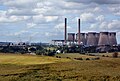 Ferrybridge Power Station - geograph.org.uk - 5649855.jpg 4,154 × 2,788; 2.31 MB
-
 Ferrybridge power station minus one cooling tower - geograph.org.uk - 6239019.jpg 4,037 × 2,742; 1.9 MB
-
 Ferrybridge power station viewed from Pontefract - geograph.org.uk - 6342659.jpg 4,288 × 3,216; 3.21 MB
-
 Ferrybridge power stations. Old and new - geograph.org.uk - 6843705.jpg 1,337 × 997; 180 KB
-
 Field adjacent to Lower Taythes Lane - geograph.org.uk - 6519467.jpg 768 × 1,024; 147 KB
-
 Field boundary, off Street Furlong lane - geograph.org.uk - 2197852.jpg 1,024 × 768; 118 KB
-
 Field of Wheat off Fairy Hill Lane - geograph.org.uk - 3533894.jpg 4,608 × 3,456; 3.05 MB
-
 Field off Goodwood Road - geograph.org.uk - 6519061.jpg 768 × 1,024; 219 KB
-
 Fields near Pontefract - geograph.org.uk - 4267362.jpg 1,000 × 750; 680 KB
-
 Footpath off Spittal Hardwick Lane - geograph.org.uk - 2475803.jpg 1,024 × 768; 180 KB
-
 Getting ready for the next crop - geograph.org.uk - 4100599.jpg 1,600 × 1,064; 663 KB
-
 Greavefield Closes Pontefract - geograph.org.uk - 6342663.jpg 4,288 × 3,216; 2.94 MB
-
 Green Lane heading South - geograph.org.uk - 2476191.jpg 1,600 × 1,200; 403 KB
-
 Greenwoods tyre centre - geograph.org.uk - 5674696.jpg 3,347 × 2,534; 1.34 MB
-
 Haverlands Farm - geograph.org.uk - 2917526.jpg 640 × 285; 31 KB
-
 Haverlands Farm - geograph.org.uk - 6849165.jpg 4,000 × 1,800; 1.85 MB
-
 Houses in Chequers Close - geograph.org.uk - 2197845.jpg 1,024 × 768; 131 KB
-
 Lone tree north of Halfpenny Lane - geograph.org.uk - 4303463.jpg 1,024 × 768; 181 KB
-
 Long Lane in winter - geograph.org.uk - 2197849.jpg 1,024 × 768; 118 KB
-
 Lower Taythes Lane (track) heading north - geograph.org.uk - 2476186.jpg 1,600 × 1,200; 556 KB
-
 Lower Taythes Lane towards Ferrybridge - geograph.org.uk - 3118789.jpg 800 × 600; 277 KB
-
 Lower Thythes Lane Pontefract - geograph.org.uk - 5654630.jpg 4,608 × 3,456; 4.3 MB
-
 M62 and A1(M) motorways at Sowgate Lane Pontefract - geograph.org.uk - 5669899.jpg 3,873 × 2,577; 1.33 MB
-
 New and old Power - geograph.org.uk - 5654705.jpg 4,608 × 3,456; 2.87 MB
-
 New housing at Pontefract - geograph.org.uk - 5650347.jpg 3,546 × 2,455; 2.1 MB
-
 New railway bridge under construction - geograph.org.uk - 2344819.jpg 1,344 × 1,008; 787 KB
-
 New TK Maxx distribution warehousing - geograph.org.uk - 5654624.jpg 4,608 × 3,456; 3.64 MB
-
 Path leading to North Featherstone - geograph.org.uk - 4101242.jpg 1,600 × 1,064; 848 KB
-
 Path leading to North Featherstone - geograph.org.uk - 4101274.jpg 1,600 × 1,064; 498 KB
-
 Path leading to North Featherstone - geograph.org.uk - 4101284.jpg 1,600 × 1,064; 683 KB
-
 Poplar Trees - geograph.org.uk - 4267364.jpg 1,000 × 750; 700 KB
-
 Poppy field (geograph 6182967).jpg 4,608 × 3,072; 2.85 MB
-
 Potato Power - geograph.org.uk - 5973135.jpg 4,608 × 3,072; 3.8 MB
-
 Potato power perspective - geograph.org.uk - 5973175.jpg 3,072 × 4,608; 3.75 MB
-
 Power Walking - geograph.org.uk - 6843691.jpg 1,338 × 952; 166 KB
-
 Public Footpath to Carleton - geograph.org.uk - 3422792.jpg 4,608 × 3,456; 3.29 MB
-
 The edge of town - geograph.org.uk - 2197838.jpg 1,024 × 768; 141 KB
-
 The old brick works road in spring - geograph.org.uk - 2388563.jpg 2,213 × 1,296; 1.83 MB
-
 The rear entrance road, Carleton High School - geograph.org.uk - 2388607.jpg 1,728 × 1,296; 1.23 MB
-
 TK Maxx and Greenwoods Tyres - geograph.org.uk - 5674703.jpg 4,193 × 2,578; 1.48 MB
-
 TK Maxx Distribution Centre - geograph.org.uk - 5655601.jpg 4,608 × 3,456; 3.62 MB
-
 Track to Bungalow Farm - geograph.org.uk - 2628035.jpg 1,600 × 1,200; 457 KB
-
 Unofficial footpath from Carleton High School - geograph.org.uk - 2337283.jpg 1,152 × 864; 829 KB
-
 View across a field near Pontefract - geograph.org.uk - 3393029.jpg 1,024 × 681; 192 KB
-
 View from field near Lower Taythes Lane - geograph.org.uk - 6519453.jpg 768 × 1,024; 187 KB
-
 Wakefield Road, Pontefract - geograph.org.uk - 5259671.jpg 1,024 × 683; 251 KB
-
 Wheat and poppies - geograph.org.uk - 2476104.jpg 1,024 × 768; 248 KB
-

-
 When the lights go out - geograph.org.uk - 5655606.jpg 4,608 × 3,456; 2.53 MB


_heading_north_-_geograph.org.uk_-_2476186.jpg)


_motorways_at_Sowgate_Lane_Pontefract_-_geograph.org.uk_-_5669899.jpg)


.jpg)


