Category:Fields in Carinthia
Jump to navigation
Jump to search
States of Austria:  Burgenland ·
  Carinthia ·
  Lower Austria ·
  Salzburg ·
  Styria ·
  Tyrol ·
  Upper Austria ·
  Vorarlberg
Subcategories
This category has the following 11 subcategories, out of 11 total.
- Maize fields in Carinthia (25 F)
- Rapeseed fields in Carinthia (1 F)
*
- Meadows in Carinthia (117 F)
F
- Fields in Bezirk Feldkirchen (1 F)
K
- Fields in Klagenfurt (6 F)
- Fields in Bezirk Klagenfurt Land (37 F)
S
- Fields in Bezirk Sankt Veit (6 F)
V
- Fields in Bezirk Völkermarkt (3 F)
Media in category "Fields in Carinthia"
The following 107 files are in this category, out of 107 total.
-
 "Olmah" u kuop?ce n'dreja na Hauštre 1951.jpg 2,861 × 1,863; 338 KB
-
 Ackern mit Traktor und Egge in Kärnten, Österreich.jpg 4,912 × 2,330; 2.85 MB
-
 Arnoldstein Radendorf Landschaft mit Strom-Verbundnetz 25052020 9084.jpg 7,292 × 4,867; 15.32 MB
-
 Arnoldstein Radendorf Strom-Verbundnetz 20052022 9299.jpg 4,928 × 3,280; 6.8 MB
-
 Ebenthal Blick vom Predigtstuhl Straße zum Kalmus Bad 29042010 66.jpg 4,288 × 2,848; 9.42 MB
-
 Feistritz an der Drau an der B100, Villach Land, Kärnten.jpg 1,435 × 734; 416 KB
-
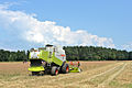
 Claas Lexion 540 Erntemaschine 18072014 842.jpg 4,928 × 3,280; 14.85 MB
-
 Dinkel-Ernte Ing Johannes Tomic 18072014 805.jpg 4,928 × 3,280; 12.34 MB
-
 Dinkel-Ernte Ing Johannes Tomic 18072014 874.jpg 3,280 × 4,928; 15.24 MB
-
 Dinkel-Ernte Ing Johannes Tomic 18072014 875.jpg 4,928 × 3,280; 15.34 MB
-
 Dinkel-Ernte Ing Johannes Tomic 18072014 880.jpg 4,928 × 3,280; 15.32 MB
-
 Dinkel-Ernte Ing Johannes Tomic 18072014 884.jpg 4,836 × 3,218; 6.09 MB
-
 Dinkel-Ernte Ing Johannes Tomic 18072014 885.jpg 4,928 × 3,280; 11.69 MB
-
 Dinkel-Ernte Ing Johannes Tomic 18072014 886.jpg 4,928 × 3,280; 11.39 MB
-
 Dinkel-Ernte Ing Johannes Tomic 18072014 891.jpg 4,928 × 3,280; 11.53 MB
-
 Dinkel-Ernte Ing Johannes Tomic 18072014 924.jpg 4,928 × 3,280; 12.21 MB
-
 Dinkel-Ernte Ing Johannes Tomic 18072014 937.jpg 4,928 × 3,280; 12.08 MB
-
 Dinkel-Ernte Ing Johannes Tomic 18072014 948.jpg 4,928 × 3,280; 13.25 MB
-
 Dinkel-Ernte Ing Johannes Tomic 18072014 968.jpg 4,928 × 3,280; 14.07 MB
-
 Dinkel-Ernte Ing Johannes Tomic 18072014 974.jpg 4,928 × 3,280; 14.33 MB
-
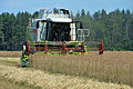
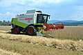
 Dinkel-Ernte Ing Johannes Tomic Fendt 712 Vario-Traktor 18072014 888.jpg 4,928 × 3,280; 12.12 MB
-
 Dinkel-Ernte Ing Johannes Tomic Fendt 712 Vario-Traktor 18072014 905.jpg 4,928 × 3,280; 11.29 MB
-
 Dinkel-Ernte Ing Johannes Tomic Fendt 712 Vario-Traktor 18072014 906.jpg 4,928 × 3,280; 13.67 MB
-
 Dinkel-Ernte Ing Johannes Tomic Fendt 712 Vario-Traktor 18072014 999.jpg 4,928 × 3,280; 13.35 MB
-
 Dinkel-Feld von Ing Johannes Tomic 18072014 721.jpg 4,928 × 3,280; 7.59 MB
-
 Dinkel-Feld von Ing Johannes Tomic 18072014 731.jpg 4,928 × 3,280; 6.48 MB
-
 Dinkel-Feld von Ing Johannes Tomic 18072014 733.jpg 4,928 × 3,280; 7.23 MB
-
 Dinkel-Feld von Ing Johannes Tomic 18072014 741.jpg 4,928 × 3,280; 13.49 MB
-
 Feistritz ob Bleiburg Dinkel-Feld und Fendt 712 mit Mahle-Filterwerk 18072014 784.jpg 4,928 × 3,280; 11.73 MB
-
 Feistritz ob Bleiburg Dinkel-Feld von Ing Johannes Tomic 18072014 725.jpg 3,280 × 4,928; 9.09 MB
-
 Feldkirchen Briefelsdorf Heuernte 05052023 9973.jpg 4,928 × 3,280; 12.15 MB
-
 Feldkirchen Briefelsdorf Heuernte Heuballen 05052023 9977.jpg 4,928 × 3,280; 13.52 MB
-
 Feldkirchen Briefelsdorf Heuernte Heuballen 05052023 9978.jpg 4,928 × 3,280; 11.45 MB
-
 Feldkirchen Maltschach Mattersdorfer Weg Landschaft 20042016 1613.jpg 7,031 × 4,855; 18.76 MB
-
 Feldkirchen Naßweg Landschaft und Petzen 05052023 9980.jpg 4,928 × 3,280; 11.44 MB
-
 Feldkirchen Nassweg Landschaft Weiler 05052023 9981.jpg 4,928 × 3,280; 11.29 MB
-
 Frauenstein Dornhof Felder und Baumgruppe mit Magdalensberg dahinter 14122016 4663.jpg 4,928 × 3,280; 10.33 MB
-
 Frauenstein Dornhof Felder und Baumgruppen mit Magdalensberg dahinter 14122016 4662.jpg 4,928 × 3,280; 11.17 MB
-
 Frauenstein Frauenstein Landschaft SO-Ansicht 05052024 5009.jpg 7,360 × 4,912; 30.74 MB
-
 Frauenstein Frauenstein Landschaft SO-Ansicht 05052024 5010.jpg 7,360 × 4,912; 30.38 MB
-
 Grafenstein Lind Saeen auf den Feldern 16042015 2072.jpg 7,360 × 4,912; 16.68 MB
-
 Grafenstein Lind Saeen auf den Feldern 16042015 2077.jpg 7,360 × 4,912; 26.38 MB
-
 Grafenstein Lind Schloss Riedenegg 12112011 223.jpg 4,288 × 2,848; 2.36 MB
-
 Grafenstein Sabuatach 02102007 26.jpg 3,872 × 2,592; 2.23 MB
-
 Grafenstein Sabuatach gruenende Fluren 12052015 0914.jpg 4,928 × 3,280; 11.16 MB
-
 Grafenstein Sabuatach Wald und Flur 12052015 3576.jpg 7,360 × 4,912; 32.32 MB
-
 Grafenstein Althofen Bauernhof 12112011 277.jpg 4,288 × 2,848; 1.43 MB
-
 Grafenstein Althofen Nischenbildstock 12112011 265.jpg 4,288 × 2,848; 2.53 MB
-
 Grafenstein Althofen Nischenbildstock 12112011 266.jpg 4,288 × 2,848; 1.58 MB
-
 Grafenstein Lind Traktorspur im Feld 12112011 221.jpg 4,288 × 2,848; 2.98 MB
-
 Heuernte Klagenfurt Land, Kärnten.jpg 4,912 × 3,264; 7.43 MB
-
 Isolamento.jpg 2,048 × 1,536; 1.25 MB
-
 Sankt Georgen am Längsee Hochosterwitz Gartenbaudenkmäler 01062015 1113.jpg 4,928 × 3,280; 16.82 MB
-
 Sankt Georgen am Längsee Hochosterwitz Gartenbaudenkmäler 01062015 1184.jpg 4,928 × 3,280; 15.87 MB
-
 Sankt Georgen am Längsee Hochosterwitz Gartenbaudenkmäler 01062015 1185.jpg 4,635 × 2,914; 14.83 MB
-
 Sankt Georgen am Längsee Hochosterwitz Gartenbaudenkmäler Tiergarten 22042007 444.jpg 3,872 × 2,592; 2.8 MB
-
 Sankt Georgen am Längsee Hochosterwitz Gartenbaudenkmäler Tiergarten 22042007 445.jpg 3,872 × 2,592; 2.66 MB
-
 Sankt Georgen am Längsee Hochosterwitz Gartenbaudenkmäler Tiergarten 22042007 446.jpg 3,872 × 2,592; 2.47 MB
-
 Insberg, Villach Land, Kärnten.jpg 1,500 × 914; 1.53 MB
-
 Karutschnig-Wiese Rodungsinsel in Köttmannsdorf, Kärnten.jpg 1,483 × 919; 1.05 MB
-

-
 Karutschnig-Wiese, Rodungsinsel in Köttmannsdorf, Kärnten.jpg 1,500 × 904; 962 KB
-
 Klagenfurt Marolla Maria Saaler Weg Schumystrasse Wegkreuz 18112008 59.jpg 4,288 × 2,848; 3.14 MB
-
 Klagenfurt Viktring Straschitz Felder und Landwirtschaft 17032009 65.jpg 4,288 × 2,848; 2.9 MB
-
 Kornfeld Gailtal, Kärnten.jpg 1,500 × 895; 954 KB
-
 Kürbisfeld im Bezirk Völkermarkt, Kärnten.jpg 4,912 × 3,264; 8.47 MB
-
 Liebenfels Rosenbichl Landschaft mit Baum im Acker 27042020 7456.jpg 4,928 × 3,280; 12.35 MB
-
 Liebenfels Rosenbichl Landschaft mit Bäumen und Feldern 27042020 7458.jpg 4,928 × 3,280; 13.39 MB
-
 Liebenfels Rosenbichl Landschaft mit Fluren und Feldern 27042020 7459.jpg 4,928 × 3,280; 9.57 MB
-
 Liebenfels Rosenbichl Mostbirne 27042020 7455.jpg 3,280 × 4,829; 11.12 MB
-
 Magdalensberg Ottmanach Trafo-Station 18072015 5883.jpg 7,285 × 4,862; 24.14 MB
-
 Matzelsdorf 20 2006.JPG 3,264 × 2,448; 1.73 MB
-
 Moosburg Hohenfeld 3 Wohnhaus 07052018 5833.jpg 4,928 × 3,280; 15.81 MB
-
 Moosburg Hohenfeld 4 Bauernhof 07052018 3150.jpg 7,360 × 4,912; 19.7 MB
-
 Moosburg Hohenfeld 4 Bauernhof und Tuderschitz Landschaft 07052018 3152.jpg 7,360 × 4,912; 21.71 MB
-
 Moosburg Hohenfeld und Tuderschitz Landschaft 07052018 3155.jpg 7,360 × 4,912; 23.68 MB
-
 Moosburg Hohenfeld Wiesen und Felder 07052018 5835.jpg 4,928 × 3,280; 13.45 MB
-
 Moosburg Schulgasse 13 Hauptschule 02112014 458.jpg 4,928 × 3,280; 12.75 MB
-
 Moosburg Schulkomplex Haupt-und Volksschule 02112014 459.jpg 4,928 × 3,280; 10.81 MB
-
 Moosburg Schulkomplex Haupt-und Volksschule 02112014 466.jpg 4,928 × 3,280; 11.08 MB
-
 MyAcker Farm Drohnenaufnahme.jpg 3,569 × 2,120; 5.76 MB
-
 Poggersdorf Annamischl 15062007 01.jpg 3,872 × 2,592; 1.36 MB
-
 Poggersdorf Annamischl Bauernhöfe 11012019 5938 5940.jpg 7,360 × 4,912; 20.03 MB
-
 Poggersdorf Linsenberg Filialkirche hl. Egydius Ost-Ansicht 11012019 5937.jpg 7,360 × 4,912; 24 MB
-
 Poggersdorf Linsenberg Landschaft mit Fluren 11012019 5938 5936.jpg 7,360 × 4,912; 33.75 MB
-
 Poggersdorf Linsenberg Landschaft mit Wiesen Feldern und Wäldern 11012019 5938 5939.jpg 7,360 × 4,912; 25.56 MB
-
 Poertschach Winklern Am Kåte Mountainbiking 14052012 922.jpg 4,288 × 2,848; 3.09 MB
-
 Pörtschach Pritschitz Flurweg Drautalbahn II ÖBB 4746 Cityjet 28022023 0825.jpg 4,928 × 2,749; 8.61 MB
-
 Pörtschach Pritschitz Werftenstraße Drautalbahn II Bahnübergang 28022023 0826.jpg 4,928 × 3,280; 12.4 MB
-
 Pörtschach Pritschitz Werftenstraße Feld Grenzstein 28022023 0821.jpg 4,928 × 3,280; 12.89 MB
-
 Pörtschach Pritschitz Werftenstraße Feld Grenzstein 28022023 0822.jpg 3,280 × 4,928; 10.26 MB
-
 Pörtschach Pritschitz Werftenstraße Felder Drautalbahn II 28022023 0824.jpg 4,928 × 3,280; 10.92 MB
-
 Pörtschach Pritschitz Werftenstraße Blick Richtung NW 26052018 3397.jpg 7,360 × 4,713; 26.86 MB
-
 Pörtschach Pritschitz Werftenstraße Bootsbauerweg 26052018 3400.jpg 7,360 × 4,912; 23.45 MB
-
 Pörtschach Pritschitz Werftenstraße Bootsbauerweg N-Ansicht 26052018 3395.jpg 7,360 × 4,912; 23.64 MB
-
 Pörtschach Winklern Am Kåte Gaisrückenstraße 77 vulgo Rumasch 08032020 8464.jpg 7,360 × 4,912; 28.92 MB
-
 Pörtschach Winklern Gaisrückenstraße 59 63 67 69 Wohnhäuser N-Ansicht 01032020 8409.jpg 7,360 × 4,912; 22.68 MB
-
 Sankt Georgen am Laengsee Sankt Sebastian Felder und Waelder 02122015 9344.jpg 7,360 × 4,912; 25.02 MB
-
 Sankt Georgen am Laengsee Sankt Sebastian Felder und Waelder 02122015 9347.jpg 7,360 × 4,912; 23.91 MB
-
 Sankt Georgen am Laengsee Sankt Sebastian und Burg Hochosterwitz 02122015 9349.jpg 7,360 × 4,912; 20.53 MB
-
 Sankt Georgen am Längsee Hochosterwitz Burg W-Ansicht 14042021 0774.jpg 7,360 × 4,912; 17.68 MB
-
 Sankt Georgen am Längsee Hochosterwitz Burg W-Ansicht 14042021 0784.jpg 7,360 × 4,912; 17.48 MB
-
 Sankt Georgen am Längsee Hochosterwitz Burg W-Ansicht 14042021 8843.jpg 4,928 × 3,280; 8.83 MB
-
 Spittal Banner.jpg 4,267 × 610; 1.23 MB
-
 Spittaler Feld - Blick Richtung Gmeineck.JPG 4,272 × 2,848; 6.22 MB
-
 Weitensfeld Wullross Stromleitungen 17042016 1525.jpg 7,218 × 4,256; 11.67 MB
-
 Wernberg Kantnig Kantniger Straße Stromleitung 30052018 5848.jpg 3,280 × 4,928; 8.29 MB


