Category:Field name maps of Germany
Jump to navigation
Jump to search
Subcategories
This category has only the following subcategory.
W
Media in category "Field name maps of Germany"
The following 38 files are in this category, out of 38 total.
-
 1833 UFK-Composit Roßwag Burgstandorte LABW StA LB.jpg 1,406 × 1,943; 2.61 MB
-
 KOCH(1896) p024 Flurnamen.jpg 1,001 × 1,105; 633 KB
-
 Bachtelweiher Bachtelmühle historische Flurkarte.png 1,467 × 862; 2.38 MB
-
 Barbarossaquelle.PNG 2,026 × 1,310; 219 KB
-
 Corres mit Flurnamen.png 1,000 × 998; 993 KB
-
 D-BW-KN-Mühlingen-Madachhof - Karte von 1765 (Ausschnitt).png 1,280 × 720; 1.95 MB
-
 Deät Lun300B.JPG 2,818 × 2,377; 582 KB
-
 Einfallsgraben.PNG 1,100 × 780; 71 KB
-
 Fluren Seehausen.jpg 605 × 456; 36 KB
-
 Flurkarte 1877 Gegen den Brunnen.png 243 × 182; 108 KB
-
 Flurkarte Aue 1840.jpg 2,407 × 1,607; 915 KB
-
 Flurkarte Berthelsdorf 1764.jpg 1,328 × 1,611; 499 KB
-
 Flurkarte.jpg 1,333 × 1,000; 1.43 MB
-
 FlurkarteNamen Sulzbach an der Murr.svg 895 × 1,017; 2.46 MB
-
 Flurnamenkarte Ermershausen.png 6,300 × 4,668; 23.72 MB
-
 Flurnamenkarte Ruethen.JPG 3,188 × 3,456; 4.69 MB
-

-
 Franzkat 0867-2-003 (Schwarzenbach).jpg 8,149 × 6,769; 4.99 MB
-
 Franzosentrift.jpg 3,166 × 2,248; 2.57 MB
-
 Friedberg Flurkarte-Uraufnahme um 1814.jpg 2,256 × 2,327; 7.48 MB
-
 Gemeindefreies Gebiet Heinrichsthaler Forst (Details).svg 2,800 × 2,664; 679 KB
-
 Gemeindefreies Gebiet Schöllkrippener Forst (Details).svg 1,672 × 2,315; 544 KB
-
 Gemeindefreies Gebiet Wiesener Forst (Details).svg 2,134 × 2,163; 529 KB
-
 Historische Flurkarte Rommelshausen.png 10,169 × 8,129; 4.34 MB
-
 Historische Flurkarte Stetten.png 9,309 × 11,006; 6.74 MB
-
 HistorischeFlurnamenWendershagen.png 552 × 670; 183 KB
-
 Krebsjauche 1760.png 1,382 × 1,309; 2.87 MB
-

-
 Leuchtenburg Historische Flurkarte.jpg 4,000 × 3,000; 3.65 MB
-
 Mamhofen, Flurkarte 1809 ib-1.jpg 2,362 × 2,377; 5.19 MB
-
 Marksteinschutzflaeche-Berlin-Spandau-Hahneberg1.jpg 2,480 × 3,508; 2.9 MB
-
 Moebiskruge 1742.png 2,058 × 2,111; 7.18 MB
-
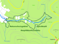 NSG Amphibienfreistätte Speckkahl.PNG 2,296 × 1,724; 177 KB
-
 NSG Weihersgrund.PNG 2,336 × 1,722; 293 KB
-
 Reichenau Gemarkungsplan 1876.jpg 4,114 × 3,396; 2 MB
-
 Sölzert.PNG 3,164 × 3,098; 1.01 MB
-
 Wandlitz - Ausschnitt Flurkarte 1774-75.jpg 3,108 × 2,272; 1.1 MB
-
 Winzingen1.jpg 2,179 × 1,906; 1.91 MB

_p024_Flurnamen.jpg)


.png)


._Karte_von_einem_Teil_des_Kurf%C3%BCrstentums_Sachse.jpg)
.jpg)


.svg)
.svg)
.svg)


.jpg)


