Category:Field Survey Company 1-20,000 maps of Lebanon
Jump to navigation
Jump to search
Media in category "Field Survey Company 1-20,000 maps of Lebanon"
The following 14 files are in this category, out of 14 total.
-
 1 Deir ez Zahrani 1943.jpg 9,336 × 7,324; 8.13 MB
-
 10 Sarafannd 1943.jpg 9,076 × 7,000; 7.67 MB
-
 11 Qasmîyé 1944.jpg 10,792 × 9,316; 15.17 MB
-
 16-28 Enn Naqoura 1948.jpg 8,291 × 7,254; 5.59 MB
-
 17-28 Zabqine 1948.jpg 8,208 × 7,414; 9.6 MB
-
 17-29 Tyr 1948.jpg 8,803 × 7,277; 9.55 MB
-
 18-29 Jouaiya 1948 v2.jpg 9,294 × 7,281; 8.28 MB
-
 19-29 Ett Taibe 1948.jpg 9,342 × 7,294; 9.96 MB
-
 2 Kafer Hoûné 1943.jpg 9,024 × 7,032; 10.49 MB
-
 3 KfaÏr ez ZaÏte 1943.jpg 8,880 × 6,866; 9.47 MB
-
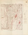
 5 Nabatîyé 1943.jpg 9,024 × 11,142; 12.61 MB
-
 6 Marjayoûn 1943.jpg 9,028 × 11,164; 13.01 MB
-
 7 Hâsbaïyah 1943.jpg 9,034 × 11,152; 13.5 MB
-
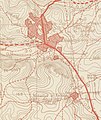 Tell Rouaiss and Jebel Rouaïsset on a map of Nabatîyé 1943 (cropped).jpg 1,702 × 2,026; 579 KB


.jpg)