Category:Fetcham
Jump to navigation
Jump to search
English: Fetcham is a residential area in Surrey, England. It is west of Leatherhead, on the other side of the River Mole and Mill Pond springs and the associated nature reserve.
Nederlands: Fetcham is een plaats in het bestuurlijke gebied Mole Valley, in het Engelse graafschap Surrey. De plaats telt 8.300 inwoners.
village in Mole Valley, Surrey, United Kingdom  | |||||
| Upload media | |||||
| Instance of | |||||
|---|---|---|---|---|---|
| Location | Mole Valley, Surrey, South East England, England | ||||
| Area |
| ||||
 | |||||
Subcategories
This category has the following 5 subcategories, out of 5 total.
Media in category "Fetcham"
The following 46 files are in this category, out of 46 total.
-
 A Path between the Ponds, Bookham Common - geograph.org.uk - 1237646.jpg 640 × 480; 252 KB
-

-
 Cattle on Fetcham Downs, Surrey - geograph.org.uk - 1394690.jpg 640 × 428; 68 KB
-
 Commonside, Fetcham - geograph.org.uk - 676581.jpg 640 × 480; 125 KB
-
 Fetcham Common Lane - geograph.org.uk - 779338.jpg 479 × 640; 210 KB
-
 Fetcham Reading Room - geograph.org.uk - 221666.jpg 640 × 480; 81 KB
-
 Fetcham The Ridgeway bus stops in September 2011.jpg 4,320 × 3,240; 4.61 MB
-
 Fetcham Village Infant School, School Lane, Fetcham (July 2013).JPG 2,200 × 1,600; 711 KB
-
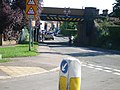
 Fetcham, Cannon Way railway bridge - geograph.org.uk - 806199.jpg 640 × 480; 87 KB
-
 Hawk's Hill - Steep Hill 11^ - geograph.org.uk - 1428841.jpg 640 × 400; 125 KB
-
 Leatherhead Tennis Club - geograph.org.uk - 6320583.jpg 1,024 × 678; 688 KB
-
 Long Copse, Fetcham - geograph.org.uk - 56572.jpg 640 × 480; 167 KB
-
 Looking Down Hawk's Hill - geograph.org.uk - 690426.jpg 640 × 480; 141 KB
-
 Milestone, Hawk's Hill - geograph.org.uk - 6259508.jpg 678 × 1,024; 855 KB
-
 Mill Pond at Fetcham - geograph.org.uk - 1166223.jpg 640 × 480; 81 KB
-
 Oakfield Junior School, Fetcham - geograph.org.uk - 64464.jpg 640 × 480; 91 KB
-
 Path Fork by Polesden Lacey - geograph.org.uk - 897398.jpg 640 × 480; 113 KB
-
 Path Through the Wheat Field - geograph.org.uk - 897408.jpg 640 × 480; 103 KB
-
 Pond, Spring Grove - geograph.org.uk - 675290.jpg 640 × 480; 122 KB
-
 Railway bridge over Cobham Road - geograph.org.uk - 51474.jpg 640 × 480; 123 KB
-
 Railway line east of Bookham station - geograph.org.uk - 51472.jpg 640 × 480; 166 KB
-
 Railway Line, Fetcham - geograph.org.uk - 676379.jpg 640 × 480; 123 KB
-
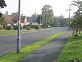 Richmond Way, Fetcham - geograph.org.uk - 56567.jpg 640 × 480; 102 KB
-
 School Lane, Fetcham - geograph.org.uk - 1436778.jpg 640 × 480; 77 KB
-
 School Lane, Fetcham - geograph.org.uk - 1436786.jpg 640 × 480; 84 KB
-
 Sheep on Fetcham Downs, Surrey - geograph.org.uk - 1394699.jpg 640 × 428; 99 KB
-
 Spring Grove, Pond - geograph.org.uk - 676373.jpg 640 × 480; 110 KB
-
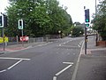
 Suburban Leatherhead - geograph.org.uk - 690416.jpg 640 × 480; 82 KB
-
 The Bell Inn, The Street, Fetcham (July 2013).jpg 2,400 × 1,600; 815 KB
-
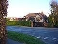
 The Bell, Fetcham - geograph.org.uk - 64467.jpg 640 × 480; 98 KB
-
 The Mole Valley from Norbury Park - geograph.org.uk - 809715.jpg 640 × 622; 112 KB
-
 The Rye at Gutters Bridge - geograph.org.uk - 403189.jpg 640 × 480; 170 KB
-
 View From Fetcham Downs - geograph.org.uk - 1394746.jpg 640 × 428; 52 KB
-
 View From Fetcham Downs - geograph.org.uk - 1394778.jpg 640 × 428; 59 KB
-
 View From Polesden Lacey - geograph.org.uk - 1394824.jpg 640 × 428; 70 KB
-
 View From Polesden Lacey - geograph.org.uk - 1394867.jpg 640 × 428; 60 KB
-
 View From Polesden Lacey - geograph.org.uk - 1394873.jpg 640 × 428; 62 KB
-
 View Near Polesden Lacey - geograph.org.uk - 1394806.jpg 640 × 360; 58 KB
-
 View Near Polesden Lacey - geograph.org.uk - 1394923.jpg 640 × 360; 54 KB
-
 View Near Polesden Lacey - geograph.org.uk - 1394995.jpg 640 × 428; 48 KB
-
 View Near Polesden Lacey. - geograph.org.uk - 1394794.jpg 640 × 360; 38 KB
-

-
 Young Street Bridge - geograph.org.uk - 687721.jpg 640 × 480; 122 KB
-
 Zen Garden - geograph.org.uk - 6240362.jpg 1,024 × 678; 742 KB
-
 Zen Garden - geograph.org.uk - 6321544.jpg 1,024 × 678; 701 KB
-


.JPG)


.jpg)


