Category:Ferriby Sluice
Jump to navigation
Jump to search
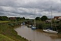
English: Ferriby Sluice is a hamlet situated near the lock complex on the Humber and River Ancholme, Lincolnshire, England.
village in the United Kingdom  | |||||
| Upload media | |||||
| Instance of | |||||
|---|---|---|---|---|---|
| Location | South Ferriby, North Lincolnshire, Lincolnshire, Yorkshire and the Humber, England | ||||
 | |||||
Subcategories
This category has the following 6 subcategories, out of 6 total.
Media in category "Ferriby Sluice"
The following 66 files are in this category, out of 66 total.
-
 A1077 at cement works - geograph.org.uk - 3522513.jpg 640 × 438; 110 KB
-
 A1077 at Ferriby Sluice - geograph.org.uk - 3787606.jpg 1,600 × 1,200; 603 KB
-
 A1077 Road Bridge at Ferriby Sluice - geograph.org.uk - 2461844.jpg 718 × 1,280; 946 KB
-

-
 Boats on East Drain near Ferriby Sluice - geograph.org.uk - 1221317.jpg 640 × 480; 134 KB
-
 Cemex cement works, Ferriby Sluice from the east - geograph.org.uk - 5264222.jpg 3,996 × 1,948; 1.01 MB
-
 Cemex cement works, Ferriby Sluice from the south - geograph.org.uk - 5264219.jpg 4,908 × 2,451; 1.34 MB
-
 Cemex Plant, Ferriby Sluice - geograph.org.uk - 405079.jpg 640 × 355; 99 KB
-
 Cemex Works - geograph.org.uk - 1082996.jpg 640 × 427; 33 KB
-
 Farm Buildings - geograph.org.uk - 1392288.jpg 640 × 480; 189 KB
-

-
 Ferriby Sluice - geograph.org.uk - 1913085.jpg 1,280 × 853; 281 KB
-
 Ferriby Sluice - geograph.org.uk - 1913108.jpg 1,280 × 854; 286 KB
-
 Ferriby Sluice - geograph.org.uk - 1913111.jpg 830 × 1,280; 280 KB
-
 Ferriby Sluice - geograph.org.uk - 2461861.jpg 1,280 × 718; 1,008 KB
-
 Ferriby Sluice - geograph.org.uk - 5028994.jpg 1,024 × 768; 188 KB
-
 Ferriby Sluice - geograph.org.uk - 5029003.jpg 1,024 × 768; 205 KB
-

-

-
 Ferriby Sluice Boats - geograph.org.uk - 2620206.jpg 640 × 427; 60 KB
-
 Ferriby Sluice Boats - geograph.org.uk - 2620208.jpg 640 × 427; 67 KB
-
 Ferriby Sluice locks gates - geograph.org.uk - 2620201.jpg 640 × 427; 54 KB
-
 Ferriby Sluice on the River Ancholme - geograph.org.uk - 4866342.jpg 1,600 × 1,065; 393 KB
-
 Ferriby Sluice towards River Humber - geograph.org.uk - 2620204.jpg 640 × 427; 75 KB
-

-
 Footbridge at Ferriby Sluice - geograph.org.uk - 1221315.jpg 474 × 640; 151 KB
-
 Footbridge over West Drain, Ferriby Sluice - geograph.org.uk - 5137238.jpg 1,065 × 1,600; 789 KB
-
 Footbridge over West Drain, Ferriby Sluice - geograph.org.uk - 5137240.jpg 1,065 × 1,600; 751 KB
-
 Footpath at Ferriby Sluice - geograph.org.uk - 4866198.jpg 1,600 × 1,065; 608 KB
-
 Footpath beside the Old River Ancholme - geograph.org.uk - 293579.jpg 640 × 480; 112 KB
-
 Humber Defence Pillbox - geograph.org.uk - 223112.jpg 640 × 480; 167 KB
-
 Humber Footpath east of Ferriby Sluice - geograph.org.uk - 1221321.jpg 640 × 480; 156 KB
-
 Humber Riverside Path Gate - geograph.org.uk - 1221334.jpg 640 × 480; 117 KB
-
 Layby on A1077 near Cement Works - geograph.org.uk - 3522508.jpg 640 × 343; 72 KB
-
 Lifting Bridge at Ferriby Sluice - geograph.org.uk - 495401.jpg 640 × 485; 115 KB
-
 Lifting Bridge at Ferriby Sluice - geograph.org.uk - 774354.jpg 640 × 480; 109 KB
-
 Lock Machinery at Ferriby Sluice - geograph.org.uk - 2461921.jpg 960 × 1,280; 1.05 MB
-
 Lock, Ferriby Sluice - geograph.org.uk - 2516982.jpg 1,600 × 1,200; 396 KB
-
 Looking back towards Ferriby Sluice - geograph.org.uk - 2168792.jpg 800 × 600; 205 KB
-
 Moorings at Ferriby Sluice - geograph.org.uk - 3787610.jpg 1,600 × 1,412; 759 KB
-
 Moorings, Ferriby Sluice - geograph.org.uk - 3198843.jpg 426 × 640; 176 KB
-
 Mudbank at the eastern end of Read's Island (geograph 3597003).jpg 1,024 × 768; 122 KB
-
 Mudbank on the north side of Read's Island (geograph 3597005).jpg 1,024 × 768; 123 KB
-
 New River Ancholme at Ferriby Sluice - geograph.org.uk - 5102956.jpg 800 × 572; 92 KB
-
 New River Ancholme at Ferriby Sluice - geograph.org.uk - 5102973.jpg 800 × 581; 122 KB
-
 Pond north west of Ferriby Sluice - geograph.org.uk - 1221325.jpg 640 × 480; 157 KB
-
 Poultry unit at Sandhills Farm - geograph.org.uk - 1392283.jpg 640 × 480; 210 KB
-
 Reeds on a pond near Ferriby Sluice - geograph.org.uk - 1221329.jpg 640 × 492; 191 KB
-
 Sloop Amy Hewson, New River Ancholme, Ferriby Sluice - geograph.org.uk - 4810524.jpg 5,184 × 3,456; 2.34 MB
-
 South Ferriby - Lock Keepers Cottage - geograph.org.uk - 183519.jpg 640 × 480; 127 KB
-
 South Ferriby Lock and Bridge - geograph.org.uk - 894339.jpg 427 × 640; 86 KB
-

-

-
 The A1077 at Ferriby Sluice - geograph.org.uk - 1071297.jpg 480 × 640; 72 KB
-
 The A1077 Bridge at Ferriby Sluice - geograph.org.uk - 1343745.jpg 640 × 428; 59 KB
-
 The East Drain at Ferriby Sluice - geograph.org.uk - 1392059.jpg 640 × 480; 103 KB
-
 The Lock Keepers Office - geograph.org.uk - 423703.jpg 640 × 401; 113 KB
-
 The New River Ancholme at Ferriby Sluice - geograph.org.uk - 2461828.jpg 1,280 × 704; 801 KB
-

-
 The Old River Ancholme - geograph.org.uk - 293389.jpg 640 × 480; 124 KB
-
 The Public Footpath to Winterton - geograph.org.uk - 293364.jpg 640 × 480; 118 KB
-
 Tidal Moorings at Ferriby Sluice - geograph.org.uk - 1392052.jpg 640 × 617; 112 KB
-
 Tidal Moorings at Ferriby Sluice - geograph.org.uk - 1469188.jpg 640 × 425; 67 KB
-
 Tidal Moorings at Ferriby Sluice - geograph.org.uk - 1469198.jpg 640 × 425; 65 KB
-
 Warren girder steel bridge at Ferriby Sluice - geograph.org.uk - 4929506.jpg 1,024 × 768; 138 KB
-
 West Drain, Ferriby Sluice - geograph.org.uk - 5138244.jpg 1,600 × 1,065; 717 KB


.jpg)
.jpg)


,_aerial_2016_-_geograph.org.uk_-_4824502.jpg)


