Category:Fernmeldeturm Schneeberg
Jump to navigation
Jump to search
| Object location | | View all coordinates using: OpenStreetMap |
|---|
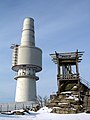
military tower on the Schneeberg in the Fichtelgebirge _-_geo-en.hlipp.de_-_11206.jpg) | |||||
| Upload media | |||||
| Instance of |
| ||||
|---|---|---|---|---|---|
| Location | Schneeberggipfel, Weißenstadter Forst-Süd, Wunsiedel, Upper Franconia, Bavaria, Germany | ||||
 | |||||
Media in category "Fernmeldeturm Schneeberg"
The following 5 files are in this category, out of 5 total.
-
 Das alte Backöfele auf dem Schneeberg (2011).jpg 3,648 × 2,736; 2.5 MB
-
 Fernmeldeturm schneeberg.jpg 768 × 1,024; 90 KB
-
 Granit, Holz und Beton - panoramio.jpg 4,608 × 3,456; 2.65 MB
-
 Schneeburg - Tower and Viewing platform in the Snow - panoramio.jpg 900 × 1,200; 194 KB
-
 Schneeburg Gate - Cold War - panoramio.jpg 1,680 × 539; 120 KB
.jpg)


