Category:Fernmeldeturm Habichtswald
Jump to navigation
Jump to search
| Object location | | View all coordinates using: OpenStreetMap |
|---|
tower  | |||||
| Upload media | |||||
| Instance of | |||||
|---|---|---|---|---|---|
| Made from material | |||||
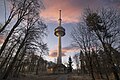
| Location | Essigberg, Hesse, Germany | ||||
| Commissioned by | |||||
| Owned by | |||||
| Height |
| ||||
 | |||||
Media in category "Fernmeldeturm Habichtswald"
The following 8 files are in this category, out of 8 total.
-
 Ahne, 2, Ehlen, Habichtswald, Landkreis Kassel.jpg 3,264 × 2,448; 5 MB
-
 Aussichtsturm Hohes Gras-05-Aussicht.jpg 4,320 × 3,240; 5.43 MB
-
 Fernsehturm Essigberg - Habichtswald - 52556114321.jpg 5,472 × 3,648; 20.52 MB
-
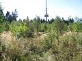
 Forkenburg (102) südöstliche Ecke Blick nach Norden mit Fernmeldeturm Habichtswald.jpg 6,000 × 4,000; 6.28 MB
-
 Habichtswald Fernmeldeturm 2015.JPG 970 × 1,293; 241 KB
-
 Habichtswald Fernmeldeturm, 2.jpg 857 × 1,536; 565 KB
-
 Habichtswald Fernmeldeturm.jpg 2,048 × 1,536; 1.36 MB
-
 Hohes gras blick essigberg wv ds 08 2009.jpg 1,333 × 1,000; 225 KB


_s%C3%BCd%C3%B6stliche_Ecke_Blick_nach_Norden_mit_Fernmeldeturm_Habichtswald.jpg)


