Category:Ferndale, Rhondda Cynon Taf
Jump to navigation
Jump to search
Български: 300px|мини|Панорамен изглед от Фърндейл
Cymraeg: Pentref a chymuned yng Nghwm Rhondda ym mwrdeisdref sirol Rhondda Cynon Taf yw Trerhondda, hefyd Glyn Rhedynog neu Glynrhedynog (Saesneg: Ferndale. Mae'r enw Cymraeg yn fater dadleuol; "Trerhondda" oedd yr enw gwreiddiol, tra mae "Glynrhedynog" yn gyfieithiad o'r enw Saesneg. Roedd y boblogaeth yn 2001 yn 4,419.
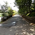
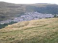
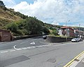
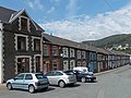
English: Ferndale is a small town located in the Rhondda Valley in the county borough of Rhondda Cynon Taf, Wales. Neighbouring villages are Maerdy and Tylorstown. Ferndale was industrialised in the mid 19th century when the first coal mine shaft was sunk in 1857 and was the first village to be intensively industrialised in the Rhondda Valley.
town and community in Rhondda Cynon Taf, Wales, UK   | |||||
| Upload media | |||||
| Pronunciation audio | |||||
|---|---|---|---|---|---|
| Instance of | |||||
| Location | Rhondda Cynon Taf, Wales | ||||
| Population |
| ||||
 | |||||
Subcategories
This category has the following 2 subcategories, out of 2 total.
F
Media in category "Ferndale, Rhondda Cynon Taf"
The following 139 files are in this category, out of 139 total.
-
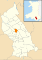 2010 Wales Rhondda Cynon Taf Community Ferndale map.svg 512 × 737; 416 KB
-
 2024 Wales Rhondda Cynon Taf Community Ferndale map.svg 512 × 737; 369 KB
-
 A glimpse through a steel girder bridge - geograph.org.uk - 6142399.jpg 2,550 × 956; 900 KB
-
 Approaching Darren Lake in Ferndale - geograph.org.uk - 4413560.jpg 4,000 × 3,000; 4.47 MB
-
 Arts Factory Trerhondda - geograph.org.uk - 5043101.jpg 4,608 × 3,456; 3.65 MB
-
 Ayron Street, Ferndale - geograph.org.uk - 3589663.jpg 800 × 670; 144 KB
-
 Back alley behind the houses in Oak St, Ferndale - geograph.org.uk - 5043026.jpg 4,608 × 3,456; 3.82 MB
-
 Barclays Bank, Ferndale - geograph.org.uk - 3611777.jpg 798 × 800; 142 KB
-
 Bench with a view, Ferndale - geograph.org.uk - 3589477.jpg 800 × 600; 164 KB
-
 Bethel Baptist Church, Ferndale - geograph.org.uk - 5043050.jpg 3,456 × 4,608; 3.07 MB
-
 Blaenllechau boundary sign - geograph.org.uk - 3612266.jpg 800 × 560; 145 KB
-
 Blanchinn (4786011a).jpg 1,021 × 748; 149 KB
-
 Bluebell clump - geograph.org.uk - 6162076.jpg 3,264 × 2,448; 3.41 MB
-
 Boarded-up The Anchor, Ferndale - geograph.org.uk - 2404852.jpg 640 × 505; 70 KB
-

-
 Bridge over former railway line at Ferndale - geograph.org.uk - 4413577.jpg 4,000 × 3,000; 3.73 MB
-

-
 Brynheulog Terrace Tylorstown - geograph.org.uk - 3589361.jpg 800 × 800; 262 KB
-

-

-
 Capel Nazareth Chapel - geograph.org.uk - 5016806.jpg 640 × 480; 64 KB
-
 Capel Penuel, Ferndale - geograph.org.uk - 5045420.jpg 4,608 × 3,456; 3.87 MB
-
 Capel Salem Newydd, Ferndale - geograph.org.uk - 5045428.jpg 3,456 × 4,608; 3.31 MB
-

-
 Corner Plaice, Ferndale - geograph.org.uk - 3612585.jpg 800 × 784; 170 KB
-

-

-
 Côr Meibion Morlais base, Ferndale - geograph.org.uk - 5043043.jpg 4,415 × 3,275; 4.03 MB
-
 Côr Meirion Morlais - geograph.org.uk - 6142371.jpg 2,048 × 1,536; 955 KB
-

-
 Dyffryn St, Ferndale - geograph.org.uk - 5045466.jpg 4,608 × 3,456; 3.73 MB
-
 Dyffryn St, Ferndale - geograph.org.uk - 5045468.jpg 4,608 × 3,456; 3.74 MB
-
 Dyffryn St, Ferndale - geograph.org.uk - 5045469.jpg 4,608 × 3,456; 3.71 MB
-
 Edge of woodland, Blaenllechau - geograph.org.uk - 2404753.jpg 640 × 510; 71 KB
-
 Entrance to Ferndale House, Ferndale - geograph.org.uk - 3612464.jpg 800 × 672; 195 KB
-
 Fallen tree near a disused quarry above Cwm Rhondda Fach - geograph.org.uk - 4413611.jpg 4,000 × 3,000; 7.21 MB
-
 Ferndale colliery view (4786011).jpg 1,079 × 772; 171 KB
-
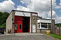 Ferndale Fire Station - geograph.org.uk - 460901.jpg 640 × 427; 212 KB
-
 Ferndale Labour Club - geograph.org.uk - 5045411.jpg 4,608 × 3,456; 3.8 MB
-
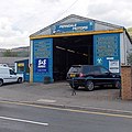 Ferndale Motors, Ferndale - geograph.org.uk - 3589390.jpg 799 × 800; 137 KB
-
 Ferndale Old Fire Station - geograph.org.uk - 460907.jpg 640 × 427; 242 KB
-
 Ferndale on a misty winter afternoon - geograph.org.uk - 6743833.jpg 2,048 × 1,536; 1.11 MB
-
 Ferndale Rugby Club (geograph 6142386).jpg 2,048 × 1,536; 1.08 MB
-
 Ferndale, Rhondda Valley - geograph.org.uk - 52041.jpg 640 × 479; 124 KB
-
 Ferndale, view over the town.jpg 640 × 480; 88 KB
-
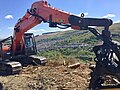 Forestry harvesting - geograph.org.uk - 6142453.jpg 2,048 × 1,536; 1.2 MB
-

-
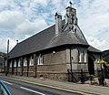
 Former Roman Catholic Church, Ferndale - geograph.org.uk - 5338006.jpg 1,024 × 791; 116 KB
-

-
 Formerly Our Lady of Penrhys Church, now dwellings - geograph.org.uk - 5045457.jpg 4,419 × 3,161; 3.56 MB
-
 Formerly Our Lady of Penrhys Church, now dwellings - geograph.org.uk - 5045459.jpg 4,608 × 3,456; 3.61 MB
-
 Funk'd Up Barbers, Ferndale - geograph.org.uk - 3589751.jpg 640 × 569; 98 KB
-
 Gary's Gents Hairdressers, Ferndale - geograph.org.uk - 3611792.jpg 800 × 575; 125 KB
-

-
 Graig Terrace urinal, Ferndale - geograph.org.uk - 3589438.jpg 800 × 789; 171 KB
-

-
 Heol Aberdar - Aberdare Road - geograph.org.uk - 5016793.jpg 640 × 480; 126 KB
-
 High St, Ferndale - geograph.org.uk - 5045405.jpg 4,608 × 3,456; 3.62 MB
-
 Houses resume, North Road, Ferndale - geograph.org.uk - 2404658.jpg 640 × 412; 59 KB
-
-
-

-
-
 North Rd, Ferndale - geograph.org.uk - 5043015.jpg 4,608 × 3,456; 3.79 MB
-
 North Road, Ferndale - geograph.org.uk - 993385.jpg 640 × 480; 81 KB
-

-
 NW boundary of Tylorstown - geograph.org.uk - 3589356.jpg 798 × 800; 175 KB
-
 Oak St, Ferndale - geograph.org.uk - 5043021.jpg 4,608 × 3,456; 3.82 MB
-
 Old Llanwonno Turn Sign - geograph.org.uk - 2258960.jpg 640 × 432; 84 KB
-
 On the Ferndale to Blaenllechau road - geograph.org.uk - 6142389.jpg 1,536 × 2,048; 1.43 MB
-
 Ordnance Survey Cut Mark - geograph.org.uk - 5430971.jpg 640 × 358; 83 KB
-
 Ordnance Survey Cut Mark - geograph.org.uk - 5430974.jpg 640 × 366; 90 KB
-
 Ordnance Survey Cut Mark - geograph.org.uk - 5430977.jpg 640 × 345; 110 KB
-
 Ordnance Survey Cut Mark - geograph.org.uk - 5430980.jpg 640 × 349; 95 KB
-
 Ordnance Survey Cut Mark - geograph.org.uk - 5430982.jpg 640 × 385; 103 KB
-
 Ordnance Survey Cut Mark - geograph.org.uk - 5430993.jpg 640 × 346; 86 KB
-
 Ordnance Survey Cut Mark - geograph.org.uk - 5431000.jpg 640 × 384; 86 KB
-
 Ordnance Survey Cut Mark - geograph.org.uk - 5431002.jpg 640 × 354; 98 KB
-
 Ordnance Survey Cut Mark - geograph.org.uk - 5431006.jpg 640 × 357; 81 KB
-
 Ordnance Survey Cut Mark - geograph.org.uk - 5431008.jpg 640 × 406; 96 KB
-
 Ordnance Survey Cut Mark - geograph.org.uk - 5431011.jpg 640 × 352; 74 KB
-
 Ordnance Survey Cut Mark - geograph.org.uk - 5431012.jpg 640 × 322; 67 KB
-
 Ordnance Survey Cut Mark - geograph.org.uk - 5431014.jpg 640 × 335; 48 KB
-
 Ordnance Survey Cut Mark - geograph.org.uk - 5431015.jpg 640 × 388; 102 KB
-
 Ordnance Survey Cut Mark - geograph.org.uk - 5431018.jpg 435 × 640; 118 KB
-
 Ordnance Survey Cut Mark - geograph.org.uk - 5431020.jpg 640 × 399; 97 KB
-
 Ordnance Survey Cut Mark - geograph.org.uk - 5431024.jpg 640 × 355; 57 KB
-
 Ordnance Survey Cut Mark - geograph.org.uk - 5431026.jpg 334 × 640; 78 KB
-
 Ordnance Survey Cut Mark - geograph.org.uk - 5433258.jpg 640 × 386; 57 KB
-
 Ordnance Survey Cut Mark - geograph.org.uk - 5433259.jpg 640 × 358; 49 KB
-
 Ordnance Survey Cut Mark - geograph.org.uk - 5433262.jpg 640 × 354; 66 KB
-
 Ordnance Survey Rivet - geograph.org.uk - 5430987.jpg 583 × 640; 79 KB
-
 Ordnance Survey Rivet - geograph.org.uk - 5430990.jpg 427 × 640; 95 KB
-
 Ordnance Survey Rivet - geograph.org.uk - 5430996.jpg 362 × 640; 84 KB
-
 Ordnance Survey Rivet - geograph.org.uk - 5430999.jpg 387 × 640; 77 KB
-
 Ordnance Survey Rivet - geograph.org.uk - 5431007.jpg 357 × 640; 71 KB
-
 Path on a ledge near Ferndale - geograph.org.uk - 4413585.jpg 4,000 × 3,000; 5.47 MB
-
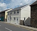
 Recently-built houses, Blaenllechau - geograph.org.uk - 3612327.jpg 800 × 540; 133 KB
-
-

-

-
 Rhondda Fach (geograph 6142409).jpg 1,536 × 2,048; 1.57 MB
-
 Rhondda Fach - geograph.org.uk - 6743837.jpg 2,048 × 1,536; 1.2 MB
-

-

-
 Rhondda Fach Methodist Church, Ferndale - geograph.org.uk - 5043054.jpg 4,608 × 3,456; 3.85 MB
-
-
 Ruined building in Cwm Rhondda Fach - geograph.org.uk - 4413605.jpg 4,000 × 3,000; 7.78 MB
-
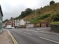
 SE boundary of Ferndale - geograph.org.uk - 3589347.jpg 799 × 800; 196 KB
-
 Shops in The Strand, Ferndale - geograph.org.uk - 3612605.jpg 798 × 800; 185 KB
-
-

-
 Steps up from North Road, Ferndale - geograph.org.uk - 2404728.jpg 480 × 640; 74 KB
-
 Steps up to Graig Terrace, Ferndale - geograph.org.uk - 3589631.jpg 800 × 726; 168 KB
-
 Taff Street, Blaenllechau - geograph.org.uk - 3612302.jpg 800 × 599; 120 KB
-
 Telegraph Poles - geograph.org.uk - 6142479.jpg 1,536 × 2,048; 931 KB
-
 Terraced houses in Ferndale - geograph.org.uk - 4413551.jpg 4,000 × 3,000; 6.15 MB
-

-
 The Anchor, Ferndale - geograph.org.uk - 5043057.jpg 4,608 × 3,456; 3.89 MB
-
 The Ferndale Hotel, Ferndale - geograph.org.uk - 5045439.jpg 4,608 × 3,456; 3.76 MB
-
 The Ferndale, Ferndale - geograph.org.uk - 3589652.jpg 800 × 654; 134 KB
-
 The Ferndale, Ferndale - geograph.org.uk - 5338030.jpg 1,024 × 768; 150 KB
-
 The former Tre Rhondda Independent Chapel - geograph.org.uk - 5043063.jpg 4,389 × 3,264; 4.21 MB
-
 The Glynrhedyn Project, Ferndale - geograph.org.uk - 3612438.jpg 800 × 714; 158 KB
-
 The Happy Wok, Ferndale - geograph.org.uk - 3589622.jpg 800 × 765; 152 KB
-
 The Industrial Co-operative Society, Ferndale, Rhondda. (4641230).jpg 1,200 × 911; 131 KB
-
 The Old Morlais Chapel, Ferndale - geograph.org.uk - 6142379.jpg 1,536 × 2,048; 1.04 MB
-

-
-
 Three arched doorways, Ferndale - geograph.org.uk - 3589644.jpg 800 × 600; 149 KB
-
 Track junction - geograph.org.uk - 6142481.jpg 2,048 × 1,536; 1.3 MB
-
 Trerhondda Welsh Independent Chapel (geograph 6142365).jpg 2,048 × 1,536; 1.01 MB
-

-
 Valleys- garden on Mountain Row, Blaenllechau (27391231441).jpg 5,184 × 3,456; 10.34 MB
-
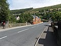
 View from road to Ferndale - geograph.org.uk - 828654.jpg 640 × 480; 90 KB
-
 View over Maerdy - geograph.org.uk - 6162129.jpg 3,264 × 2,448; 2.86 MB
-
 View to Blaenllechau from hillside above Ferndale - geograph.org.uk - 4413545.jpg 3,963 × 2,259; 4.59 MB
-

-


.jpg)


.jpg)


.jpg)


.jpg)


.jpg)


.jpg)

.jpg)


