Category:Ferme au colombier (Néron)
Jump to navigation
Jump to search
| Object location | | View all coordinates using: OpenStreetMap |
|---|
|
This building is inscrit au titre des monuments historiques de la France. It is indexed in the base Mérimée, a database of architectural heritage maintained by the French Ministry of Culture, under the reference PA00097165
|
human settlement in France ,_N%C3%A9ron,_Eure-et-Loir_(France).JPG) | |||||
| Upload media | |||||
| Instance of | |||||
|---|---|---|---|---|---|
| Location | Néron, canton of Nogent-le-Roi | ||||
| Heritage designation |
| ||||
 | |||||
Media in category "Ferme au colombier (Néron)"
The following 6 files are in this category, out of 6 total.
-
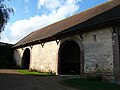
 Bâtiments de la ferme attenante à l'église Saint-Léger, Néron, Eure-et-Loir (France).JPG 1,344 × 2,023; 1.05 MB
-
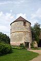 Colombier de la ferme attenante à l'église (XVII°), Néron, Eure-et-Loir (France).JPG 2,173 × 3,264; 3.51 MB
-
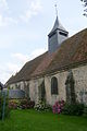 Eglise Saint-Léger vue depuis la cour de la ferme, Néron, Eure-et-Loir (France).JPG 2,174 × 3,264; 3.65 MB
-
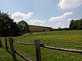
 Ferme au colombier Néron Eure-et-Loir France.JPG 3,264 × 2,448; 3.77 MB
-
 Ferme au colombier1.jpg 4,160 × 3,120; 4.69 MB
-
 Ferme au colombier2.jpg 4,160 × 3,120; 4.67 MB
.JPG)
.JPG)


