
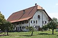
Category:Ferme, Route Cantonale, Erli 2, Morat
| Object location | | View all coordinates using: OpenStreetMap |
|---|
rural building in Murten in the canton of Fribourg, Switzerland  | |||||
| Upload media | |||||
| Instance of | |||||
|---|---|---|---|---|---|
| Part of | |||||
| Location | Murten, See District, Canton of Fribourg, Switzerland | ||||
| Street address |
| ||||
| Heritage designation | |||||
 | |||||
Media in category "Ferme, Route Cantonale, Erli 2, Morat"
This category contains only the following file.
-
 Farm Erli 2 Murten Aug 2011.jpg 4,752 × 3,168; 6.16 MB