Category:Ferdinand Magellan's Death historical marker
Jump to navigation
Jump to search
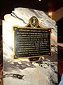
NHCP historical marker for the site of the death of Ferdinand Magellan  | |||||
| Upload media | |||||
| Instance of | |||||
|---|---|---|---|---|---|
| Commemorates | |||||
| Location | Liberty Shrine, Mactan, Lapu-Lapu, Central Visayas, PH | ||||
| Street address |
| ||||
| Creator |
| ||||
| Inception |
| ||||
 | |||||
Media in category "Ferdinand Magellan's Death historical marker"
The following 4 files are in this category, out of 4 total.
-
 Ferdinand Magellan's Death NHCP Historical Marker copy.jpg 1,944 × 2,169; 3.38 MB
-
 Lapu Lapu Shrine Lapu Magellan Marker Lapu City.JPG 1,944 × 2,592; 1.98 MB
-
 Lapu-lapuShrine05.jpg 3,024 × 1,998; 9.08 MB
-
 MactanShrineBack.jpg 1,536 × 2,048; 1.36 MB


