Category:Fenye Yutu
Jump to navigation
Jump to search
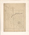
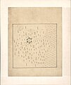
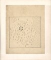
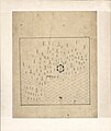
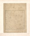
The Atlas of the Borders of the World (分野輿圖, 分野舆图, Fēnyě Yútú, Fen-yeh Yü-t`u) was a Chinese atlas of the Ming dynasty, including a map of China and maps of Beizhili, Nanzhili, and the various Chinese provinces with their capitals, prefectures, and counties. It also included a star chart of the Northern Celestial Hemisphere with its Chinese constellations, two vague charts of the tribes of Manchuria as known to the Chinese, and a map of the Pacific Ocean haphazardly filled with known and mythical islands.
Media in category "Fenye Yutu"
The following 46 files are in this category, out of 46 total.
-
 Fen ye yu tu. LOC 2002626777-1.jpg 4,216 × 5,094; 2.54 MB
-
 Fen ye yu tu. LOC 2002626777-1.tif 4,216 × 5,094; 61.44 MB
-
 Fen ye yu tu. LOC 2002626777-10.jpg 4,248 × 5,128; 2.03 MB
-
 Fen ye yu tu. LOC 2002626777-10.tif 4,248 × 5,128; 62.32 MB
-
 Fen ye yu tu. LOC 2002626777-11.jpg 4,272 × 5,116; 1.94 MB
-
 Fen ye yu tu. LOC 2002626777-11.tif 4,272 × 5,116; 62.53 MB
-
 Fen ye yu tu. LOC 2002626777-12.jpg 4,272 × 5,104; 1.81 MB
-
 Fen ye yu tu. LOC 2002626777-12.tif 4,272 × 5,104; 62.38 MB
-
 Fen ye yu tu. LOC 2002626777-13.jpg 4,284 × 5,093; 1.82 MB
-
 Fen ye yu tu. LOC 2002626777-13.tif 4,284 × 5,093; 62.42 MB
-
 Fen ye yu tu. LOC 2002626777-14.jpg 4,260 × 5,093; 2.04 MB
-
 Fen ye yu tu. LOC 2002626777-14.tif 4,260 × 5,093; 62.07 MB
-
 Fen ye yu tu. LOC 2002626777-15.jpg 4,260 × 5,070; 1.81 MB
-
 Fen ye yu tu. LOC 2002626777-15.tif 4,260 × 5,070; 61.79 MB
-
 Fen ye yu tu. LOC 2002626777-16.jpg 4,272 × 5,080; 1.9 MB
-
 Fen ye yu tu. LOC 2002626777-16.tif 4,272 × 5,080; 62.09 MB
-
 Fen ye yu tu. LOC 2002626777-17.jpg 4,260 × 5,104; 1.86 MB
-
 Fen ye yu tu. LOC 2002626777-17.tif 4,260 × 5,104; 62.21 MB
-
 Fen ye yu tu. LOC 2002626777-18.jpg 4,248 × 5,105; 1.88 MB
-
 Fen ye yu tu. LOC 2002626777-18.tif 4,248 × 5,105; 62.04 MB
-
 Fen ye yu tu. LOC 2002626777-19.jpg 4,251 × 5,082; 1.98 MB
-
 Fen ye yu tu. LOC 2002626777-19.tif 4,251 × 5,082; 61.81 MB
-
 Fen ye yu tu. LOC 2002626777-2.jpg 4,227 × 5,122; 2.11 MB
-
 Fen ye yu tu. LOC 2002626777-2.tif 4,227 × 5,122; 61.94 MB
-
 Fen ye yu tu. LOC 2002626777-20.jpg 4,248 × 5,069; 1.92 MB
-
 Fen ye yu tu. LOC 2002626777-20.tif 4,248 × 5,069; 61.61 MB
-
 Fen ye yu tu. LOC 2002626777-21.jpg 4,217 × 5,027; 2.01 MB
-
 Fen ye yu tu. LOC 2002626777-21.tif 4,217 × 5,027; 60.65 MB
-
 Fen ye yu tu. LOC 2002626777-22.jpg 4,210 × 5,052; 1.73 MB
-
 Fen ye yu tu. LOC 2002626777-22.tif 4,210 × 5,052; 60.85 MB
-
 Fen ye yu tu. LOC 2002626777-23.jpg 4,236 × 5,020; 1.92 MB
-
 Fen ye yu tu. LOC 2002626777-23.tif 4,236 × 5,020; 60.84 MB
-
 Fen ye yu tu. LOC 2002626777-3.jpg 4,252 × 5,075; 2.26 MB
-
 Fen ye yu tu. LOC 2002626777-3.tif 4,252 × 5,075; 61.74 MB
-
 Fen ye yu tu. LOC 2002626777-4.jpg 4,237 × 5,073; 2.14 MB
-
 Fen ye yu tu. LOC 2002626777-4.tif 4,237 × 5,073; 61.5 MB
-
 Fen ye yu tu. LOC 2002626777-5.jpg 4,185 × 5,064; 2.26 MB
-
 Fen ye yu tu. LOC 2002626777-5.tif 4,185 × 5,064; 60.63 MB
-
 Fen ye yu tu. LOC 2002626777-6.jpg 4,248 × 5,118; 2.01 MB
-
 Fen ye yu tu. LOC 2002626777-6.tif 4,248 × 5,118; 62.2 MB
-
 Fen ye yu tu. LOC 2002626777-7.jpg 4,248 × 5,117; 2.04 MB
-
 Fen ye yu tu. LOC 2002626777-7.tif 4,248 × 5,117; 62.19 MB
-
 Fen ye yu tu. LOC 2002626777-8.jpg 4,272 × 5,105; 1.88 MB
-
 Fen ye yu tu. LOC 2002626777-8.tif 4,272 × 5,105; 62.4 MB
-
 Fen ye yu tu. LOC 2002626777-9.jpg 4,260 × 5,092; 2.14 MB
-
 Fen ye yu tu. LOC 2002626777-9.tif 4,260 × 5,092; 62.06 MB


