Category:Fenton, Staffordshire
Jump to navigation
Jump to search
town in Staffordshire, UK  | |||||
| Upload media | |||||
| Instance of | |||||
|---|---|---|---|---|---|
| Location | City of Stoke-on-Trent, Staffordshire, West Midlands, England | ||||
| Different from | |||||
 | |||||
English: Fenton is one of the six towns of the Stoke-on-Trent conurbation which were federated in 1910. It is situated in the south-east of the city. Arnold Bennett called his fictionalised version of Stoke on Trent the "Five Towns", and Fenton has been dubbed the town Arnold Bennett forgot.
Italiano: Fenton è una delle sei comunità che, aggregate, formano la città di Stoke-on-Trent, nella contea dello Staffordshire, in Inghilterra.
Svenska: Fenton är en av de sex städer som år 1925 förenades för att forma staden Stoke-on-Trent, Staffordshire, England. Den är belägen sydöst om staden. Arnold Bennett kallade sin fiktionaliserade version av Stoke-on-Trent för de "fem städerna" och Fenton har därför blivit kallad staden som Arnold Bennett glömde.
Subcategories
This category has the following 10 subcategories, out of 10 total.
B
- Berryhill Fields (16 F)
F
- Fenton Cemetery (12 F)
- Fenton Industrial Estate (9 F)
- Fenton Park (18 F)
- Fenton railway station (3 F)
M
- Morley Ware (4 F)
S
Media in category "Fenton, Staffordshire"
The following 38 files are in this category, out of 38 total.
-

-
 Access bridge over A50 for Britannia Stadium - geograph.org.uk - 3593228.jpg 1,024 × 731; 94 KB
-
 Berry Hill Fields - geograph.org.uk - 5190823.jpg 4,896 × 3,672; 6.74 MB
-
 Berry Hill Fields - geograph.org.uk - 5190843.jpg 4,896 × 3,672; 6.93 MB
-
 Berry Hill Fields - geograph.org.uk - 5190849.jpg 4,896 × 3,672; 6.85 MB
-
 Berry Hill Fields and Fenton Industrial Estate - geograph.org.uk - 5193580.jpg 4,896 × 3,672; 4.5 MB
-
 Berry Hill Fields from Bassilow Road - geograph.org.uk - 5190798.jpg 4,896 × 3,672; 7.04 MB
-
 Berry Hill Fields, horse shelter - geograph.org.uk - 5192525.jpg 4,896 × 3,672; 4.9 MB
-
 Berry Hill Fields, puddle on path - geograph.org.uk - 5190865.jpg 4,896 × 3,672; 6.76 MB
-
 Berry Hill Fields, stile into paddock - geograph.org.uk - 5190860.jpg 4,896 × 3,672; 7.07 MB
-

-

-

-
-
 Erikssonmap.JPG 495 × 358; 38 KB
-
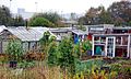
 Fenton Allotments - geograph.org.uk - 5195332.jpg 3,264 × 2,448; 2.4 MB
-
 Fenton Masts - geograph.org.uk - 5112867.jpg 1,500 × 1,000; 1.03 MB
-

-
 Fenton, car park for Topps Tiles and The Range - geograph.org.uk - 5149181.jpg 3,264 × 2,448; 2.5 MB
-
 Fenton, vandalised phone box on the corner of Alfred Street - geograph.org.uk - 5196210.jpg 3,264 × 2,448; 3.22 MB
-
 Fenton, Victoria Road - geograph.org.uk - 5196185.jpg 3,264 × 2,448; 2.38 MB
-
 Fenton.JPG 2,530 × 1,518; 222 KB
-
 Footbridge, Hawkins Street, Fenton - geograph.org.uk - 4447341.jpg 640 × 428; 121 KB
-
 Footpath between Fenton Park and Cemetery - geograph.org.uk - 5190786.jpg 4,896 × 3,672; 7.13 MB
-
 Mouse House estate agents sign, Carron Street, Fenton.jpg 4,608 × 3,456; 3.51 MB
-
 Roundabout - Fenton - geograph.org.uk - 3990594.jpg 4,468 × 2,683; 5.23 MB
-
 Roundabout at junction of A52 and A5007, Fenton - geograph.org.uk - 5351812.jpg 3,667 × 2,736; 2.69 MB
-
 The Allotments - geograph.org.uk - 587187.jpg 640 × 382; 140 KB
-
 The Allotments - geograph.org.uk - 587189.jpg 640 × 415; 137 KB
-
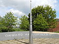 The Fenton Monument.jpg 4,608 × 3,456; 3.56 MB
-
 The Pit Stop (Car Wash) in Longton - geograph.org.uk - 4714462.jpg 640 × 428; 99 KB
-
 The Potteries from Berry Hill Fields - geograph.org.uk - 6736792.jpg 3,912 × 2,321; 3.17 MB
-
 Victoria Road in Fenton Low - geograph.org.uk - 5546606.jpg 1,500 × 1,101; 148 KB
-
 Victoria Road in Fenton Low - geograph.org.uk - 5546612.jpg 1,500 × 1,102; 123 KB
-
 William Baker drinking fountain, Fenton.jpg 3,240 × 4,320; 4.22 MB
-
 Glebe Hill - geograph.org.uk - 155170.jpg 640 × 480; 210 KB
-
 Glebe Hill View - geograph.org.uk - 155168.jpg 640 × 480; 140 KB
-
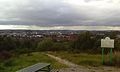
 Hanley City - geograph.org.uk - 155173.jpg 640 × 480; 156 KB


_in_Longton_-_geograph.org.uk_-_4714462.jpg)


